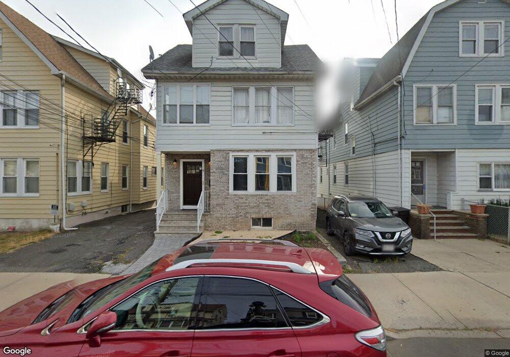
41 Grove St Unit 1 Bloomfield, NJ 07003
Estimated Value: $601,000 - $847,000
2
Beds
1
Bath
2,890
Sq Ft
$254/Sq Ft
Est. Value
About This Home
This home is located at 41 Grove St Unit 1, Bloomfield, NJ 07003 and is currently estimated at $735,333, approximately $254 per square foot. 41 Grove St Unit 1 is a home located in Essex County with nearby schools including Carteret School, Bloomfield Middle School, and Bloomfield High School.
Ownership History
Date
Name
Owned For
Owner Type
Purchase Details
Closed on
Jan 15, 1996
Sold by
O'Mara Frances
Bought by
Raymond Marie and Raymond Paul
Current Estimated Value
Create a Home Valuation Report for This Property
The Home Valuation Report is an in-depth analysis detailing your home's value as well as a comparison with similar homes in the area
Home Values in the Area
Average Home Value in this Area
Purchase History
| Date | Buyer | Sale Price | Title Company |
|---|---|---|---|
| Raymond Marie | $135,000 | -- |
Source: Public Records
Tax History Compared to Growth
Tax History
| Year | Tax Paid | Tax Assessment Tax Assessment Total Assessment is a certain percentage of the fair market value that is determined by local assessors to be the total taxable value of land and additions on the property. | Land | Improvement |
|---|---|---|---|---|
| 2025 | $13,990 | $428,100 | $90,400 | $337,700 |
| 2024 | $13,990 | $428,100 | $90,400 | $337,700 |
| 2022 | $13,708 | $428,100 | $90,400 | $337,700 |
| 2021 | $13,455 | $428,100 | $90,400 | $337,700 |
| 2020 | $13,250 | $428,100 | $90,400 | $337,700 |
| 2019 | $12,138 | $304,900 | $89,000 | $215,900 |
| 2018 | $12,086 | $304,900 | $89,000 | $215,900 |
| 2017 | $11,903 | $304,900 | $89,000 | $215,900 |
| 2016 | $11,769 | $304,900 | $89,000 | $215,900 |
| 2015 | $11,662 | $304,900 | $89,000 | $215,900 |
| 2014 | $11,449 | $304,900 | $89,000 | $215,900 |
Source: Public Records
Map
Nearby Homes
- 413 Beardsley Ave Unit 3
- 413 Beardsley Ave
- 107 La France Ave
- 18 Whitman Ave
- 228 N 17th St
- 149 Leslie St
- 265 N 17th St
- 220 N 17th St
- 267 N 17th St
- 219 N 16th St
- 7 Whitman Ave
- 42 La France Ave
- 28 Lafayette Ave
- 12 Madison Ave
- 17 Chauncey Ave
- 205 N 15th St
- 141 N 16th St
- 200 N 15th St
- 65 Leslie St
- 23 Belmont Ave