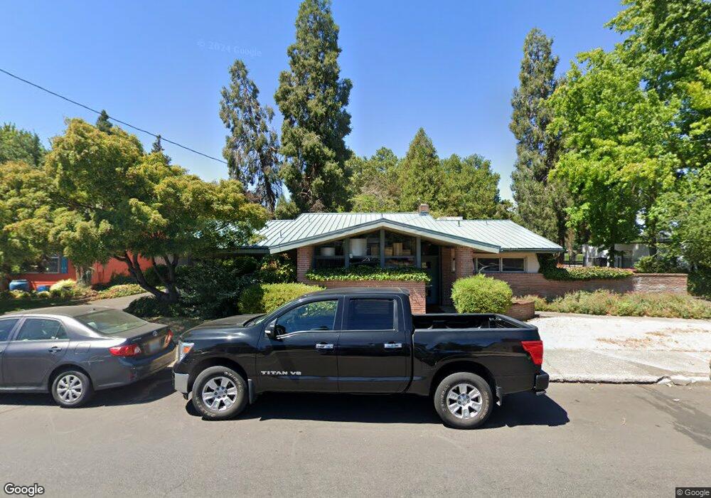
41 Hawthorne St Medford, OR 97504
Estimated Value: $297,411
--
Bed
--
Bath
1,996
Sq Ft
$149/Sq Ft
Est. Value
About This Home
This home is located at 41 Hawthorne St, Medford, OR 97504 and is currently estimated at $297,411, approximately $149 per square foot. 41 Hawthorne St is a home located in Jackson County with nearby schools including Roosevelt Elementary School, Hedrick Middle School, and South Medford High School.
Ownership History
Date
Name
Owned For
Owner Type
Purchase Details
Closed on
Jun 25, 2019
Sold by
Clay Duane C
Bought by
Campbell Ronald G and Campbell Sharel A
Current Estimated Value
Purchase Details
Closed on
Nov 2, 2010
Sold by
Clay Arthur L and Clay Duane C
Bought by
Clay Duane C and Clay Living Trust
Purchase Details
Closed on
Jul 11, 1984
Sold by
Jennings G Scott and Jennings Mary Ann
Bought by
Clay A L and Clay Duane C
Create a Home Valuation Report for This Property
The Home Valuation Report is an in-depth analysis detailing your home's value as well as a comparison with similar homes in the area
Home Values in the Area
Average Home Value in this Area
Purchase History
| Date | Buyer | Sale Price | Title Company |
|---|---|---|---|
| Campbell Ronald G | $215,000 | Ticor Title | |
| Clay Duane C | -- | None Available | |
| Clay A L | $103,000 | Amerititle Inc |
Source: Public Records
Tax History Compared to Growth
Tax History
| Year | Tax Paid | Tax Assessment Tax Assessment Total Assessment is a certain percentage of the fair market value that is determined by local assessors to be the total taxable value of land and additions on the property. | Land | Improvement |
|---|---|---|---|---|
| 2025 | $4,746 | $323,720 | $200,870 | $122,850 |
| 2024 | $4,746 | $323,720 | $200,870 | $122,850 |
| 2023 | $4,952 | $317,840 | $197,220 | $120,620 |
| 2022 | $4,739 | $317,840 | $197,220 | $120,620 |
| 2021 | $4,571 | $305,630 | $189,640 | $115,990 |
| 2020 | $3,858 | $259,000 | $160,710 | $98,290 |
| 2019 | $3,930 | $259,000 | $160,710 | $98,290 |
| 2018 | $5,877 | $384,120 | $100,530 | $283,590 |
| 2017 | $5,769 | $384,120 | $100,530 | $283,590 |
| 2016 | $5,809 | $362,080 | $94,760 | $267,320 |
| 2015 | $5,584 | $362,080 | $94,760 | $267,320 |
| 2014 | $5,485 | $341,310 | $89,320 | $251,990 |
Source: Public Records
Map
Nearby Homes
- 619 E Main St
- 109 Geneva St
- 31 Geneva St
- 818 Sherman St
- 2749 Pronghorn Ln
- 214 Stark St
- 719 Bennett Ave
- 23 - 27 Crater Lake Ave
- 23 Crater Lake Ave
- 1008 Queen Anne Ave
- 1016 Queen Anne Ave
- 858 E 9th St
- 313 Marie St
- 1104 Reddy Ave
- 122 Willamette Ave
- 824 N Riverside Ave
- 120 Ashland Ave
- 440 N Grape St
- 531 Effie St
- 815 Niantic St
- 33 Hawthorne St
- 45 Hawthorne St Unit 2
- 29 Hawthorne St
- 42 Hawthorne St
- 36 Hawthorne St
- 0 Hawthorne
- 48 Hawthorne St Unit 1
- 48 Hawthorne St Unit 2
- 48 Hawthorne St
- 30 Hawthorne St
- 21 Hawthorne St
- 17 Hawthorne St
- 18 Hawthorne St
- 115 Genessee St
- 121 Genessee St
- 13 Hawthorne St
- 203 Genessee St
- 111 Genessee St
- 14 Hawthorne St
- 105 Genessee St