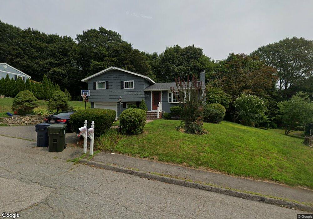
41 Highgate Rd Marlborough, MA 01752
Estimated Value: $505,120 - $571,000
3
Beds
2
Baths
1,050
Sq Ft
$524/Sq Ft
Est. Value
About This Home
This home is located at 41 Highgate Rd, Marlborough, MA 01752 and is currently estimated at $550,280, approximately $524 per square foot. 41 Highgate Rd is a home located in Middlesex County with nearby schools including Marlborough High School, New Covenant Christian School, and Glenhaven Academy - JRI School.
Ownership History
Date
Name
Owned For
Owner Type
Purchase Details
Closed on
Jan 14, 2011
Sold by
Tanner Phyllis and Tanner James J
Bought by
Rosenau Brendon T and Rosenau Jessica L
Current Estimated Value
Home Financials for this Owner
Home Financials are based on the most recent Mortgage that was taken out on this home.
Original Mortgage
$233,000
Outstanding Balance
$155,212
Interest Rate
4.46%
Mortgage Type
Purchase Money Mortgage
Estimated Equity
$395,068
Create a Home Valuation Report for This Property
The Home Valuation Report is an in-depth analysis detailing your home's value as well as a comparison with similar homes in the area
Home Values in the Area
Average Home Value in this Area
Purchase History
| Date | Buyer | Sale Price | Title Company |
|---|---|---|---|
| Rosenau Brendon T | $253,000 | -- |
Source: Public Records
Mortgage History
| Date | Status | Borrower | Loan Amount |
|---|---|---|---|
| Open | Rosenau Brendon T | $233,000 |
Source: Public Records
Tax History
| Year | Tax Paid | Tax Assessment Tax Assessment Total Assessment is a certain percentage of the fair market value that is determined by local assessors to be the total taxable value of land and additions on the property. | Land | Improvement |
|---|---|---|---|---|
| 2025 | $4,742 | $480,900 | $231,100 | $249,800 |
| 2024 | $4,558 | $445,100 | $210,100 | $235,000 |
| 2023 | $4,559 | $395,100 | $168,800 | $226,300 |
| 2022 | $4,511 | $343,800 | $160,800 | $183,000 |
| 2021 | $12,844 | $317,000 | $134,000 | $183,000 |
| 2020 | $4,261 | $300,500 | $127,600 | $172,900 |
| 2019 | $4,139 | $294,200 | $125,100 | $169,100 |
| 2018 | $9,963 | $280,200 | $99,500 | $180,700 |
| 2017 | $3,498 | $228,300 | $98,600 | $129,700 |
| 2016 | $3,303 | $215,300 | $98,600 | $116,700 |
| 2015 | $3,532 | $224,100 | $105,900 | $118,200 |
Source: Public Records
Map
Nearby Homes
- 48 Cook Ln
- 38 Airport Blvd
- 244 Robert Rd
- 181 Boston Post Rd E Unit 26
- 181 Boston Post Rd E Unit 64
- 70 Phelps St
- 24 Clinton St
- 70 Victoria Ln
- 79 Royce Rd
- 69 Johansen Dr
- 40 Sheridan Rd
- 183 Sherwood Dr S
- 28 Ruth Dr
- 0 Stevens St
- 84 Crosby Rd
- 61 Lincoln St
- 112 Shawmut Ave
- 75 Lincoln St
- 24 Wilson St Unit 4
- 67 Wellington St
Your Personal Tour Guide
Ask me questions while you tour the home.