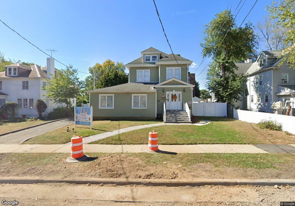
41 Hilton Ave Hempstead, NY 11550
Estimated Value: $812,745
8
Beds
4
Baths
3,600
Sq Ft
$226/Sq Ft
Est. Value
About This Home
This home is located at 41 Hilton Ave, Hempstead, NY 11550 and is currently estimated at $812,745, approximately $225 per square foot. 41 Hilton Ave is a home located in Nassau County with nearby schools including The Academy Charter School, Evergreen Charter School, and Crescent School.
Ownership History
Date
Name
Owned For
Owner Type
Purchase Details
Closed on
May 28, 2020
Sold by
Georgia Papazis Esq
Bought by
Malachite Housing Llc
Current Estimated Value
Purchase Details
Closed on
Jan 27, 2005
Sold by
Scibilia Joseph
Bought by
Hillmarc Properties Llc
Purchase Details
Closed on
Jan 22, 1998
Sold by
Herchenroder John
Bought by
Scibilia Joseph C
Create a Home Valuation Report for This Property
The Home Valuation Report is an in-depth analysis detailing your home's value as well as a comparison with similar homes in the area
Home Values in the Area
Average Home Value in this Area
Purchase History
| Date | Buyer | Sale Price | Title Company |
|---|---|---|---|
| Malachite Housing Llc | $469,000 | Chicago Title Ins Co | |
| Malachite Housing Llc | $469,000 | Chicago Title Ins Co | |
| Malachite Housing Llc | $469,000 | Chicago Title Ins Co | |
| Hillmarc Properties Llc | $455,000 | -- | |
| Hillmarc Properties Llc | $455,000 | -- | |
| Scibilia Joseph C | $235,000 | -- | |
| Scibilia Joseph C | $235,000 | -- |
Source: Public Records
Tax History Compared to Growth
Tax History
| Year | Tax Paid | Tax Assessment Tax Assessment Total Assessment is a certain percentage of the fair market value that is determined by local assessors to be the total taxable value of land and additions on the property. | Land | Improvement |
|---|---|---|---|---|
| 2025 | $15,667 | $3,238 | $3,238 | -- |
| 2024 | $1,944 | $3,238 | $3,238 | $0 |
| 2023 | $15,980 | $3,238 | $3,238 | $0 |
| 2022 | $15,980 | $3,238 | $3,238 | $0 |
| 2021 | $23,612 | $3,143 | $3,143 | $0 |
| 2020 | $20,580 | $2,647 | $1,671 | $976 |
| 2019 | $4,398 | $3,904 | $2,464 | $1,440 |
| 2018 | $11,383 | $3,904 | $0 | $0 |
| 2017 | $17,970 | $3,904 | $2,464 | $1,440 |
| 2016 | $29,637 | $3,904 | $2,464 | $1,440 |
| 2015 | $3,455 | $3,904 | $2,464 | $1,440 |
| 2014 | $3,455 | $3,904 | $2,464 | $1,440 |
| 2013 | $3,164 | $3,904 | $2,464 | $1,440 |
Source: Public Records
Map
Nearby Homes
- 22 Mulford Place Unit 2D
- 22 Mulford Place Unit 6C
- 32 Cathedral Ave Unit 6c
- 35 Mulford Place
- 30 Cathedral Ave Unit 4A
- 82 Hilton Ave
- 144 Hilton Ave
- 44 Saint Pauls Rd S
- 39 Hilbert St
- 144 N Franklin St
- 14 Parsons Dr
- 24 Parsons Dr
- 20 Wendell St Unit A16
- 20 Wendell St Unit E2
- 20 Wendell St Unit 39C
- 60 Parsons Dr
- 60 Long Dr
- 87 Parsons Dr
- 200 Hilton Ave Unit 55
- 47 Stratford Rd
- 37 Hilton Ave
- 45 Hilton Ave
- 32 Mulford Place
- 33 Hilton Ave
- 24 Mulford Place Unit 6F
- 24 Mulford Place Unit 6E
- 24 Mulford Place Unit B
- 24 Mulford Place Unit 1
- 24 Mulford Place Unit 2E
- 24 Mulford Place Unit 5C
- 24 Mulford Place Unit 2B
- 24 Mulford Place Unit 6C
- 24 Mulford Place Unit 1E
- 24 Mulford Place Unit 4F
- 24 Mulford Place Unit 3B
- 24 Mulford Place Unit 6D
- 24 Mulford Place Unit 5D
- 24 Mulford Place Unit 3E
- 24 Mulford Place Unit 1C
- 24 Mulford Place Unit 5E