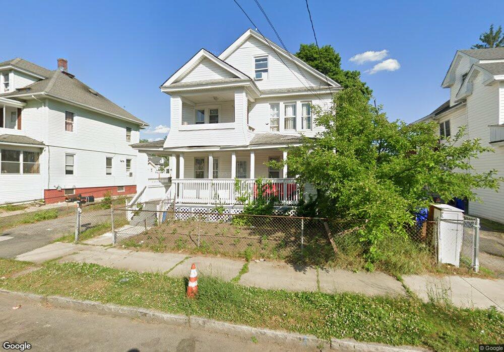
41 Home St Unit 43 Springfield, MA 01104
Liberty Heights NeighborhoodEstimated Value: $347,235 - $450,000
6
Beds
2
Baths
2,960
Sq Ft
$133/Sq Ft
Est. Value
About This Home
This home is located at 41 Home St Unit 43, Springfield, MA 01104 and is currently estimated at $394,309, approximately $133 per square foot. 41 Home St Unit 43 is a home located in Hampden County with nearby schools including Glenwood School, Van Sickle Academy, and High School Of Commerce.
Ownership History
Date
Name
Owned For
Owner Type
Purchase Details
Closed on
Feb 1, 2006
Sold by
Cruz Noel
Bought by
Abel Wilner
Current Estimated Value
Purchase Details
Closed on
Mar 25, 2002
Sold by
Manufacturers & Trader
Bought by
Cruz Noel
Home Financials for this Owner
Home Financials are based on the most recent Mortgage that was taken out on this home.
Original Mortgage
$39,900
Interest Rate
6.91%
Mortgage Type
Purchase Money Mortgage
Purchase Details
Closed on
Mar 14, 2001
Sold by
Reeves Paul J
Bought by
Manufacturers & Trader
Create a Home Valuation Report for This Property
The Home Valuation Report is an in-depth analysis detailing your home's value as well as a comparison with similar homes in the area
Home Values in the Area
Average Home Value in this Area
Purchase History
| Date | Buyer | Sale Price | Title Company |
|---|---|---|---|
| Abel Wilner | $170,000 | -- | |
| Cruz Noel | $57,000 | -- | |
| Manufacturers & Trader | $52,100 | -- |
Source: Public Records
Mortgage History
| Date | Status | Borrower | Loan Amount |
|---|---|---|---|
| Previous Owner | Manufacturers & Trader | $39,900 | |
| Previous Owner | Manufacturers & Trader | $59,625 | |
| Previous Owner | Manufacturers & Trader | $51,600 |
Source: Public Records
Tax History Compared to Growth
Tax History
| Year | Tax Paid | Tax Assessment Tax Assessment Total Assessment is a certain percentage of the fair market value that is determined by local assessors to be the total taxable value of land and additions on the property. | Land | Improvement |
|---|---|---|---|---|
| 2025 | $5,386 | $343,500 | $37,400 | $306,100 |
| 2024 | $5,237 | $326,100 | $37,400 | $288,700 |
| 2023 | $4,564 | $267,700 | $33,100 | $234,600 |
| 2022 | $4,035 | $214,400 | $30,900 | $183,500 |
| 2021 | $3,914 | $207,100 | $28,100 | $179,000 |
| 2020 | $3,683 | $188,600 | $28,100 | $160,500 |
| 2019 | $3,224 | $163,800 | $23,300 | $140,500 |
| 2018 | $3,178 | $161,500 | $23,300 | $138,200 |
| 2017 | $3,055 | $155,400 | $24,700 | $130,700 |
| 2016 | $2,709 | $137,800 | $24,700 | $113,100 |
| 2015 | $2,632 | $133,800 | $24,700 | $109,100 |
Source: Public Records
Map
Nearby Homes
- 11 Leroy Place
- 31 Denton Cir
- 121 Wait St
- 74 David St
- 44-46 Hastings St
- 723-725 Carew St
- 708-710 Carew St
- 92 Miller St
- 70 Norman St
- 774-776 Liberty St
- 62-64 Governor St
- 596-598 Newbury St
- 750 Liberty St
- 55 Governor St
- 24 Morrell St
- 46-48 Wait St
- 56-58 Phoenix St
- 661 Carew St
- 11 Calvin St
- 37 Phoenix St
- 41-43 Home St
- 43 Home St
- 37-39 Home St
- 37 Home St Unit 39
- 47 Home St
- 31 Home St Unit 33
- 31-33 Home St
- 51 Home St Unit 53
- 40 Woodmont St
- 57 Home St
- 872 Liberty St Unit 874
- 878 Liberty St
- 34 Woodmont St Unit 36
- 46 Home St
- 27 Home St
- 44 Home St Unit 46
- 44-46 Home St
- 40 Home St Unit 42
- 50 Home St
- 36 Home St