Estimated Value: $611,000 - $659,578
4
Beds
3
Baths
1,700
Sq Ft
$372/Sq Ft
Est. Value
About This Home
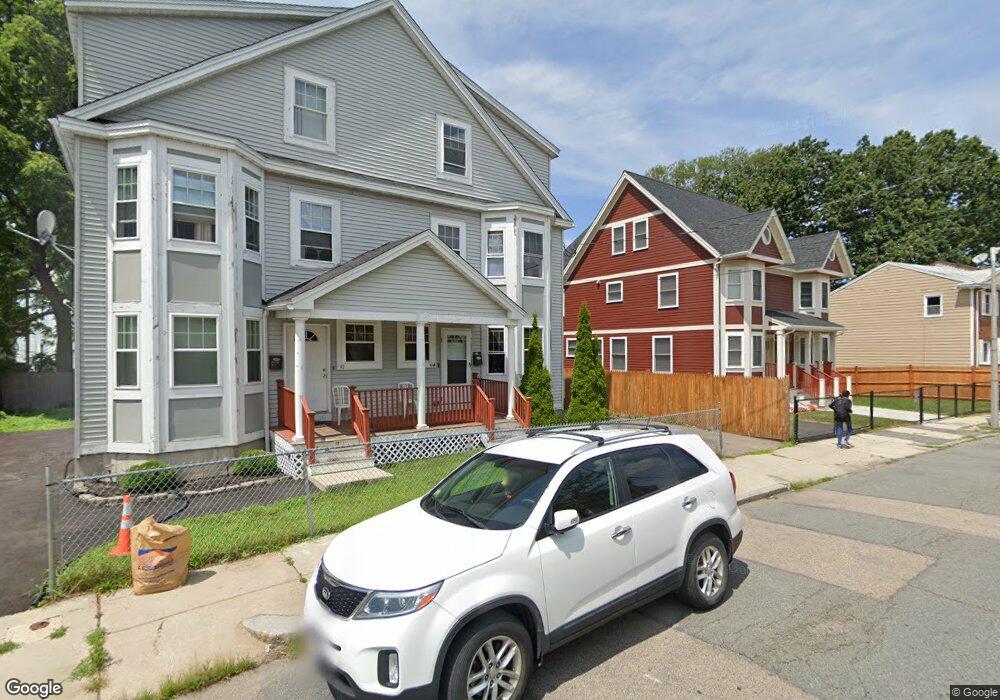
This home is located at 41 Jacob St, Dorchester Center, MA 02124 and is currently estimated at $632,395, approximately $371 per square foot. 41 Jacob St is a home located in Suffolk County with nearby schools including Codman Academy Charter Public School and Berea Seventh-day Adventist Academy.
Ownership History
Date
Name
Owned For
Owner Type
Purchase Details
Closed on
May 1, 2008
Sold by
41 Jacob Street Rt
Bought by
Hartfield Kimberly L and Hartfield Kimberly
Current Estimated Value
Home Financials for this Owner
Home Financials are based on the most recent Mortgage that was taken out on this home.
Original Mortgage
$211,750
Outstanding Balance
$134,870
Interest Rate
5.99%
Mortgage Type
Purchase Money Mortgage
Estimated Equity
$497,525
Create a Home Valuation Report for This Property
The Home Valuation Report is an in-depth analysis detailing your home's value as well as a comparison with similar homes in the area
Home Values in the Area
Average Home Value in this Area
Purchase History
| Date | Buyer | Sale Price | Title Company |
|---|---|---|---|
| Hartfield Kimberly L | $275,000 | -- |
Source: Public Records
Mortgage History
| Date | Status | Borrower | Loan Amount |
|---|---|---|---|
| Open | Hartfield Kimberly L | $211,750 |
Source: Public Records
Tax History Compared to Growth
Tax History
| Year | Tax Paid | Tax Assessment Tax Assessment Total Assessment is a certain percentage of the fair market value that is determined by local assessors to be the total taxable value of land and additions on the property. | Land | Improvement |
|---|---|---|---|---|
| 2025 | $5,995 | $517,700 | $0 | $517,700 |
| 2024 | $5,581 | $512,000 | $0 | $512,000 |
| 2023 | $5,336 | $496,800 | $0 | $496,800 |
| 2022 | $5,145 | $472,900 | $0 | $472,900 |
| 2021 | $4,900 | $459,200 | $0 | $459,200 |
| 2020 | $4,172 | $395,100 | $0 | $395,100 |
| 2019 | $3,892 | $369,300 | $0 | $369,300 |
| 2018 | $3,686 | $351,700 | $0 | $351,700 |
| 2017 | $3,579 | $338,000 | $0 | $338,000 |
| 2016 | $3,411 | $310,100 | $0 | $310,100 |
| 2015 | $2,777 | $229,300 | $0 | $229,300 |
| 2014 | $2,747 | $218,400 | $0 | $218,400 |
Source: Public Records
Map
Nearby Homes
- 38 Mascot St Unit 3
- 14-16 Jacob St
- 68 Mascot St
- 24 Marden Ave
- 251 Norfolk St Unit A
- 140 Callender St
- 8 Oakhurst St Unit 4
- 32 Crowell St
- 69 Lucerne St
- 57 Stratton St
- 21 Ashton St Unit 1
- 73 Stanton St
- 5 Sutton St
- 5 Sutton St Unit 3B
- 10 Sutton St
- 808 Morton St Unit 3
- 44 Floyd St
- 44 Evans St
- 139 Selden St
- 67 Wildwood St
- 41 Jacob St Unit 3
- 41 Jacob St Unit 41A
- 41 Jacob St Unit 1
- 41 Jacob St Unit 2
- 43 Jacob St
- 37 Jacob St Unit A
- 42 Jacob St
- 47 Jacob St
- 47 Jacob St Unit 51
- 44 Jacob St
- 49 Jacob St
- 45 Jacob St
- 38 Mascot St Unit 2
- 38 Mascot St Unit 1
- 38 Mascot St
- 32 Jacob St Unit 2
- 32 Jacob St Unit 1
- 32 Jacob St Unit 36
- 32 Jacob St Unit 36
- 32 Jacob St Unit 36