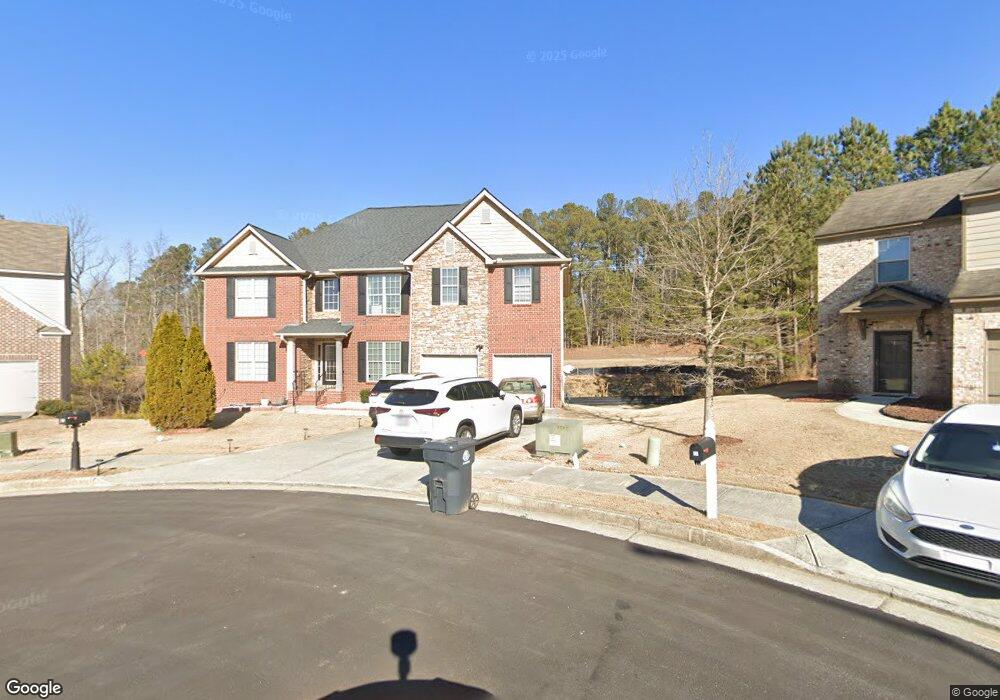
41 Kelso Way Dallas, GA 30132
Estimated Value: $414,000 - $466,000
5
Beds
4
Baths
3,794
Sq Ft
$117/Sq Ft
Est. Value
About This Home
This home is located at 41 Kelso Way, Dallas, GA 30132 and is currently estimated at $444,346, approximately $117 per square foot. 41 Kelso Way is a home located in Paulding County with nearby schools including Northside Elementary School, Lena Mae Moses Middle School, and North Paulding High School.
Ownership History
Date
Name
Owned For
Owner Type
Purchase Details
Closed on
Jan 21, 2022
Sold by
Nju Matilda
Bought by
Fru Eugene Nsoh
Current Estimated Value
Purchase Details
Closed on
Jan 31, 2007
Sold by
Nju Matilda
Bought by
Nju Matilda and Tuma Jude
Home Financials for this Owner
Home Financials are based on the most recent Mortgage that was taken out on this home.
Original Mortgage
$252,850
Interest Rate
6.14%
Mortgage Type
New Conventional
Create a Home Valuation Report for This Property
The Home Valuation Report is an in-depth analysis detailing your home's value as well as a comparison with similar homes in the area
Home Values in the Area
Average Home Value in this Area
Purchase History
| Date | Buyer | Sale Price | Title Company |
|---|---|---|---|
| Fru Eugene Nsoh | $387,000 | -- | |
| Nju Matilda | -- | -- | |
| Nju Matilda | $298,000 | -- | |
| Westland Homes Inc | -- | -- |
Source: Public Records
Mortgage History
| Date | Status | Borrower | Loan Amount |
|---|---|---|---|
| Previous Owner | Westland Homes Inc | $252,850 |
Source: Public Records
Tax History Compared to Growth
Tax History
| Year | Tax Paid | Tax Assessment Tax Assessment Total Assessment is a certain percentage of the fair market value that is determined by local assessors to be the total taxable value of land and additions on the property. | Land | Improvement |
|---|---|---|---|---|
| 2024 | $4,218 | $169,576 | $12,000 | $157,576 |
| 2023 | $4,036 | $175,880 | $12,000 | $163,880 |
| 2022 | $4,057 | $157,480 | $12,000 | $145,480 |
| 2021 | $3,305 | $115,600 | $10,000 | $105,600 |
| 2020 | $3,055 | $104,720 | $10,000 | $94,720 |
| 2019 | $3,066 | $103,600 | $10,000 | $93,600 |
| 2018 | $3,031 | $102,480 | $10,000 | $92,480 |
| 2017 | $3,037 | $101,280 | $10,000 | $91,280 |
| 2016 | $2,475 | $83,720 | $10,000 | $73,720 |
| 2015 | $2,435 | $80,960 | $10,000 | $70,960 |
| 2014 | $2,262 | $73,520 | $10,000 | $63,520 |
| 2013 | -- | $67,760 | $10,000 | $57,760 |
Source: Public Records
Map
Nearby Homes
- 38 Kelso Way
- 749 Scotland Dr
- 89 Dundee Crossing
- 144 Aberdeen Way
- 219 Aberdeen Way
- 439 Scotland Dr
- 18 Mountain Ct
- 272 Kades Cove Dr
- 103 Beautyberry Ln
- Green Plan at Sheffield Highlands
- Harbor Plan at Sheffield Highlands
- Flora Plan at Sheffield Highlands
- Hayden Plan at Sheffield Highlands
- Cali Plan at Sheffield Highlands
- 00 Snote Jones Rd
- 428 Snote Jones Rd
- LOT 1 Snote Jones Rd
- LOT 2 Snote Jones Rd
- 0 Snote Jones Rd Unit 10480976
- 35 Kelso Way
- 44 Kelso Way
- 254 Maxton Ave
- 290 Maxton Ave
- 276 Maxton Ave
- 32 Kelso Way
- 296 Maxton Ave
- 230 Maxton Ave
- 220 Maxton Ave
- 302 Maxton Ave
- 204 Maxton Ave
- 2515 Cartersville Hwy
- 257 Maxton Ave
- 269 Maxton Ave
- 279 Maxton Ave
- 233 Maxton Ave
- 308 Maxton Ave
- 223 Maxton Ave
- 192 Maxton Ave
- 2513 Cartersville Hwy