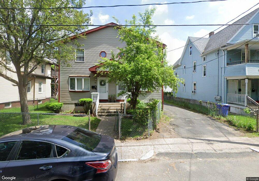
41 Lansing Place Unit 43 Springfield, MA 01108
Forest Park NeighborhoodEstimated Value: $306,753 - $391,000
4
Beds
4
Baths
2,176
Sq Ft
$164/Sq Ft
Est. Value
About This Home
This home is located at 41 Lansing Place Unit 43, Springfield, MA 01108 and is currently estimated at $356,688, approximately $163 per square foot. 41 Lansing Place Unit 43 is a home located in Hampden County with nearby schools including Sumner Avenue Elementary School, Forest Park Middle School, and High School Of Commerce.
Ownership History
Date
Name
Owned For
Owner Type
Purchase Details
Closed on
Mar 15, 2023
Sold by
Vince Llc
Bought by
Beezer Shannoya
Current Estimated Value
Home Financials for this Owner
Home Financials are based on the most recent Mortgage that was taken out on this home.
Original Mortgage
$261,250
Outstanding Balance
$252,392
Interest Rate
6.09%
Mortgage Type
Purchase Money Mortgage
Estimated Equity
$104,296
Purchase Details
Closed on
Jul 2, 2007
Sold by
Lansing Mgmt Inc and Lansing Properties
Bought by
Vince Llc
Purchase Details
Closed on
Aug 12, 1987
Sold by
Donovan James
Bought by
Donovan James M
Create a Home Valuation Report for This Property
The Home Valuation Report is an in-depth analysis detailing your home's value as well as a comparison with similar homes in the area
Home Values in the Area
Average Home Value in this Area
Purchase History
| Date | Buyer | Sale Price | Title Company |
|---|---|---|---|
| Beezer Shannoya | $275,000 | None Available | |
| Vince Llc | -- | -- | |
| Vince Llc | -- | -- | |
| Donovan James M | $81,000 | -- |
Source: Public Records
Mortgage History
| Date | Status | Borrower | Loan Amount |
|---|---|---|---|
| Open | Beezer Shannoya | $261,250 | |
| Previous Owner | Donovan James M | $351,000 |
Source: Public Records
Tax History Compared to Growth
Tax History
| Year | Tax Paid | Tax Assessment Tax Assessment Total Assessment is a certain percentage of the fair market value that is determined by local assessors to be the total taxable value of land and additions on the property. | Land | Improvement |
|---|---|---|---|---|
| 2025 | $4,028 | $256,900 | $24,600 | $232,300 |
| 2024 | $4,095 | $255,000 | $23,000 | $232,000 |
| 2023 | $3,412 | $200,100 | $21,900 | $178,200 |
| 2022 | $3,058 | $162,500 | $19,900 | $142,600 |
| 2021 | $3,238 | $171,300 | $18,100 | $153,200 |
| 2020 | $3,211 | $164,400 | $18,100 | $146,300 |
| 2019 | $2,633 | $133,800 | $18,100 | $115,700 |
| 2018 | $2,739 | $140,300 | $18,100 | $122,200 |
| 2017 | $2,739 | $139,300 | $14,500 | $124,800 |
| 2016 | $2,725 | $138,600 | $14,500 | $124,100 |
| 2015 | $2,577 | $131,000 | $14,500 | $116,500 |
Source: Public Records
Map
Nearby Homes
- 125 Oakland St
- 8 Wilmont St
- 15-19 Litchfield St
- 72 Hall St
- 52 Wilmont St
- 127 Dickinson St
- 93 Wilmont St
- 49 Euclid Ave
- 95 Dickinson St
- 78-80 Shamrock St
- 127-129 Ranney St
- 298 Oakland St
- 14 Greenleaf St
- 242-244 Orange St
- 177 Johnson St
- 21 Mountainview St
- 106 Malden St
- 15 Mountainview St
- 28 Mountainview St
- 122 Bellevue Ave
- 41-43 Lansing Place
- 45 Lansing Place
- 35 Lansing Place Unit 37
- 47 Lansing Place
- 47 Lansing Place Unit 1
- 33 Lansing Place
- 51 Lansing Place Unit 53
- 48 Kenwood Park
- 52 Kenwood Park
- 42 Kenwood Park
- 55-57 Lansing Place
- 58 Kenwood Park
- 58 Kenwood Park Unit 1st floor
- 55 Lansing Place Unit 57
- 36 Kenwood Park
- 62 Kenwood Park
- 59 Lansing Place Unit 61
- 109 Oakland St
- 131 Oakland St
- 32 Kenwood Park