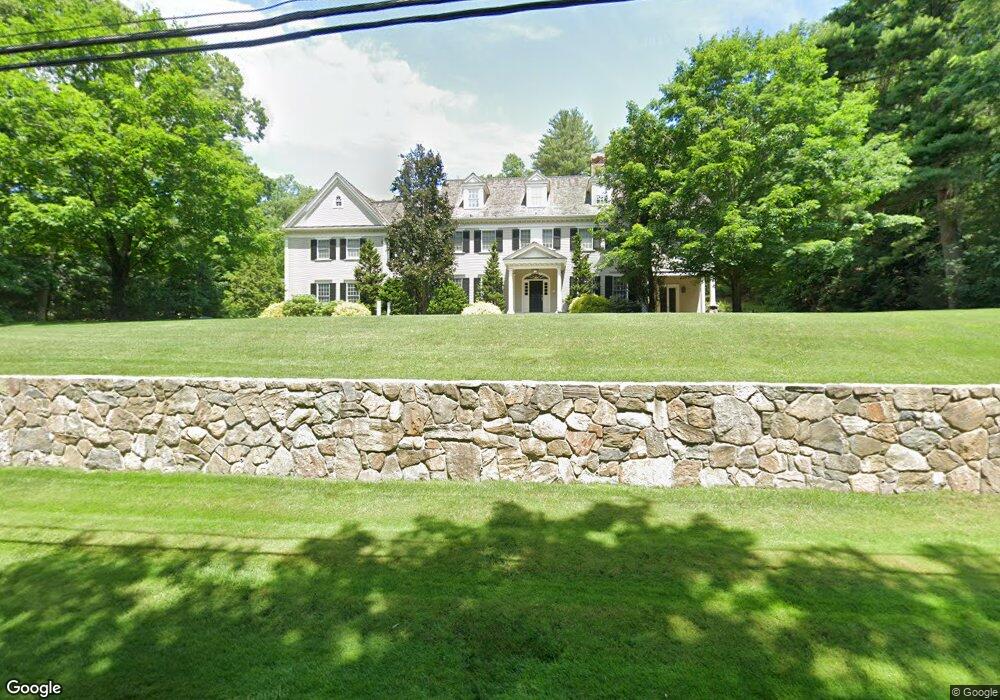
41 Lawrence Rd Weston, MA 02493
Estimated Value: $4,682,000 - $5,409,000
5
Beds
8
Baths
7,500
Sq Ft
$682/Sq Ft
Est. Value
About This Home
This home is located at 41 Lawrence Rd, Weston, MA 02493 and is currently estimated at $5,115,333, approximately $682 per square foot. 41 Lawrence Rd is a home located in Middlesex County with nearby schools including Country Elementary School, Woodland Elementary School, and Weston Middle School.
Ownership History
Date
Name
Owned For
Owner Type
Purchase Details
Closed on
Dec 17, 2004
Sold by
Lawrence Road T and Barsamian Heidi J
Bought by
Macdonald B Lane and Macdonald Wendy W
Current Estimated Value
Home Financials for this Owner
Home Financials are based on the most recent Mortgage that was taken out on this home.
Original Mortgage
$2,149,000
Outstanding Balance
$1,072,637
Interest Rate
5.68%
Mortgage Type
Purchase Money Mortgage
Estimated Equity
$4,042,696
Purchase Details
Closed on
Dec 3, 2003
Sold by
Lawrence Road T
Bought by
Barsamian Heidi J and Barsamian Peter A
Home Financials for this Owner
Home Financials are based on the most recent Mortgage that was taken out on this home.
Original Mortgage
$300,000
Interest Rate
6.03%
Purchase Details
Closed on
Sep 3, 2002
Sold by
Nolan Robert A and Shaughnessy John J
Bought by
Lawrence Road T and Barsamian Peter A
Home Financials for this Owner
Home Financials are based on the most recent Mortgage that was taken out on this home.
Original Mortgage
$1,566,700
Interest Rate
6.55%
Mortgage Type
Purchase Money Mortgage
Create a Home Valuation Report for This Property
The Home Valuation Report is an in-depth analysis detailing your home's value as well as a comparison with similar homes in the area
Home Values in the Area
Average Home Value in this Area
Purchase History
| Date | Buyer | Sale Price | Title Company |
|---|---|---|---|
| Macdonald B Lane | $3,070,000 | -- | |
| Barsamian Heidi J | -- | -- | |
| Lawrence Road T | -- | -- | |
| Lawrence Road T | $1,081,000 | -- |
Source: Public Records
Mortgage History
| Date | Status | Borrower | Loan Amount |
|---|---|---|---|
| Open | Macdonald B Lane | $2,149,000 | |
| Previous Owner | Lawrence Road T | $300,000 | |
| Previous Owner | Lawrence Road T | $1,566,700 |
Source: Public Records
Tax History Compared to Growth
Tax History
| Year | Tax Paid | Tax Assessment Tax Assessment Total Assessment is a certain percentage of the fair market value that is determined by local assessors to be the total taxable value of land and additions on the property. | Land | Improvement |
|---|---|---|---|---|
| 2025 | $41,465 | $3,735,600 | $1,545,700 | $2,189,900 |
| 2024 | $40,728 | $3,662,600 | $1,545,700 | $2,116,900 |
| 2023 | $40,873 | $3,452,100 | $1,545,700 | $1,906,400 |
| 2022 | $40,284 | $3,144,700 | $1,475,700 | $1,669,000 |
| 2021 | $38,866 | $2,994,300 | $1,404,900 | $1,589,400 |
| 2020 | $37,059 | $3,032,900 | $1,404,900 | $1,628,000 |
| 2019 | $38,301 | $3,042,200 | $1,404,900 | $1,637,300 |
| 2018 | $39,054 | $3,121,800 | $1,404,900 | $1,716,900 |
| 2017 | $38,958 | $3,141,800 | $1,404,900 | $1,736,900 |
| 2016 | $35,212 | $2,895,700 | $963,900 | $1,931,800 |
| 2015 | $34,576 | $2,815,600 | $918,300 | $1,897,300 |
Source: Public Records
Map
Nearby Homes
- 6 Steepletree Ln
- 8 Fox Hollow
- 620 South Ave
- 1 Astra Unit 1
- 606 Wisteria Way
- 12 Astra
- 1601 Wisteria Way
- 180 Highland St
- 02 Wellesley St
- 01 Wellesley St
- 42 Westerly Rd
- 125 Woodridge Rd
- 6 Briar Ln
- 19 Old Connecticut Path
- 3 Idlewile Ln
- 12 Nancy Rd
- 2 Candleberry Ln
- 1 Pine Summit Cir
- 23 Pine Summit Cir Unit 23
- 120 Rockport Rd