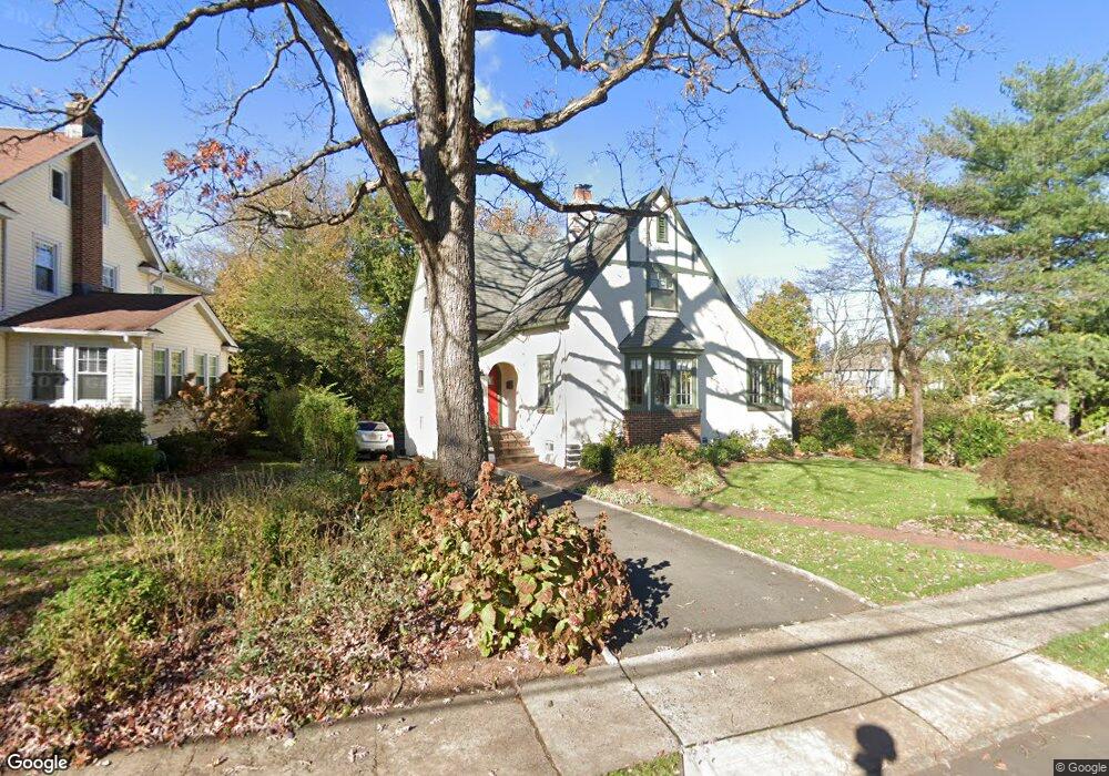
41 Locust Dr Summit, NJ 07901
Estimated Value: $990,536 - $1,660,000
Studio
--
Bath
1,821
Sq Ft
$763/Sq Ft
Est. Value
About This Home
This home is located at 41 Locust Dr, Summit, NJ 07901 and is currently estimated at $1,389,134, approximately $762 per square foot. 41 Locust Dr is a home located in Union County with nearby schools including L C Johnson Summit Middle School, Summit Sr High School, and Oak Knoll School of the Holy Child.
Ownership History
Date
Name
Owned For
Owner Type
Purchase Details
Closed on
Nov 18, 2005
Sold by
Loughlin Thomas G
Bought by
Anderson Kevin M and Anderson Elaine
Current Estimated Value
Home Financials for this Owner
Home Financials are based on the most recent Mortgage that was taken out on this home.
Original Mortgage
$359,650
Outstanding Balance
$198,261
Interest Rate
6.14%
Mortgage Type
New Conventional
Estimated Equity
$1,190,873
Purchase Details
Closed on
Nov 2, 1995
Sold by
Miller Marney J
Bought by
Loughlin Thomas and Loughlin Ashbrook
Create a Home Valuation Report for This Property
The Home Valuation Report is an in-depth analysis detailing your home's value as well as a comparison with similar homes in the area
Home Values in the Area
Average Home Value in this Area
Purchase History
| Date | Buyer | Sale Price | Title Company |
|---|---|---|---|
| Anderson Kevin M | $837,000 | -- | |
| Loughlin Thomas | $280,000 | First American |
Source: Public Records
Mortgage History
| Date | Status | Borrower | Loan Amount |
|---|---|---|---|
| Open | Anderson Kevin M | $359,650 |
Source: Public Records
Tax History
| Year | Tax Paid | Tax Assessment Tax Assessment Total Assessment is a certain percentage of the fair market value that is determined by local assessors to be the total taxable value of land and additions on the property. | Land | Improvement |
|---|---|---|---|---|
| 2025 | $14,031 | $322,100 | $180,900 | $141,200 |
| 2024 | $13,937 | $322,100 | $180,900 | $141,200 |
| 2023 | $13,937 | $322,100 | $180,900 | $141,200 |
| 2022 | $13,796 | $322,100 | $180,900 | $141,200 |
| 2021 | $13,905 | $322,100 | $180,900 | $141,200 |
| 2020 | $14,044 | $322,100 | $180,900 | $141,200 |
| 2019 | $14,060 | $322,100 | $180,900 | $141,200 |
| 2018 | $13,969 | $322,100 | $180,900 | $141,200 |
| 2017 | $14,060 | $322,100 | $180,900 | $141,200 |
| 2016 | $13,854 | $322,100 | $180,900 | $141,200 |
| 2015 | $13,583 | $314,400 | $180,900 | $133,500 |
| 2014 | $12,916 | $314,400 | $180,900 | $133,500 |
Source: Public Records
Map
Nearby Homes
- 42 Locust Dr
- 40 Prospect St
- 61 Tulip St
- 67 Tulip St
- 64 Tulip St
- 69 Elm St
- 107 Kent Place Blvd
- 84 Pine Grove Ave
- 49 Norwood Ave
- 105 Larned Rd
- 4 Parkview Terrace
- 709 Springfield Ave Unit One
- 709 Springfield Ave Unit 4
- 709 Springfield Ave Unit 2
- 709 Springfield Ave Unit 3
- 76 Woodland Ave
- 25 Bedford Rd
- 88 Beekman Rd
- 1 Irving Place
- 23 Euclid Ave
Your Personal Tour Guide
Ask me questions while you tour the home.