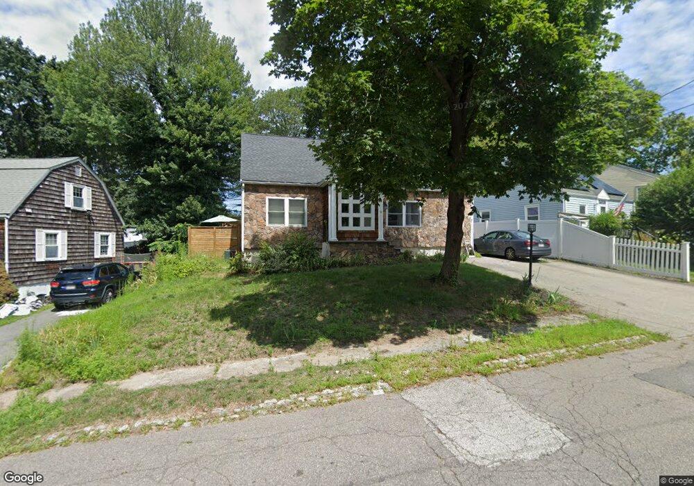
41 Lone Pine Path Weymouth, MA 02188
Weymouth Landing NeighborhoodEstimated Value: $617,000 - $685,000
3
Beds
2
Baths
1,829
Sq Ft
$355/Sq Ft
Est. Value
About This Home
This home is located at 41 Lone Pine Path, Weymouth, MA 02188 and is currently estimated at $648,539, approximately $354 per square foot. 41 Lone Pine Path is a home located in Norfolk County with nearby schools including Frederick C Murphy, Abigail Adams Middle School, and Weymouth Middle School Chapman.
Ownership History
Date
Name
Owned For
Owner Type
Purchase Details
Closed on
Oct 27, 2006
Sold by
Fielding Teresa M
Bought by
Dervishi Arben and Bowden Kerry A
Current Estimated Value
Home Financials for this Owner
Home Financials are based on the most recent Mortgage that was taken out on this home.
Original Mortgage
$293,600
Outstanding Balance
$176,290
Interest Rate
6.48%
Mortgage Type
Purchase Money Mortgage
Estimated Equity
$472,249
Create a Home Valuation Report for This Property
The Home Valuation Report is an in-depth analysis detailing your home's value as well as a comparison with similar homes in the area
Home Values in the Area
Average Home Value in this Area
Purchase History
| Date | Buyer | Sale Price | Title Company |
|---|---|---|---|
| Dervishi Arben | $367,000 | -- |
Source: Public Records
Mortgage History
| Date | Status | Borrower | Loan Amount |
|---|---|---|---|
| Open | Dervishi Arben | $293,600 | |
| Closed | Dervishi Arben | $73,400 |
Source: Public Records
Tax History
| Year | Tax Paid | Tax Assessment Tax Assessment Total Assessment is a certain percentage of the fair market value that is determined by local assessors to be the total taxable value of land and additions on the property. | Land | Improvement |
|---|---|---|---|---|
| 2025 | $5,287 | $523,500 | $212,700 | $310,800 |
| 2024 | $5,126 | $499,100 | $202,600 | $296,500 |
| 2023 | $4,833 | $462,500 | $187,600 | $274,900 |
| 2022 | $4,718 | $411,700 | $173,700 | $238,000 |
| 2021 | $4,466 | $380,400 | $173,700 | $206,700 |
| 2020 | $4,241 | $355,800 | $173,700 | $182,100 |
| 2019 | $4,141 | $341,700 | $167,000 | $174,700 |
| 2018 | $4,081 | $326,500 | $159,000 | $167,500 |
| 2017 | $3,990 | $311,500 | $151,500 | $160,000 |
| 2016 | $3,894 | $304,200 | $145,700 | $158,500 |
| 2015 | $3,662 | $283,900 | $139,000 | $144,900 |
| 2014 | $3,470 | $260,900 | $129,400 | $131,500 |
Source: Public Records
Map
Nearby Homes
- 82 Lester Ln
- 107 Summer St
- 33 Congress St
- 15 Summer St
- 11 Richmond St
- 19 Vine St Unit 3
- 19 Vine St Unit 2
- 122 Washington St Unit Twenty-two
- 25 Richmond St
- 31 Doris Rd
- 37 Lantern Ln
- 41 Lantern Ln
- 501 Commerce Dr Unit 2310
- 501 Commerce Dr Unit 4308
- 46 Roosevelt Rd
- 116 Greenvale Ave
- 300 Commercial St Unit 23
- 747 Middle St
- 8 Tara Dr Unit 4
- 8 Tara Dr Unit 5
- 35 Lone Pine Path
- 47 Lone Pine Path
- 26 Briarwood Trail
- 53 Lone Pine Path
- 29 Lone Pine Path
- 23 Briarwood Trail
- 40 Lone Pine Path
- 46 Lone Pine Path
- 59 Lone Pine Path
- 25 Lone Pine Path
- 50 Lone Pine Path
- 30 Lone Pine Path
- 36 Lone Pine Path
- 65 Lone Pine Path
- 21 Briarwood Trail
- 56 Lone Pine Path
- 19 Lone Pine Path
- 20 Briarwood Trail
- 69 Lone Pine Path
- 20 Lone Pine Path
Your Personal Tour Guide
Ask me questions while you tour the home.