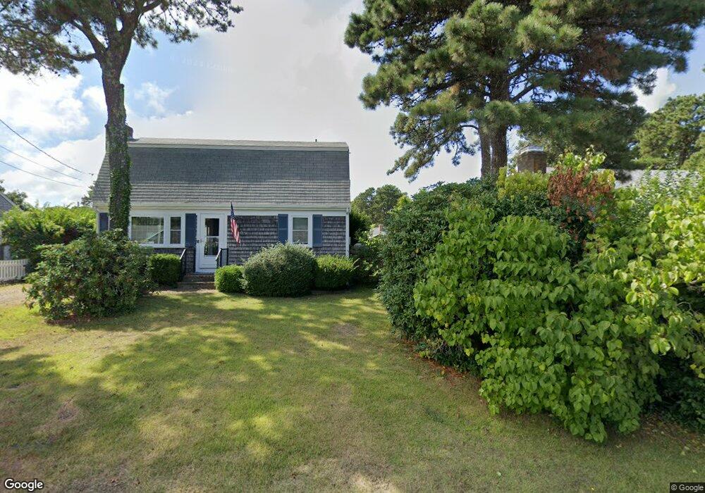
41 Lorree Ln Dennis Port, MA 02639
Dennis Port NeighborhoodEstimated Value: $573,000 - $640,635
3
Beds
2
Baths
1,128
Sq Ft
$534/Sq Ft
Est. Value
About This Home
This home is located at 41 Lorree Ln, Dennis Port, MA 02639 and is currently estimated at $602,659, approximately $534 per square foot. 41 Lorree Ln is a home located in Barnstable County with nearby schools including Dennis-Yarmouth Regional High School and St. Pius X. School.
Ownership History
Date
Name
Owned For
Owner Type
Purchase Details
Closed on
Nov 18, 2024
Sold by
Mcdonough Jacqueline M
Bought by
Jacqueline M Mcdonough Ft and Clark
Current Estimated Value
Purchase Details
Closed on
Oct 6, 2017
Sold by
Mcdonough Mary E
Bought by
Mcdonough Jacqueline M
Create a Home Valuation Report for This Property
The Home Valuation Report is an in-depth analysis detailing your home's value as well as a comparison with similar homes in the area
Home Values in the Area
Average Home Value in this Area
Purchase History
| Date | Buyer | Sale Price | Title Company |
|---|---|---|---|
| Jacqueline M Mcdonough Ft | -- | None Available | |
| Jacqueline M Mcdonough Ft | -- | None Available | |
| Mcdonough Jacqueline M | -- | -- | |
| Mcdonough Jacqueline M | -- | -- |
Source: Public Records
Tax History Compared to Growth
Tax History
| Year | Tax Paid | Tax Assessment Tax Assessment Total Assessment is a certain percentage of the fair market value that is determined by local assessors to be the total taxable value of land and additions on the property. | Land | Improvement |
|---|---|---|---|---|
| 2025 | $2,295 | $530,000 | $198,700 | $331,300 |
| 2024 | $2,186 | $498,000 | $191,100 | $306,900 |
| 2023 | $2,114 | $452,700 | $173,700 | $279,000 |
| 2022 | $2,037 | $363,800 | $156,500 | $207,300 |
| 2021 | $2,095 | $347,400 | $175,400 | $172,000 |
| 2020 | $1,888 | $309,500 | $153,400 | $156,100 |
| 2019 | $1,784 | $289,200 | $150,400 | $138,800 |
| 2018 | $1,721 | $271,400 | $143,200 | $128,200 |
| 2017 | $1,609 | $261,700 | $133,000 | $128,700 |
| 2016 | $1,636 | $250,500 | $143,200 | $107,300 |
| 2015 | $1,603 | $250,500 | $143,200 | $107,300 |
| 2014 | $1,461 | $230,100 | $122,800 | $107,300 |
Source: Public Records
Map
Nearby Homes
- 31 Easy St
- 22 Wixon Rd
- 19 Standish Way
- 80 Michaels Ave
- 72 Bassett Ln
- 4 Coffey Ln
- 125 Main St Unit 3
- 22 Ferncliff Rd
- 71 Main St
- 268 Main St
- 37 Beach Hills Rd
- 37-A Beach Hills Rd
- 262 Old Wharf Rd Unit 67
- 262 Old Wharf Rd Unit 5
- 262 Old Wharf Rd Unit 5
- 262 Old Wharf Rd Unit 20
- 262 Old Wharf Rd Unit 87
- 37 Ocean Dr Unit 2
- 64 Beaten Rd
- 241 Old Wharf Rd Unit 127
- 7 3rd Mate Row
- 37 Lorree Ln
- 3 3rd Mate Row
- 37 Easy St
- 8 2nd Mate Row
- 41 Easy St
- 49 Lorree Ln
- 43 Easy St
- 4 2nd Mate Row
- 35 Easy St
- 8 3rd Mate Row
- 0 Easy St Unit 68-7 2013680
- 0 Easy St Unit 1-2
- 47 Easy St
- 54 Captain Chase Rd
- 4 3rd Mate Row
- 58 Captain Chase Rd
- 46 Captain Chase Rd
- 49 Easy St
- 29 Lorree Ln