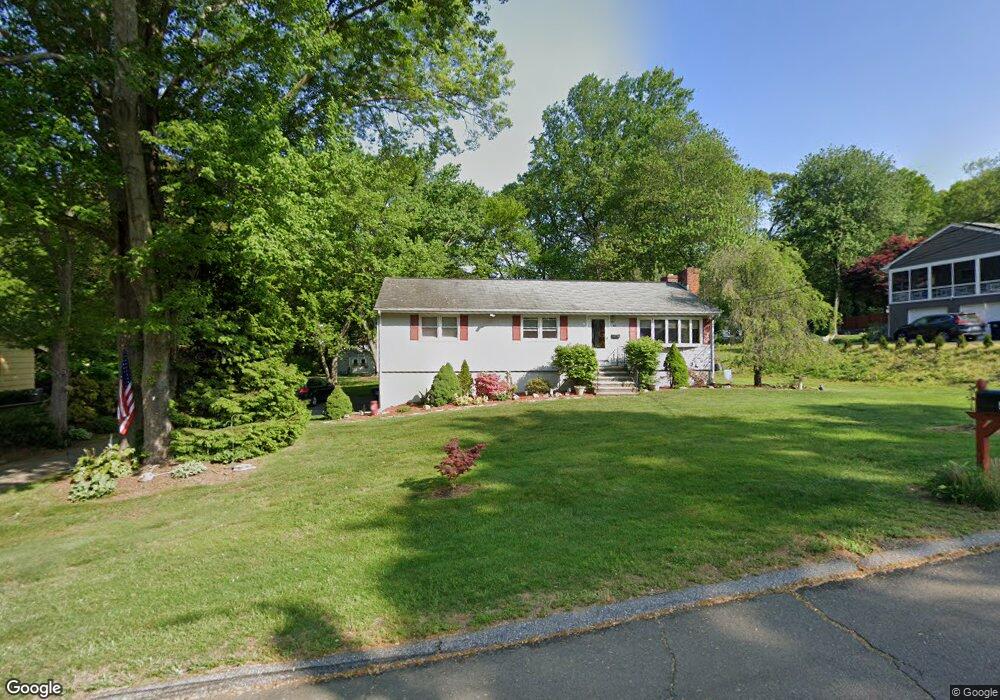
41 Lounsbury Rd Trumbull, CT 06611
Trumbull Center NeighborhoodEstimated Value: $670,000 - $720,000
3
Beds
4
Baths
2,050
Sq Ft
$336/Sq Ft
Est. Value
About This Home
This home is located at 41 Lounsbury Rd, Trumbull, CT 06611 and is currently estimated at $688,061, approximately $335 per square foot. 41 Lounsbury Rd is a home located in Fairfield County with nearby schools including Frenchtown Elementary School, Madison Middle School, and Trumbull High School.
Ownership History
Date
Name
Owned For
Owner Type
Purchase Details
Closed on
Sep 5, 1995
Sold by
Blueweiss Jeffrey and Blueweiss Lynn
Bought by
Adams Brian and Adams Angela
Current Estimated Value
Home Financials for this Owner
Home Financials are based on the most recent Mortgage that was taken out on this home.
Original Mortgage
$120,000
Interest Rate
7.61%
Mortgage Type
Unknown
Create a Home Valuation Report for This Property
The Home Valuation Report is an in-depth analysis detailing your home's value as well as a comparison with similar homes in the area
Home Values in the Area
Average Home Value in this Area
Purchase History
| Date | Buyer | Sale Price | Title Company |
|---|---|---|---|
| Adams Brian | $227,000 | -- |
Source: Public Records
Mortgage History
| Date | Status | Borrower | Loan Amount |
|---|---|---|---|
| Closed | Adams Brian | $120,000 |
Source: Public Records
Tax History Compared to Growth
Tax History
| Year | Tax Paid | Tax Assessment Tax Assessment Total Assessment is a certain percentage of the fair market value that is determined by local assessors to be the total taxable value of land and additions on the property. | Land | Improvement |
|---|---|---|---|---|
| 2025 | $11,534 | $312,410 | $156,590 | $155,820 |
| 2024 | $11,219 | $312,410 | $156,590 | $155,820 |
| 2023 | $11,037 | $312,410 | $156,590 | $155,820 |
| 2022 | $10,861 | $312,410 | $156,590 | $155,820 |
| 2021 | $9,255 | $253,260 | $130,480 | $122,780 |
| 2020 | $9,079 | $253,260 | $130,480 | $122,780 |
| 2018 | $8,855 | $253,260 | $130,480 | $122,780 |
| 2017 | $8,677 | $253,260 | $130,480 | $122,780 |
| 2016 | $8,502 | $253,260 | $130,480 | $122,780 |
| 2015 | $8,626 | $254,000 | $130,500 | $123,500 |
| 2014 | $8,441 | $254,000 | $130,500 | $123,500 |
Source: Public Records
Map
Nearby Homes
- 1675 Old Town Rd
- 11 Linda Dr
- 8 Moorland Rd
- 715 Frenchtown Rd Unit 31
- 1800 Chopsey Hill Rd
- 60 Lillian Dr
- 122 Paugusett Cir
- 90 Sequoia Rd
- 121 Paugusett Cir
- 26 Grove St
- 58 Daniels Farm Rd
- 7 Manor Dr
- 87 Parkway Dr
- 11 Laurel St
- 33 Enclave Dr Unit 33
- 87 Oliver St
- 291 Frenchtown Rd
- 2851 Old Town Rd
- 1 Village Dr
- Lot 31 Valley View Rd
- 53 Lounsbury Rd
- 27 Lounsbury Rd
- 127 Woolsley Ave
- 121 Woolsley Ave
- 131 Woolsley Ave
- 65 Lounsbury Rd
- 133 Woolsley Ave
- 117 Woolsley Ave
- 36 Lounsbury Rd
- 93 Leonard Place
- 24 Lounsbury Rd
- 64 Lounsbury Rd
- 50 Lounsbury Rd
- 87 Leonard Place
- 113 Woolsley Ave
- 10 Lounsbury Rd
- 77 Lounsbury Rd
- 128 Woolsley Ave
- 139 Woolsley Ave
- 41 Arrowhead Rd