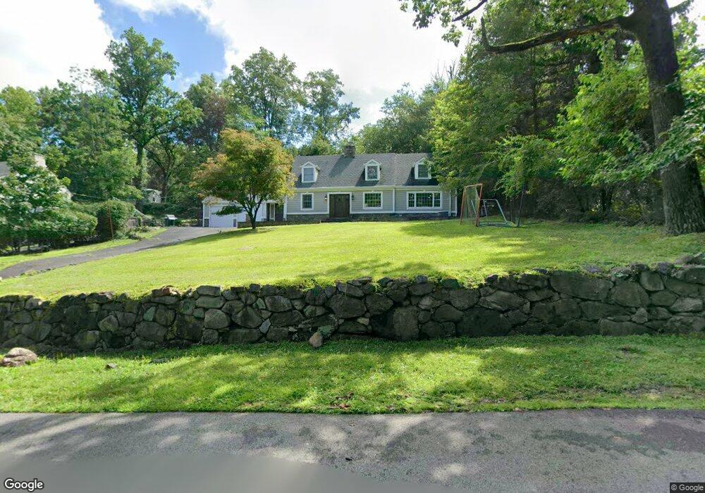
41 Malcolm Rd Mahwah, NJ 07430
Estimated Value: $829,508 - $1,146,000
--
Bed
--
Bath
2,219
Sq Ft
$420/Sq Ft
Est. Value
About This Home
This home is located at 41 Malcolm Rd, Mahwah, NJ 07430 and is currently estimated at $932,127, approximately $420 per square foot. 41 Malcolm Rd is a home located in Bergen County with nearby schools including Mahwah High School.
Ownership History
Date
Name
Owned For
Owner Type
Purchase Details
Closed on
Apr 25, 2020
Sold by
Ford Thomas and Mcginnis Deirdre
Bought by
Ford Thomas and Mcginnis Deirdre
Current Estimated Value
Home Financials for this Owner
Home Financials are based on the most recent Mortgage that was taken out on this home.
Original Mortgage
$519,446
Outstanding Balance
$460,301
Interest Rate
3.3%
Mortgage Type
FHA
Estimated Equity
$471,826
Purchase Details
Closed on
May 19, 2004
Purchase Details
Closed on
Jan 3, 1997
Sold by
Markham Paul D
Bought by
Renicker Edward and Renicker Susan M
Home Financials for this Owner
Home Financials are based on the most recent Mortgage that was taken out on this home.
Original Mortgage
$283,000
Interest Rate
7.46%
Purchase Details
Closed on
Oct 14, 1994
Sold by
Patterson George and Patterson Candace
Bought by
Markham Paul
Create a Home Valuation Report for This Property
The Home Valuation Report is an in-depth analysis detailing your home's value as well as a comparison with similar homes in the area
Home Values in the Area
Average Home Value in this Area
Purchase History
| Date | Buyer | Sale Price | Title Company |
|---|---|---|---|
| Ford Thomas | $174,670 | Solidifi | |
| -- | $610,000 | -- | |
| Renicker Edward | $314,000 | -- | |
| Markham Paul | $330,000 | -- |
Source: Public Records
Mortgage History
| Date | Status | Borrower | Loan Amount |
|---|---|---|---|
| Open | Ford Thomas | $519,446 | |
| Previous Owner | Renicker Edward | $283,000 |
Source: Public Records
Tax History Compared to Growth
Tax History
| Year | Tax Paid | Tax Assessment Tax Assessment Total Assessment is a certain percentage of the fair market value that is determined by local assessors to be the total taxable value of land and additions on the property. | Land | Improvement |
|---|---|---|---|---|
| 2025 | $10,749 | $520,800 | $330,000 | $190,800 |
| 2024 | $10,609 | $520,800 | $330,000 | $190,800 |
| 2023 | $10,270 | $520,800 | $330,000 | $190,800 |
| 2022 | $10,270 | $520,800 | $330,000 | $190,800 |
| 2021 | $10,161 | $520,800 | $330,000 | $190,800 |
| 2020 | $9,916 | $520,800 | $330,000 | $190,800 |
| 2019 | $9,588 | $520,800 | $330,000 | $190,800 |
| 2018 | $9,453 | $520,800 | $330,000 | $190,800 |
| 2017 | $9,301 | $520,800 | $330,000 | $190,800 |
| 2016 | $9,098 | $520,800 | $330,000 | $190,800 |
| 2015 | $8,973 | $520,800 | $330,000 | $190,800 |
| 2014 | $8,822 | $520,800 | $330,000 | $190,800 |
Source: Public Records
Map
Nearby Homes
- 12 Alcott Rd
- 37 Hillside Ave
- 66 Thunderhead Place
- 13 Winter Terrace
- 324 Franklin Turnpike
- 16 Gardner St
- 163 Rutherford Rd
- 2256 Margaret Ct Unit 21A
- 2120 Gunston Ct
- 2115 Henry Ct Unit 1
- 2 Reid Ct
- 2130 Isabelle Ct
- 2054 Charles Ct
- 2170 Kent Ct
- 1415 York St
- 199 Island Rd
- 1248 Garrison Ct Unit E1
- 12 Sagamore Ave
- 1194 Richmond Rd Unit A2
- 199 Parkside Dr