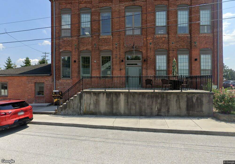
41 Monarch St Littlestown, PA 17340
Estimated Value: $651,069
--
Bed
--
Bath
26,270
Sq Ft
$25/Sq Ft
Est. Value
About This Home
This home is located at 41 Monarch St, Littlestown, PA 17340 and is currently estimated at $651,069, approximately $24 per square foot. 41 Monarch St is a home located in Adams County with nearby schools including Rolling Acres El School, Maple Avenue Middle School, and Littlestown Senior High School.
Ownership History
Date
Name
Owned For
Owner Type
Purchase Details
Closed on
Jul 21, 2015
Sold by
41 Monarch St Llc
Bought by
S&B Hawk Properties Llc
Current Estimated Value
Home Financials for this Owner
Home Financials are based on the most recent Mortgage that was taken out on this home.
Original Mortgage
$700,000
Outstanding Balance
$549,041
Interest Rate
4.03%
Mortgage Type
Construction
Estimated Equity
$102,028
Purchase Details
Closed on
Jan 2, 2003
Bought by
41 Monarch St Llc
Create a Home Valuation Report for This Property
The Home Valuation Report is an in-depth analysis detailing your home's value as well as a comparison with similar homes in the area
Home Values in the Area
Average Home Value in this Area
Purchase History
| Date | Buyer | Sale Price | Title Company |
|---|---|---|---|
| S&B Hawk Properties Llc | $375,000 | None Available | |
| 41 Monarch St Llc | $105,000 | -- |
Source: Public Records
Mortgage History
| Date | Status | Borrower | Loan Amount |
|---|---|---|---|
| Open | S&B Hawk Properties Llc | $700,000 |
Source: Public Records
Tax History Compared to Growth
Tax History
| Year | Tax Paid | Tax Assessment Tax Assessment Total Assessment is a certain percentage of the fair market value that is determined by local assessors to be the total taxable value of land and additions on the property. | Land | Improvement |
|---|---|---|---|---|
| 2025 | $17,093 | $743,600 | $105,300 | $638,300 |
| 2024 | $16,473 | $743,600 | $105,300 | $638,300 |
| 2023 | $15,834 | $743,600 | $105,300 | $638,300 |
| 2022 | $15,738 | $743,600 | $105,300 | $638,300 |
| 2021 | $15,273 | $743,600 | $105,300 | $638,300 |
| 2020 | $15,090 | $743,600 | $105,300 | $638,300 |
| 2019 | $14,638 | $743,600 | $105,300 | $638,300 |
| 2018 | $14,371 | $743,600 | $105,300 | $638,300 |
| 2017 | $6,080 | $322,900 | $105,300 | $217,600 |
| 2016 | -- | $322,900 | $105,300 | $217,600 |
| 2015 | -- | $323,500 | $105,900 | $217,600 |
| 2014 | -- | $323,500 | $105,900 | $217,600 |
Source: Public Records
Map
Nearby Homes
- 61 E King St
- 211 E King St
- 115 Charles St
- 117 Charles St
- 28 Gettysburg Ct Unit 60
- 129 W King St
- 22 Rita Marie Ave
- 535 Lumber St
- 449 Glenwyn Dr
- 559 Lumber St
- 567 Lumber St
- 41 Smith Cir
- 140 Apple Grove Ln Unit 425
- 135 Apple Grove Ln Unit 438
- 15 Yorktowne Ct Unit 97
- 52 Stayman Way Unit 81
- 162 Newark St
- 5 Manor Cir Unit 103
- 440 N Queen St
- 161 Stoners Cir
- 41 Monarch St
- 95 Monarch St
- 30 Crescent Ln Unit 38A
- 28 Crescent Ln Unit 38B
- 26 Crescent Ln Unit 38C
- 24 Crescent Ln Unit 38D
- 22 Crescent Ln Unit 38E
- 302 S Queen St
- 9 Monarch St
- 20 Crescent Ln Unit 38F
- 25 Starlite Dr Unit 46
- 27 Starlite Dr Unit 47
- 23 Starlite Dr Unit 45
- 29 Starlite Dr Unit 48
- 21 Starlite Dr Unit 44
- 318 S Queen St
- 31 Starlite Dr Unit 49
- 18 Crescent Ln Unit 38G
- 322 S Queen St
- 33 Starlite Dr Unit 50