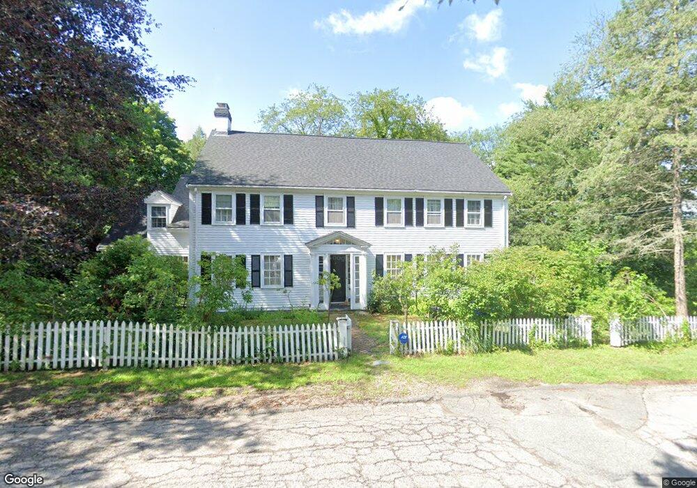
41 Morton Rd Milton, MA 02186
Columbine Cliffs NeighborhoodEstimated Value: $1,756,362 - $2,212,000
5
Beds
4
Baths
3,546
Sq Ft
$558/Sq Ft
Est. Value
About This Home
This home is located at 41 Morton Rd, Milton, MA 02186 and is currently estimated at $1,980,341, approximately $558 per square foot. 41 Morton Rd is a home located in Norfolk County with nearby schools including Milton High School, Conservatory Lab Upper School, and Saint John Paul II Catholic Academy.
Ownership History
Date
Name
Owned For
Owner Type
Purchase Details
Closed on
Nov 29, 2018
Sold by
Stevens Kathie S
Bought by
K Seymour Stevens Ret
Current Estimated Value
Purchase Details
Closed on
Jun 22, 1983
Bought by
Seymour-Stevens Kathie
Create a Home Valuation Report for This Property
The Home Valuation Report is an in-depth analysis detailing your home's value as well as a comparison with similar homes in the area
Home Values in the Area
Average Home Value in this Area
Purchase History
| Date | Buyer | Sale Price | Title Company |
|---|---|---|---|
| K Seymour Stevens Ret | -- | -- | |
| Seymour-Stevens Kathie | $135,000 | -- |
Source: Public Records
Mortgage History
| Date | Status | Borrower | Loan Amount |
|---|---|---|---|
| Previous Owner | Seymour-Stevens Kathie | $100,000 | |
| Previous Owner | Seymour-Stevens Kathie | $100,000 |
Source: Public Records
Tax History Compared to Growth
Tax History
| Year | Tax Paid | Tax Assessment Tax Assessment Total Assessment is a certain percentage of the fair market value that is determined by local assessors to be the total taxable value of land and additions on the property. | Land | Improvement |
|---|---|---|---|---|
| 2025 | $15,065 | $1,358,400 | $591,200 | $767,200 |
| 2024 | $14,530 | $1,330,600 | $563,100 | $767,500 |
| 2023 | $14,286 | $1,253,200 | $536,300 | $716,900 |
| 2022 | $13,641 | $1,093,900 | $536,300 | $557,600 |
| 2021 | $13,408 | $1,021,200 | $490,200 | $531,000 |
| 2020 | $13,190 | $1,005,300 | $485,500 | $519,800 |
| 2019 | $13,735 | $1,042,100 | $537,400 | $504,700 |
| 2018 | $13,093 | $948,100 | $450,900 | $497,200 |
| 2017 | $12,247 | $903,200 | $429,400 | $473,800 |
| 2016 | $12,051 | $892,700 | $429,400 | $463,300 |
| 2015 | $12,503 | $896,900 | $416,200 | $480,700 |
Source: Public Records
Map
Nearby Homes
- 75 Canton Ave
- 4 School St
- 131 Eliot St Unit 312
- 131 Eliot St Unit 408
- 131 Eliot St Unit 305
- 21A High St Unit 2
- 1245 Adams St Unit B503
- 1245 Adams St Unit B406
- 1245 Adams St Unit B506
- 1245 Adams St Unit B210
- 8-14R Temple St
- 18-20 Cedar St Unit 2
- 32-32R Temple St
- 88 Wharf St Unit 306
- 88 Wharf St Unit 511
- 21 Tanglewood Rd Unit 1
- 21 Tanglewood Rd Unit 2
- 19 Standard St Unit 2
- 3 Paula Rd
- 56 Oakridge St