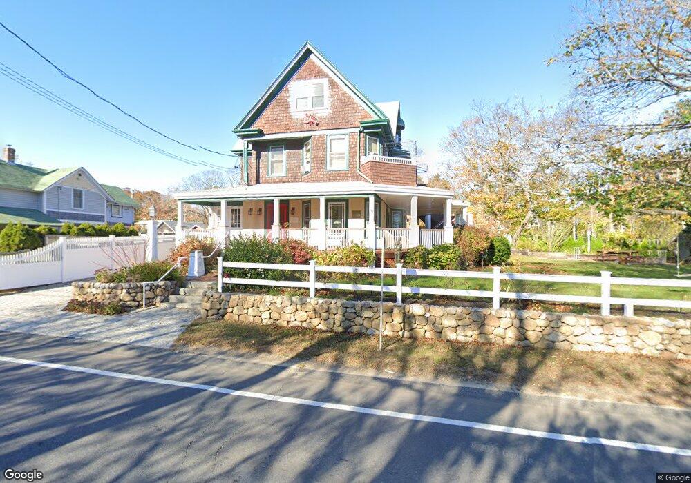
41 New York Ave Vineyard Haven, MA 02568
Oak Bluffs NeighborhoodEstimated Value: $1,999,000 - $2,396,000
5
Beds
1
Bath
2,390
Sq Ft
$897/Sq Ft
Est. Value
About This Home
This home is located at 41 New York Ave, Vineyard Haven, MA 02568 and is currently estimated at $2,142,650, approximately $896 per square foot. 41 New York Ave is a home located in Dukes County with nearby schools including Oak Bluffs Elementary School, Martha's Vineyard Regional High School, and Vineyard Montessori School.
Ownership History
Date
Name
Owned For
Owner Type
Purchase Details
Closed on
Dec 29, 2023
Sold by
Paris Theodore and Paris Calvin R
Bought by
Paris Theodore and Paris Joelle B
Current Estimated Value
Purchase Details
Closed on
Jan 11, 2010
Sold by
Paris Calvin R and Robinson Pauline A
Bought by
Paris Calvin R and Paris Theodore Thurgo
Purchase Details
Closed on
Dec 28, 2005
Sold by
Four Gables Llc
Bought by
Paris Calvin R and Robinson Pauline A
Home Financials for this Owner
Home Financials are based on the most recent Mortgage that was taken out on this home.
Original Mortgage
$700,000
Interest Rate
6.39%
Mortgage Type
Purchase Money Mortgage
Create a Home Valuation Report for This Property
The Home Valuation Report is an in-depth analysis detailing your home's value as well as a comparison with similar homes in the area
Home Values in the Area
Average Home Value in this Area
Purchase History
| Date | Buyer | Sale Price | Title Company |
|---|---|---|---|
| Paris Theodore | -- | None Available | |
| Paris Calvin R | -- | -- | |
| Paris Calvin R | $875,000 | -- |
Source: Public Records
Mortgage History
| Date | Status | Borrower | Loan Amount |
|---|---|---|---|
| Previous Owner | Paris Calvin R | $700,000 |
Source: Public Records
Tax History Compared to Growth
Tax History
| Year | Tax Paid | Tax Assessment Tax Assessment Total Assessment is a certain percentage of the fair market value that is determined by local assessors to be the total taxable value of land and additions on the property. | Land | Improvement |
|---|---|---|---|---|
| 2025 | $10,074 | $1,994,800 | $1,086,800 | $908,000 |
| 2024 | $9,707 | $1,856,100 | $987,600 | $868,500 |
| 2023 | $8,856 | $1,677,200 | $959,600 | $717,600 |
| 2022 | $8,739 | $1,287,000 | $729,400 | $557,600 |
| 2021 | $7,792 | $1,057,200 | $631,200 | $426,000 |
| 2020 | $7,424 | $997,900 | $601,200 | $396,700 |
| 2019 | $7,466 | $970,900 | $580,900 | $390,000 |
| 2018 | $6,991 | $892,900 | $501,200 | $391,700 |
| 2017 | $6,674 | $818,900 | $465,000 | $353,900 |
| 2016 | $6,361 | $784,400 | $479,400 | $305,000 |
| 2015 | $6,090 | $765,100 | $479,400 | $285,700 |
| 2014 | $6,054 | $775,200 | $484,400 | $290,800 |
Source: Public Records
Map
Nearby Homes
- 23 Laurel Ave
- 12 & 14 Maple Ave
- 9 Brunswick Ave
- 26 Hampson Ave
- 25 Hampson Ave
- 22 Greenleaf Ave
- 22 Greenleaf Ave
- 17 John Wesley Ave
- 47 E Chop Dr Unit 5
- 47 E Chop Dr Unit 4
- 47 E Chop Dr Unit 3
- 47 E Chop Dr Unit 2
- 47 E Chop Dr Unit 1
- 47 E Chop Dr
- 47 E East Chop Dr Unit 5
- 10 Siloam Ave
- 17 Siloam Ave
- 54 Towanticut Ave
- 41 Trinity Park
- 2 Lincoln Ave