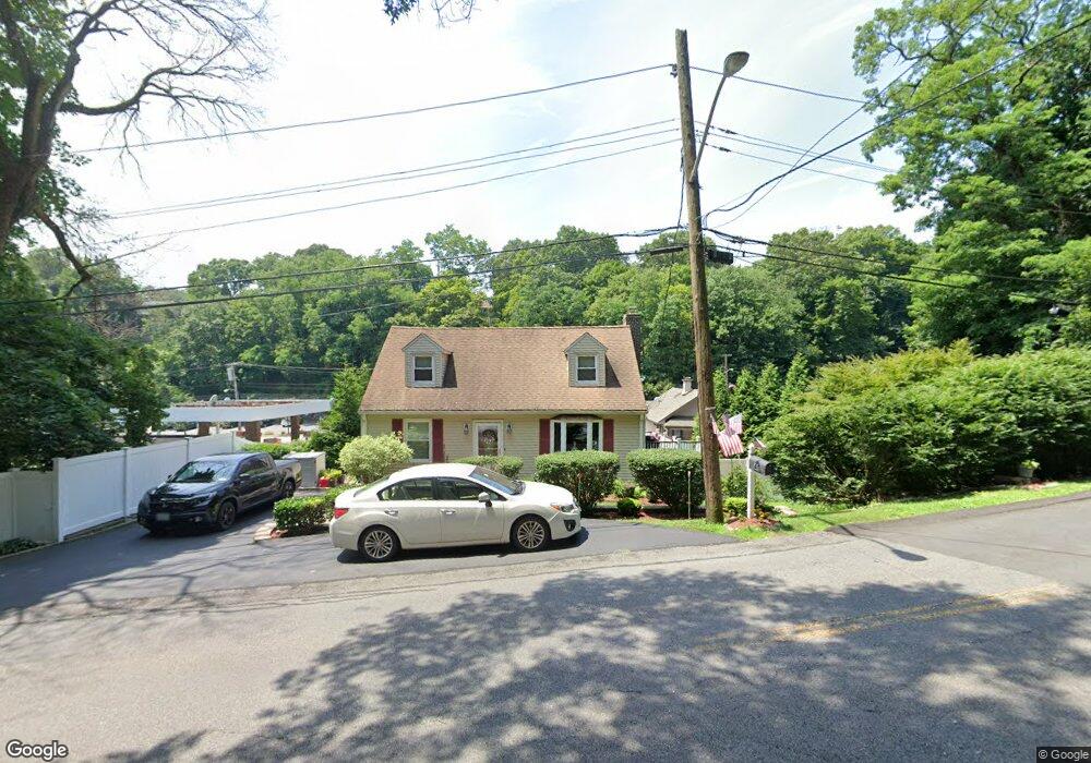
41 Palmer Ave White Plains, NY 10603
North White Plains NeighborhoodEstimated Value: $686,279 - $743,000
--
Bed
--
Bath
1,237
Sq Ft
$572/Sq Ft
Est. Value
About This Home
This home is located at 41 Palmer Ave, White Plains, NY 10603 and is currently estimated at $708,070, approximately $572 per square foot. 41 Palmer Ave is a home located in Westchester County with nearby schools including Virginia Road Elementary School, Kensico School, and Valhalla Middle School.
Ownership History
Date
Name
Owned For
Owner Type
Purchase Details
Closed on
Jul 3, 2001
Sold by
Pietropaolo Brian Vincent and Stanton Pietropaolo Maryalice
Bought by
Mottola Joseph A and Mottola Holly A
Current Estimated Value
Home Financials for this Owner
Home Financials are based on the most recent Mortgage that was taken out on this home.
Original Mortgage
$260,100
Outstanding Balance
$100,381
Interest Rate
7.16%
Mortgage Type
Unknown
Estimated Equity
$607,689
Purchase Details
Closed on
Sep 22, 1997
Sold by
Smith Mark A and Ozalis Sheila A
Bought by
Kolt Gayle B
Create a Home Valuation Report for This Property
The Home Valuation Report is an in-depth analysis detailing your home's value as well as a comparison with similar homes in the area
Home Values in the Area
Average Home Value in this Area
Purchase History
| Date | Buyer | Sale Price | Title Company |
|---|---|---|---|
| Mottola Joseph A | $289,000 | Fidelity National Title Ins | |
| Kolt Gayle B | $230,000 | First American Title Ins Co |
Source: Public Records
Mortgage History
| Date | Status | Borrower | Loan Amount |
|---|---|---|---|
| Open | Mottola Joseph A | $260,100 |
Source: Public Records
Tax History Compared to Growth
Tax History
| Year | Tax Paid | Tax Assessment Tax Assessment Total Assessment is a certain percentage of the fair market value that is determined by local assessors to be the total taxable value of land and additions on the property. | Land | Improvement |
|---|---|---|---|---|
| 2024 | $9,104 | $7,400 | $2,500 | $4,900 |
| 2023 | $8,497 | $7,400 | $2,500 | $4,900 |
| 2022 | $7,895 | $7,400 | $2,500 | $4,900 |
| 2021 | $7,913 | $7,400 | $2,500 | $4,900 |
| 2020 | $7,888 | $7,400 | $2,500 | $4,900 |
| 2019 | $8,882 | $7,400 | $2,500 | $4,900 |
| 2018 | $7,989 | $7,400 | $2,500 | $4,900 |
| 2017 | $4,761 | $7,400 | $2,500 | $4,900 |
| 2016 | $9,429 | $7,400 | $2,500 | $4,900 |
| 2015 | -- | $7,400 | $2,500 | $4,900 |
| 2014 | -- | $7,400 | $2,500 | $4,900 |
| 2013 | -- | $7,400 | $2,500 | $4,900 |
Source: Public Records
Map
Nearby Homes
- 11 Church St
- 35 Washington Ave N
- 9 Pinewood Cir
- 50 Cloverdale Ave
- 32 Custis Ave
- 34 Custis Ave
- 21 Washington Ave N
- 973 N Broadway
- 175 Edgepark Rd
- 492 N Broadway Unit 28
- 499 N Broadway Unit 2B
- 499 N Broadway Unit 1J
- 30 Maryton Rd
- 0 Gilbert Place Unit ONEH6266462
- 10 Rock Cliff Place
- 721 Old Kensico Rd
- 640 Old Kensico Rd
- 681 Old Kensico Rd
- 0 Fairview Cir Unit LOT 149
- 72 Lawrence Ct Unit D
- 758 N Broadway
- 48 Grove Rd
- 768 N Broadway
- 34 Palmer Ave
- 43 Grove Rd
- 2 Roberta Place
- 39 Grove Rd
- 32 Palmer Ave
- 3 Roberta Place
- 42 Grove Rd
- 35 Grove Rd
- 7 Freedom Rd S
- 30 Palmer Ave
- 11 Freedom Rd
- 56 General Heath Ave
- 13 Freedom Rd
- 52 General Heath Ave
- 28 Palmer Ave
- 50 General Heath Ave
- 58 General Heath Ave