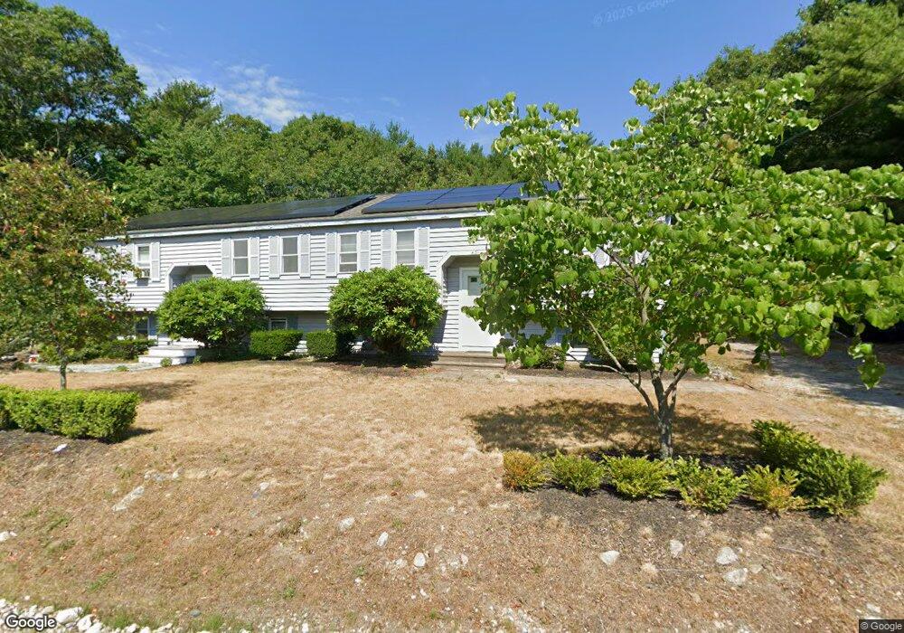
41 Park Rd Unit 43 Plymouth, MA 02360
North Plymouth NeighborhoodEstimated Value: $653,380 - $692,000
6
Beds
2
Baths
1,968
Sq Ft
$343/Sq Ft
Est. Value
About This Home
This home is located at 41 Park Rd Unit 43, Plymouth, MA 02360 and is currently estimated at $674,095, approximately $342 per square foot. 41 Park Rd Unit 43 is a home located in Plymouth County with nearby schools including Hedge Elementary School, Plymouth Community Intermediate, and Plymouth North High School.
Ownership History
Date
Name
Owned For
Owner Type
Purchase Details
Closed on
Nov 12, 2024
Sold by
Thomas Barry K and Thomas Cali J
Bought by
Barry Lee Thomas Lt and Thomas
Current Estimated Value
Purchase Details
Closed on
Jan 12, 2017
Sold by
Girard Geraldine and Girard John P
Bought by
Girard T T and Girard G
Create a Home Valuation Report for This Property
The Home Valuation Report is an in-depth analysis detailing your home's value as well as a comparison with similar homes in the area
Home Values in the Area
Average Home Value in this Area
Purchase History
| Date | Buyer | Sale Price | Title Company |
|---|---|---|---|
| Barry Lee Thomas Lt | -- | None Available | |
| Barry Lee Thomas Lt | -- | None Available | |
| Girard T T | -- | -- | |
| Girard T T | -- | -- |
Source: Public Records
Mortgage History
| Date | Status | Borrower | Loan Amount |
|---|---|---|---|
| Previous Owner | Girard T T | $51,000 |
Source: Public Records
Tax History Compared to Growth
Tax History
| Year | Tax Paid | Tax Assessment Tax Assessment Total Assessment is a certain percentage of the fair market value that is determined by local assessors to be the total taxable value of land and additions on the property. | Land | Improvement |
|---|---|---|---|---|
| 2025 | $7,434 | $585,800 | $233,400 | $352,400 |
| 2024 | $6,999 | $543,800 | $215,600 | $328,200 |
| 2023 | $6,758 | $492,900 | $196,600 | $296,300 |
| 2022 | $6,342 | $411,000 | $175,400 | $235,600 |
| 2021 | $5,982 | $370,200 | $175,400 | $194,800 |
| 2020 | $5,198 | $317,900 | $162,100 | $155,800 |
| 2019 | $4,724 | $285,600 | $132,100 | $153,500 |
| 2018 | $4,500 | $273,400 | $122,100 | $151,300 |
| 2017 | $4,274 | $257,800 | $122,100 | $135,700 |
| 2016 | $4,194 | $257,800 | $122,100 | $135,700 |
| 2015 | $4,020 | $258,700 | $122,100 | $136,600 |
| 2014 | $3,857 | $254,900 | $122,100 | $132,800 |
Source: Public Records
Map
Nearby Homes
- 62 Spooner St
- 5-7 Forest Ave
- 393 Court St Unit 4
- 393 Court St Unit 7
- 393 Court St Unit 1
- 22 Main St Unit A
- 35 Sawmill Dr
- 4 S Spooner St Unit 6
- 4 S Spooner St Unit 7
- 4 S Spooner St Unit 8
- 2 S Spooner St Unit 3
- 2 S Spooner St Unit 1
- 2 S Spooner St Unit 4
- 20 Orchard Ave
- 20-22 Hedge Rd
- 48 Smiths Ln
- 17 Howlands Ln
- 70 Hedge Rd
- 94 Main St
- 291 Court St
- 49 Park Rd Unit 51
- 49-51 Park Rd
- 33 Park Rd Unit 35
- 35 Park Rd Unit 35
- 27 Park Rd
- 37 Park Rd Unit 39
- 37-39 Park Rd
- 23 Park Rd
- 23 Park Rd
- 21 Park Rd Unit 1
- 17 Park Rd
- 17 Park Rd Unit 1
- 17-23 Park Rd Unit 19
- 19 Park Rd Unit 1
- 90 Spooner St Unit 92
- 90-92 Spooner St
- 9 Park Rd
- 86 Spooner St Unit 88
- 24 Park Rd
- 15 Park Rd