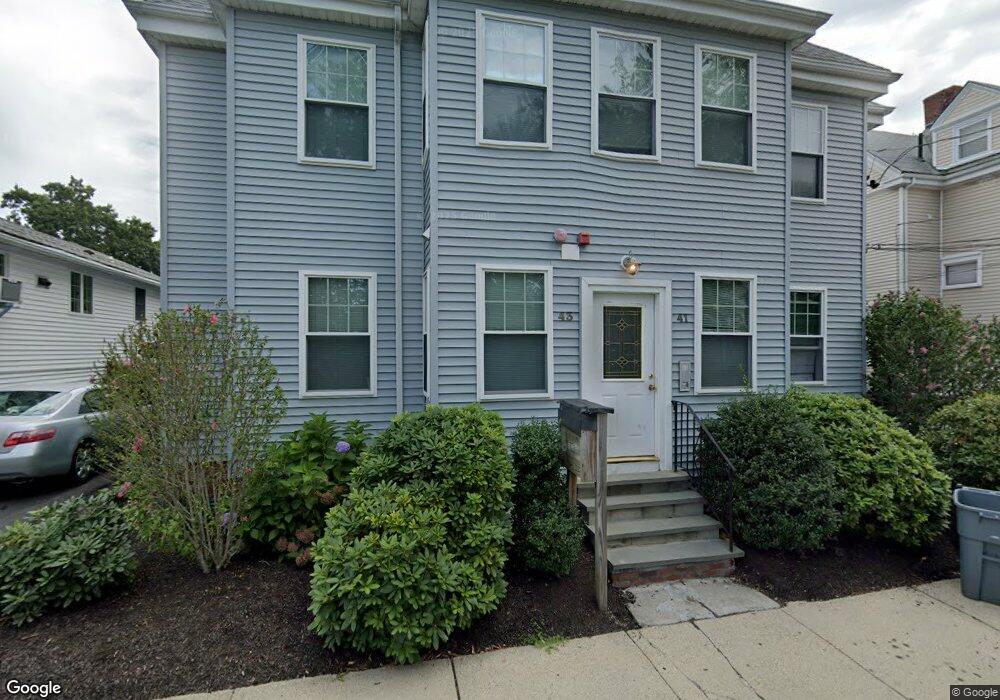
41 Port Norfolk St Unit 43 Dorchester, MA 02122
Neponset-Port Norfolk NeighborhoodEstimated Value: $692,000 - $856,000
2
Beds
3
Baths
1,632
Sq Ft
$471/Sq Ft
Est. Value
About This Home
This home is located at 41 Port Norfolk St Unit 43, Dorchester, MA 02122 and is currently estimated at $768,673, approximately $471 per square foot. 41 Port Norfolk St Unit 43 is a home located in Suffolk County with nearby schools including Neighborhood House Charter School, St Brendan School, and Quincy Catholic Academy.
Ownership History
Date
Name
Owned For
Owner Type
Purchase Details
Closed on
May 20, 2020
Sold by
Chefitz Elliot
Bought by
Chefitz Elliot and Chefitz Nicole M
Current Estimated Value
Home Financials for this Owner
Home Financials are based on the most recent Mortgage that was taken out on this home.
Original Mortgage
$480,000
Outstanding Balance
$428,129
Interest Rate
3.3%
Mortgage Type
VA
Estimated Equity
$344,352
Purchase Details
Closed on
Feb 1, 2013
Sold by
Beliveau Nicholas
Bought by
Beliveau Nicholas and Beliveau Jennie
Home Financials for this Owner
Home Financials are based on the most recent Mortgage that was taken out on this home.
Original Mortgage
$342,000
Interest Rate
3.41%
Mortgage Type
New Conventional
Create a Home Valuation Report for This Property
The Home Valuation Report is an in-depth analysis detailing your home's value as well as a comparison with similar homes in the area
Home Values in the Area
Average Home Value in this Area
Purchase History
| Date | Buyer | Sale Price | Title Company |
|---|---|---|---|
| Chefitz Elliot | -- | None Available | |
| Beliveau Nicholas | -- | -- |
Source: Public Records
Mortgage History
| Date | Status | Borrower | Loan Amount |
|---|---|---|---|
| Open | Chefitz Elliot | $90,000 | |
| Open | Chefitz Elliot | $480,000 | |
| Previous Owner | Chefitz Elliot | $500,000 | |
| Previous Owner | Beliveau Nicholas | $342,000 | |
| Previous Owner | Beliveau Nicholas | $342,000 |
Source: Public Records
Tax History Compared to Growth
Tax History
| Year | Tax Paid | Tax Assessment Tax Assessment Total Assessment is a certain percentage of the fair market value that is determined by local assessors to be the total taxable value of land and additions on the property. | Land | Improvement |
|---|---|---|---|---|
| 2025 | $8,053 | $695,400 | $0 | $695,400 |
| 2024 | $6,918 | $634,700 | $0 | $634,700 |
| 2023 | $6,617 | $616,100 | $0 | $616,100 |
| 2022 | $6,322 | $581,100 | $0 | $581,100 |
| 2021 | $6,020 | $564,200 | $0 | $564,200 |
| 2020 | $5,710 | $540,700 | $0 | $540,700 |
| 2019 | $5,374 | $509,900 | $0 | $509,900 |
| 2018 | $4,949 | $472,200 | $0 | $472,200 |
| 2017 | $4,590 | $433,400 | $0 | $433,400 |
| 2016 | $4,455 | $405,000 | $0 | $405,000 |
| 2015 | $4,160 | $343,500 | $0 | $343,500 |
| 2014 | $3,964 | $315,100 | $0 | $315,100 |
Source: Public Records
Map
Nearby Homes
- 378 Neponset Ave
- 36 Mckone St
- 36 Mckone St Unit 2
- 36 Mckone St Unit 1
- 4 Chickatawbut St
- 582 Freeport St Unit 2
- 56 Coffey St Unit 7
- 49 Coffey St Unit B
- 48 Coffey St Unit 3C
- 18 Salina Rd
- 158 Quincy Shore Dr Unit 78
- 10 Coffey St Unit 25
- 148 Quincy Shore Dr Unit 30
- 90 Quincy Shore Dr Unit 106
- 90 Quincy Shore Dr Unit 417
- 4 Payne St Unit THREE
- 4 Payne St Unit One
- 60 Houghton St Unit 62
- 133 Commander Shea Blvd Unit 215
- 133 Commander Shea Blvd Unit 614
- 41 Port Norfolk St Unit 43
- 41 Port Norfolk St Unit 43
- 41 Port Norfolk St Unit 43
- 41 Port Norfolk St Unit 2
- 41 Port Norfolk St
- 41 Port Norfolk St Unit 1R
- 41-43 Port Norfolk St Unit 3
- 41-43 Port Norfolk St Unit 1L
- 41-43 Port Norfolk St Unit 2
- 41-43 Port Norfolk St Unit 1R
- 37 Port Norfolk St
- 49 Port Norfolk St
- 35 Port Norfolk St
- 35 Port Norfolk St Unit 2
- 35 Port Norfolk St Unit 1
- 46 Port Norfolk St Unit 1
- 46 Port Norfolk St
- 46 Port Norfolk St Unit 2
- 46 Port Norfolk St Unit 3
- 51 Port Norfolk St