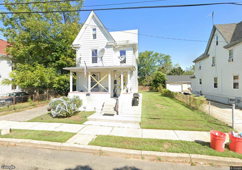
41 Roosevelt St Unit B Paulsboro, NJ 08066
Estimated Value: $174,000 - $262,000
1
Bed
1
Bath
1,488
Sq Ft
$142/Sq Ft
Est. Value
About This Home
This home is located at 41 Roosevelt St Unit B, Paulsboro, NJ 08066 and is currently estimated at $210,938, approximately $141 per square foot. 41 Roosevelt St Unit B is a home located in Gloucester County with nearby schools including Billingsport Elementary School, Loudenslager Elementary School, and Paulsboro High School.
Ownership History
Date
Name
Owned For
Owner Type
Purchase Details
Closed on
Aug 31, 2021
Sold by
Lamprey Sean M
Bought by
Smith Jarred
Current Estimated Value
Home Financials for this Owner
Home Financials are based on the most recent Mortgage that was taken out on this home.
Original Mortgage
$93,750
Outstanding Balance
$85,178
Interest Rate
2.7%
Mortgage Type
New Conventional
Estimated Equity
$125,760
Purchase Details
Closed on
Jan 13, 2004
Sold by
Krauss David
Bought by
Lamprey Sean M
Home Financials for this Owner
Home Financials are based on the most recent Mortgage that was taken out on this home.
Original Mortgage
$120,400
Interest Rate
5.98%
Mortgage Type
FHA
Purchase Details
Closed on
May 27, 2003
Sold by
Cesarano Michael and Cesarano Karen Lee
Bought by
Krauss David
Create a Home Valuation Report for This Property
The Home Valuation Report is an in-depth analysis detailing your home's value as well as a comparison with similar homes in the area
Home Values in the Area
Average Home Value in this Area
Purchase History
| Date | Buyer | Sale Price | Title Company |
|---|---|---|---|
| Smith Jarred | $125,000 | Foundation Title Llc | |
| Lamprey Sean M | $90,000 | -- | |
| Krauss David | $55,000 | Homestead Title Agency |
Source: Public Records
Mortgage History
| Date | Status | Borrower | Loan Amount |
|---|---|---|---|
| Open | Smith Jarred | $93,750 | |
| Previous Owner | Lamprey Sean M | $120,400 |
Source: Public Records
Tax History Compared to Growth
Tax History
| Year | Tax Paid | Tax Assessment Tax Assessment Total Assessment is a certain percentage of the fair market value that is determined by local assessors to be the total taxable value of land and additions on the property. | Land | Improvement |
|---|---|---|---|---|
| 2025 | $4,853 | $110,300 | $13,700 | $96,600 |
| 2024 | $4,849 | $110,300 | $13,700 | $96,600 |
| 2023 | $4,849 | $110,300 | $13,700 | $96,600 |
| 2022 | $4,761 | $110,300 | $13,700 | $96,600 |
| 2021 | $4,668 | $110,300 | $13,700 | $96,600 |
| 2020 | $4,639 | $110,300 | $13,700 | $96,600 |
| 2019 | $4,494 | $110,300 | $13,700 | $96,600 |
| 2018 | $4,237 | $110,300 | $13,700 | $96,600 |
| 2017 | $4,219 | $110,300 | $13,700 | $96,600 |
| 2016 | $4,019 | $110,300 | $13,700 | $96,600 |
| 2015 | $3,996 | $110,300 | $13,700 | $96,600 |
| 2014 | $3,880 | $115,200 | $17,700 | $97,500 |
Source: Public Records
Map
Nearby Homes
- 46 Roosevelt St
- 53-55 Roosevelt St
- 53 Capitol St
- 140 142 W Jefferson St
- 28 W Jefferson St
- 21 W Adams St
- 1043 Penn Line Rd
- 11 W Washington St
- 27 29 E Adams St
- 122 W Washington St
- 591 N Delaware St Unit M10
- 28 E Adams St
- 227 W Buck St
- 106 E Adams St
- 212 E Jefferson St
- 546 Billings Ave
- 269 W Broad St
- 344 W Washington St
- 335 W Buck St
- L18 20 W Broad St
- 41 Roosevelt St Unit 2ND FL
- 41 Roosevelt St
- 45 Roosevelt St
- 37 Roosevelt St
- 51 Roosevelt St
- 33 Roosevelt St
- 0 Roosevelt St Unit 55 A
- 54 Roosevelt St
- 53 Roosevelt St Unit B
- 53 Roosevelt St Unit 55
- 55 Roosevelt St
- 55 Roosevelt St Unit B
- 55 Roosevelt St
- 48 Roosevelt St
- 29 Roosevelt St
- 50 Roosevelt St
- 50 Capitol St
- 44-46 Capitol St
- 54 Capitol St
- 52-54 Roosevelt St