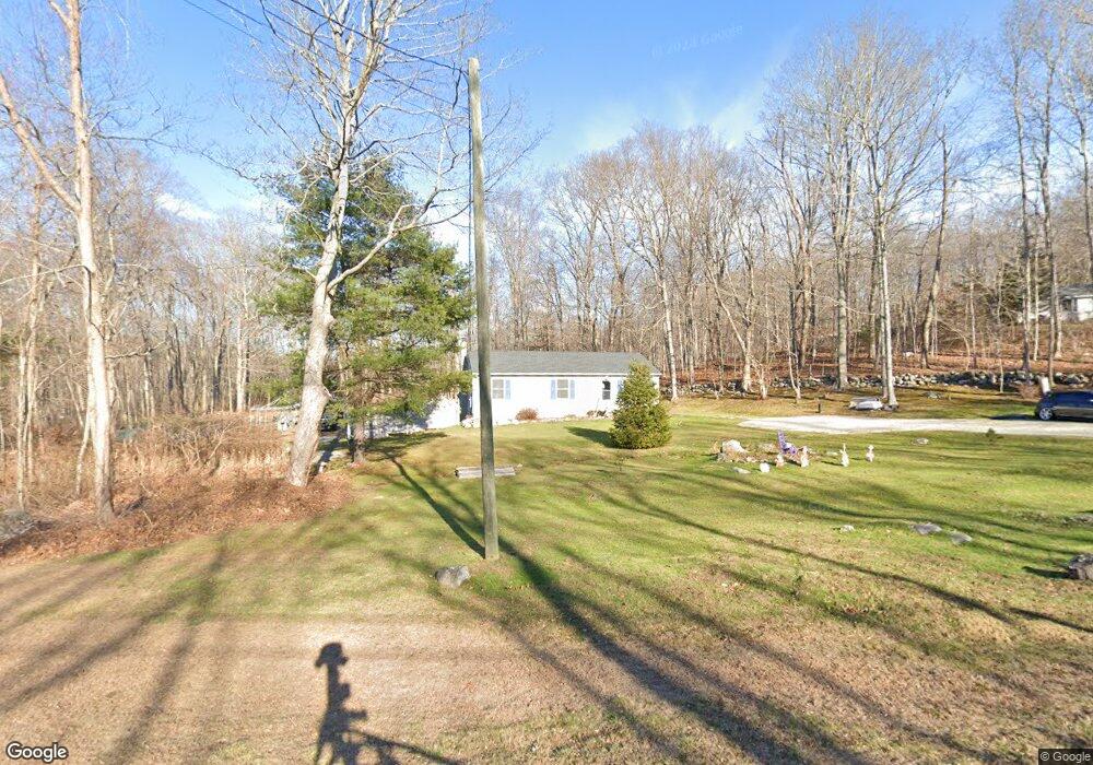
41 Route 87 Andover, CT 06232
Estimated Value: $293,000 - $328,000
3
Beds
1
Bath
1,056
Sq Ft
$295/Sq Ft
Est. Value
About This Home
This home is located at 41 Route 87, Andover, CT 06232 and is currently estimated at $311,492, approximately $294 per square foot. 41 Route 87 is a home located in Tolland County with nearby schools including Andover Elementary School, RHAM Middle School, and RHAM High School.
Ownership History
Date
Name
Owned For
Owner Type
Purchase Details
Closed on
Aug 1, 2003
Sold by
Welch James
Bought by
Nichols Thomas and Nichols Sandra
Current Estimated Value
Home Financials for this Owner
Home Financials are based on the most recent Mortgage that was taken out on this home.
Original Mortgage
$151,500
Outstanding Balance
$65,060
Interest Rate
5.28%
Estimated Equity
$246,432
Purchase Details
Closed on
Nov 7, 1995
Sold by
Bigelow Brook Homes
Bought by
Tomkiel Stephen
Home Financials for this Owner
Home Financials are based on the most recent Mortgage that was taken out on this home.
Original Mortgage
$115,400
Interest Rate
7.58%
Mortgage Type
Unknown
Purchase Details
Closed on
Aug 31, 1994
Sold by
Sammartino Christine
Bought by
Bigelow Brook Homes
Create a Home Valuation Report for This Property
The Home Valuation Report is an in-depth analysis detailing your home's value as well as a comparison with similar homes in the area
Home Values in the Area
Average Home Value in this Area
Purchase History
| Date | Buyer | Sale Price | Title Company |
|---|---|---|---|
| Nichols Thomas | $154,000 | -- | |
| Nichols Thomas | $154,000 | -- | |
| Tomkiel Stephen | $115,440 | -- | |
| Tomkiel Stephen | $115,440 | -- | |
| Bigelow Brook Homes | $40,000 | -- |
Source: Public Records
Mortgage History
| Date | Status | Borrower | Loan Amount |
|---|---|---|---|
| Open | Bigelow Brook Homes | $25,000 | |
| Open | Bigelow Brook Homes | $151,500 | |
| Closed | Bigelow Brook Homes | $151,500 | |
| Previous Owner | Bigelow Brook Homes | $115,400 |
Source: Public Records
Tax History Compared to Growth
Tax History
| Year | Tax Paid | Tax Assessment Tax Assessment Total Assessment is a certain percentage of the fair market value that is determined by local assessors to be the total taxable value of land and additions on the property. | Land | Improvement |
|---|---|---|---|---|
| 2025 | $4,195 | $132,790 | $36,750 | $96,040 |
| 2024 | $4,178 | $132,790 | $36,750 | $96,040 |
| 2023 | $4,155 | $132,790 | $36,750 | $96,040 |
| 2022 | $4,237 | $132,790 | $36,750 | $96,040 |
| 2021 | $4,284 | $119,000 | $47,000 | $72,000 |
| 2020 | $4,234 | $118,900 | $47,000 | $71,900 |
| 2019 | $4,160 | $118,900 | $47,000 | $71,900 |
| 2018 | $4,037 | $118,900 | $47,000 | $71,900 |
| 2017 | $3,864 | $118,900 | $47,000 | $71,900 |
| 2016 | $3,935 | $128,100 | $47,000 | $81,100 |
| 2015 | $3,935 | $128,100 | $47,000 | $81,100 |
| 2014 | $3,935 | $128,100 | $47,000 | $81,100 |
Source: Public Records
Map
Nearby Homes
- 43 Route 87
- 00 Bunker Hill Rd
- 239 Lake Rd
- 127 Route 87
- 44 Route 6
- 10 Lakeview Park
- 0 Us Highway 6
- 78 Bear Swamp Rd
- 0 Wheeling Rd Unit 24116879
- 41 Oakwood Ln
- 40 Wheeling Rd
- 127 U S 6
- 78 Hennequin Rd
- 35 Basket Shop Rd
- 219 Reynolds Dr
- 17 Ireland Dr
- 1902 South St
- 83 Morin Ave
- 53 Skinner Hill Rd
- 14 Edgarton Rd