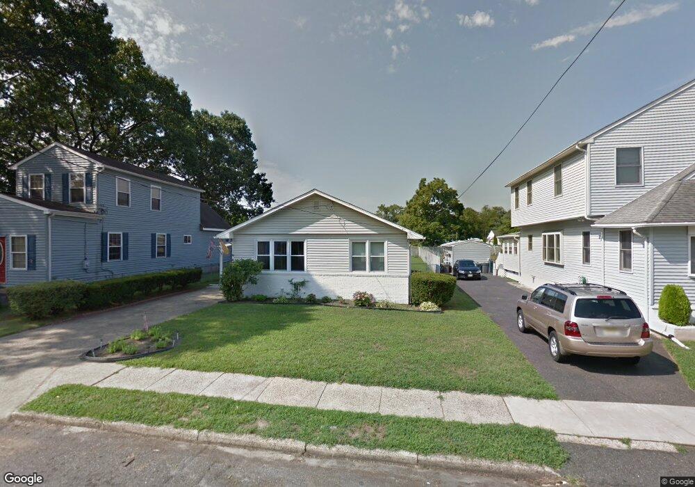
41 S Highland Ave Runnemede, NJ 08078
Estimated Value: $239,329 - $334,000
Studio
--
Bath
1,275
Sq Ft
$240/Sq Ft
Est. Value
About This Home
This home is located at 41 S Highland Ave, Runnemede, NJ 08078 and is currently estimated at $306,082, approximately $240 per square foot. 41 S Highland Ave is a home located in Camden County with nearby schools including Mary E. Volz Elementary School, Bingham Elementary School, and Triton High School.
Ownership History
Date
Name
Owned For
Owner Type
Purchase Details
Closed on
Dec 19, 2022
Sold by
Peters Christopher
Bought by
Peters Christopher and Lowe Robert L
Current Estimated Value
Purchase Details
Closed on
Apr 27, 2009
Sold by
Peters Christopher and Lautos Florence M
Bought by
Peters Christopher
Purchase Details
Closed on
Jul 30, 1998
Sold by
Defrates Bruce
Bought by
Lautos Lawrence J and Lautos Florence
Home Financials for this Owner
Home Financials are based on the most recent Mortgage that was taken out on this home.
Original Mortgage
$30,000
Interest Rate
6.86%
Create a Home Valuation Report for This Property
The Home Valuation Report is an in-depth analysis detailing your home's value as well as a comparison with similar homes in the area
Home Values in the Area
Average Home Value in this Area
Purchase History
| Date | Buyer | Sale Price | Title Company |
|---|---|---|---|
| Peters Christopher | -- | -- | |
| Redacted Upon Request | -- | None Listed On Document | |
| Peters Christopher | -- | -- | |
| Lautos Lawrence J | $92,250 | -- |
Source: Public Records
Mortgage History
| Date | Status | Borrower | Loan Amount |
|---|---|---|---|
| Previous Owner | Lautos Lawrence J | $30,000 |
Source: Public Records
Tax History
| Year | Tax Paid | Tax Assessment Tax Assessment Total Assessment is a certain percentage of the fair market value that is determined by local assessors to be the total taxable value of land and additions on the property. | Land | Improvement |
|---|---|---|---|---|
| 2025 | $6,687 | $148,400 | $46,000 | $102,400 |
| 2024 | $6,484 | $148,400 | $46,000 | $102,400 |
| 2023 | $6,484 | $148,400 | $46,000 | $102,400 |
| 2022 | $6,277 | $148,400 | $46,000 | $102,400 |
| 2021 | $6,128 | $148,400 | $46,000 | $102,400 |
| 2020 | $6,068 | $148,400 | $46,000 | $102,400 |
| 2019 | $5,957 | $148,400 | $46,000 | $102,400 |
| 2018 | $5,843 | $148,400 | $46,000 | $102,400 |
| 2017 | $5,693 | $148,400 | $46,000 | $102,400 |
| 2016 | $5,621 | $148,400 | $46,000 | $102,400 |
| 2015 | $5,638 | $148,400 | $46,000 | $102,400 |
| 2014 | $5,565 | $148,400 | $46,000 | $102,400 |
Source: Public Records
Map
Nearby Homes
- 37 S Highland Ave
- 45 S Highland Ave
- 33 S Highland Ave
- 51 S Highland Ave
- 29 S Highland Ave
- 415 W Evesham Rd
- 409 W Evesham Rd
- 405 W Evesham Rd
- 54 S Rowand Ave
- 23 S Highland Ave
- 36 S Highland Ave
- 48 S Rowand Ave
- 336 Phillips Ave
- 32 S Rowand Ave
- 44 S Highland Ave
- 19 S Highland Ave
- 44 S Rowand Ave
- 505-A W Evesham Rd Unit A
- 40 S Highland Ave
- 28 S Rowand Ave
Your Personal Tour Guide
Ask me questions while you tour the home.