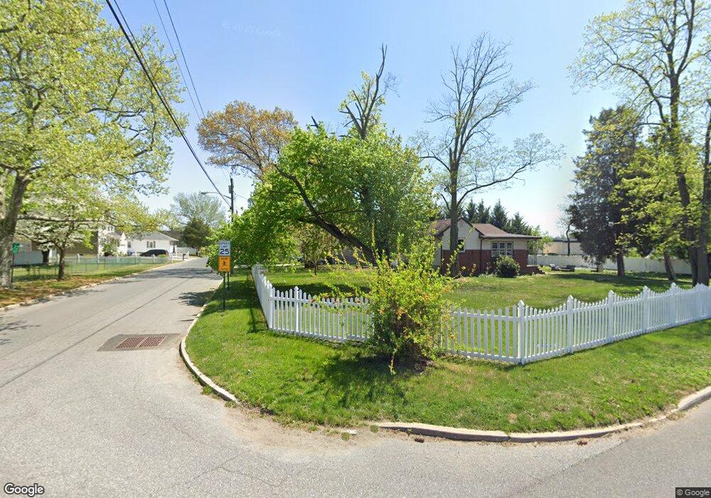
41 Salem Ave West Deptford, NJ 08086
West Deptford Township NeighborhoodEstimated Value: $318,000 - $402,000
3
Beds
2
Baths
1,345
Sq Ft
$264/Sq Ft
Est. Value
About This Home
This home is located at 41 Salem Ave, West Deptford, NJ 08086 and is currently estimated at $355,751, approximately $264 per square foot. 41 Salem Ave is a home located in Gloucester County with nearby schools including Red Bank Elementary School, Oakview Elementary School, and Green-Fields Elementary School.
Ownership History
Date
Name
Owned For
Owner Type
Purchase Details
Closed on
Nov 25, 2009
Sold by
Rizzo Valenti Inc
Bought by
Barger Jonathan
Current Estimated Value
Home Financials for this Owner
Home Financials are based on the most recent Mortgage that was taken out on this home.
Original Mortgage
$202,275
Outstanding Balance
$132,678
Interest Rate
5.01%
Mortgage Type
New Conventional
Estimated Equity
$223,073
Create a Home Valuation Report for This Property
The Home Valuation Report is an in-depth analysis detailing your home's value as well as a comparison with similar homes in the area
Home Values in the Area
Average Home Value in this Area
Purchase History
| Date | Buyer | Sale Price | Title Company |
|---|---|---|---|
| Barger Jonathan | $197,850 | Elite Choice Title Llc |
Source: Public Records
Mortgage History
| Date | Status | Borrower | Loan Amount |
|---|---|---|---|
| Open | Barger Jonathan | $202,275 |
Source: Public Records
Tax History Compared to Growth
Tax History
| Year | Tax Paid | Tax Assessment Tax Assessment Total Assessment is a certain percentage of the fair market value that is determined by local assessors to be the total taxable value of land and additions on the property. | Land | Improvement |
|---|---|---|---|---|
| 2025 | $6,635 | $190,000 | $52,400 | $137,600 |
| 2024 | $6,549 | $190,000 | $52,400 | $137,600 |
| 2023 | $6,549 | $190,000 | $52,400 | $137,600 |
| 2022 | $6,519 | $190,000 | $52,400 | $137,600 |
| 2021 | $6,496 | $190,000 | $52,400 | $137,600 |
| 2020 | $6,481 | $190,000 | $52,400 | $137,600 |
| 2019 | $6,300 | $190,000 | $52,400 | $137,600 |
| 2018 | $6,129 | $190,000 | $52,400 | $137,600 |
| 2017 | $5,987 | $190,000 | $52,400 | $137,600 |
| 2016 | $5,820 | $190,000 | $52,400 | $137,600 |
| 2015 | $5,544 | $190,000 | $52,400 | $137,600 |
| 2014 | $5,269 | $187,600 | $52,400 | $135,200 |
Source: Public Records
Map
Nearby Homes
- 67 Pelican Place
- 10 Kennedy Ct
- 439 Crown Point Rd
- 136 Sandpiper Ln
- 433 Crown Point Rd
- 121 Cape May Ave
- 400 Audubon Ave
- 6 Phoebe Terrace
- 64 Tilden Rd
- 107 Audubon Ave
- 97 Church St
- 232 Snowy Egret Ln
- 253 Snowy Egret Ln
- 247 Crown Point Rd
- 266 Passaic Ave
- 1810 Fernwood Dr
- 740 Carter Hill Dr
- 1311 Barnesdale Rd
- 4 Saint Emilion Ct
- 112 N Drexel St
- 37 Salem Ave
- 38 Salem Ave
- 155 Grove Ave
- 33 Salem Ave
- 34 Salem Ave
- 28 Salem Ave
- 154 Grove Ave
- 31 Cumberland Ave
- 27 Cumberland Ave
- 24 Salem Ave
- 40 Cumberland Ave
- 101 Eastlack Dr
- 36 Cumberland Ave
- 44 Cumberland Ave
- 19 Salem Ave
- 32 Cumberland Ave
- 1 Kennedy Ct
- 171 Grove Ave
- 10 Pelican Place
- 28 Cumberland Ave