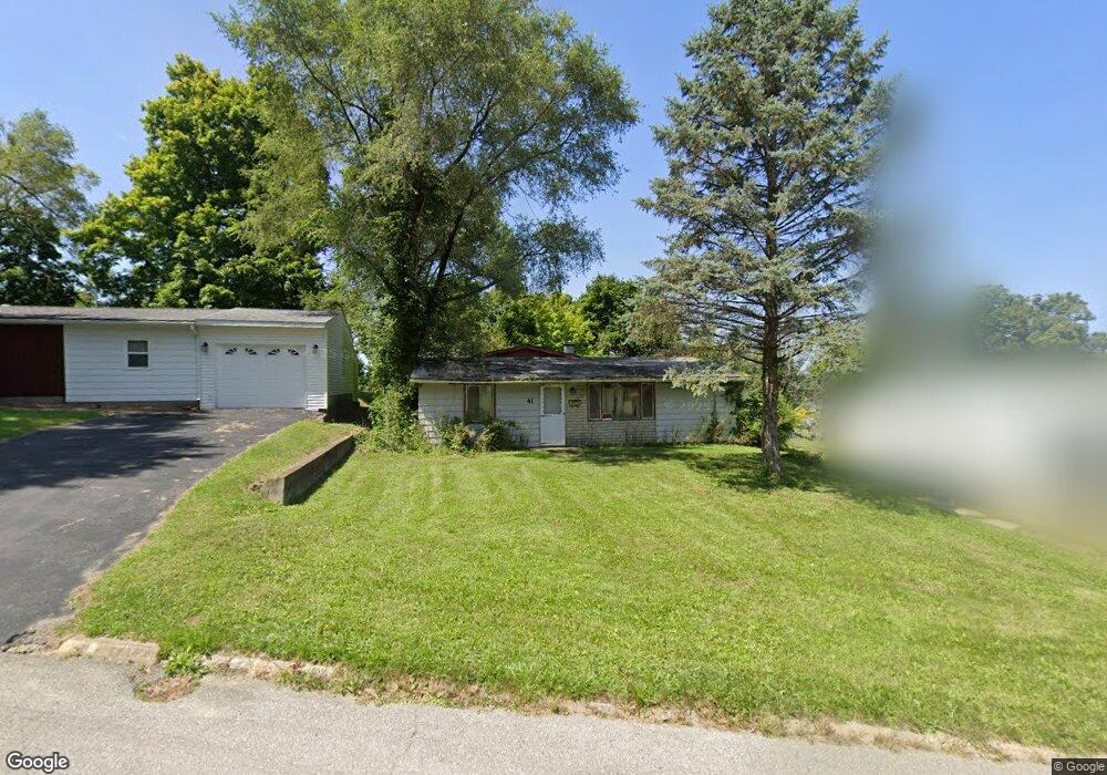
41 Shady Ln New Paris, OH 45347
Estimated Value: $115,000 - $144,000
3
Beds
1
Bath
1,175
Sq Ft
$110/Sq Ft
Est. Value
About This Home
This home is located at 41 Shady Ln, New Paris, OH 45347 and is currently estimated at $129,538, approximately $110 per square foot. 41 Shady Ln is a home located in Preble County with nearby schools including National Trail Elementary School, National Trail Middle School, and National Trail High School.
Ownership History
Date
Name
Owned For
Owner Type
Purchase Details
Closed on
May 13, 2025
Sold by
Hollar Clinton R
Bought by
Preble County Land Reutilization Corporation
Current Estimated Value
Purchase Details
Closed on
Aug 18, 2000
Sold by
Hathaway Jay
Bought by
Hollar Clinton R
Home Financials for this Owner
Home Financials are based on the most recent Mortgage that was taken out on this home.
Original Mortgage
$55,100
Interest Rate
8.16%
Mortgage Type
New Conventional
Purchase Details
Closed on
Jul 6, 1995
Sold by
Bolinger Charles E
Bought by
Hathaway Jay E and Hathaway Patricia A
Home Financials for this Owner
Home Financials are based on the most recent Mortgage that was taken out on this home.
Original Mortgage
$25,300
Interest Rate
7.9%
Mortgage Type
New Conventional
Create a Home Valuation Report for This Property
The Home Valuation Report is an in-depth analysis detailing your home's value as well as a comparison with similar homes in the area
Home Values in the Area
Average Home Value in this Area
Purchase History
| Date | Buyer | Sale Price | Title Company |
|---|---|---|---|
| Preble County Land Reutilization Corporation | -- | Freedom Title | |
| Preble County Land Reutilization Corporation | -- | Freedom Title | |
| Hollar Clinton R | $56,900 | -- | |
| Hathaway Jay E | $25,300 | -- |
Source: Public Records
Mortgage History
| Date | Status | Borrower | Loan Amount |
|---|---|---|---|
| Previous Owner | Hollar Clinton R | $55,100 | |
| Previous Owner | Hathaway Jay E | $25,300 |
Source: Public Records
Tax History Compared to Growth
Tax History
| Year | Tax Paid | Tax Assessment Tax Assessment Total Assessment is a certain percentage of the fair market value that is determined by local assessors to be the total taxable value of land and additions on the property. | Land | Improvement |
|---|---|---|---|---|
| 2024 | $905 | $21,280 | $2,940 | $18,340 |
| 2023 | $905 | $21,280 | $2,940 | $18,340 |
| 2022 | $993 | $20,690 | $2,630 | $18,060 |
| 2021 | $1,025 | $20,690 | $2,630 | $18,060 |
| 2020 | $990 | $20,690 | $2,630 | $18,060 |
| 2019 | $929 | $19,400 | $2,560 | $16,840 |
| 2018 | $898 | $19,400 | $2,560 | $16,840 |
| 2017 | $787 | $19,400 | $2,560 | $16,840 |
| 2016 | $685 | $16,140 | $2,490 | $13,650 |
| 2014 | $683 | $16,140 | $2,490 | $13,650 |
| 2013 | $715 | $16,135 | $2,485 | $13,650 |
Source: Public Records
Map
Nearby Homes
- 443 S Spring St
- 200 Pearl St
- 307 E Cherry St
- 202 Nelson St
- 700 W Cherry St
- 123 Hutton St
- 125 High St
- 8458 Hawley Mills Rd
- 309 N Spring St
- 10051 State Route 320
- 10263 Cr 335
- 5695 New Paris Gettysburg Rd
- 0 Industrial Pkwy Unit 10048533
- 0 Industrial Pkwy Unit 202406115
- 4741 Wolverton Rd
- 6100 Hodgin Rd Unit LotWP002
- 6100 Hodgin Rd
- 6670 Murray Rd
- 3907 Woodside Dr
- 0000 Woodside Dr