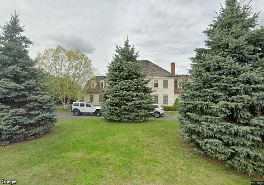
41 Shaker Bay Rd Latham, NY 12110
Estimated Value: $1,006,000 - $1,684,856
4
Beds
6
Baths
6,000
Sq Ft
$231/Sq Ft
Est. Value
About This Home
This home is located at 41 Shaker Bay Rd, Latham, NY 12110 and is currently estimated at $1,385,952, approximately $230 per square foot. 41 Shaker Bay Rd is a home located in Albany County with nearby schools including Boght Hills School, Shaker Junior High School, and Shaker High School.
Ownership History
Date
Name
Owned For
Owner Type
Purchase Details
Closed on
Oct 20, 2005
Sold by
Shaker Bay Limited Partne Rship
Bought by
Abraham J David
Current Estimated Value
Home Financials for this Owner
Home Financials are based on the most recent Mortgage that was taken out on this home.
Original Mortgage
$799,760
Outstanding Balance
$440,136
Interest Rate
5.37%
Mortgage Type
Adjustable Rate Mortgage/ARM
Estimated Equity
$945,816
Create a Home Valuation Report for This Property
The Home Valuation Report is an in-depth analysis detailing your home's value as well as a comparison with similar homes in the area
Home Values in the Area
Average Home Value in this Area
Purchase History
| Date | Buyer | Sale Price | Title Company |
|---|---|---|---|
| Abraham J David | $125,000 | Pasquariello & Weiskopf |
Source: Public Records
Mortgage History
| Date | Status | Borrower | Loan Amount |
|---|---|---|---|
| Open | Abraham J David | $799,760 |
Source: Public Records
Tax History Compared to Growth
Tax History
| Year | Tax Paid | Tax Assessment Tax Assessment Total Assessment is a certain percentage of the fair market value that is determined by local assessors to be the total taxable value of land and additions on the property. | Land | Improvement |
|---|---|---|---|---|
| 2024 | $27,822 | $718,000 | $215,400 | $502,600 |
| 2023 | $27,224 | $718,000 | $215,400 | $502,600 |
| 2022 | $28,019 | $718,000 | $215,400 | $502,600 |
| 2021 | $27,892 | $718,000 | $215,400 | $502,600 |
| 2020 | $32,183 | $718,000 | $215,400 | $502,600 |
| 2019 | $14,568 | $718,000 | $215,400 | $502,600 |
| 2018 | $31,786 | $718,000 | $215,400 | $502,600 |
| 2017 | $0 | $718,000 | $215,400 | $502,600 |
| 2016 | $28,371 | $718,000 | $215,400 | $502,600 |
| 2015 | -- | $718,000 | $215,400 | $502,600 |
| 2014 | -- | $718,000 | $215,400 | $502,600 |
Source: Public Records
Map
Nearby Homes
- 52 Alpine Dr
- 32 Schalren Dr
- 20 Schalren Dr
- 70 Island View Rd
- 98 Pollock Rd
- 13 Davis Place
- 92 Westchester Dr
- 4609 Foxwood Dr S
- 27 Carriage Rd
- 7 Trevor Ct
- 41 Mill Rd
- 45 Carriage Rd
- 32 Carriage Rd
- 123 Southbury Rd
- 5002 Forest Point Dr
- 5006 Forest Point Dr
- 99 Boyack Rd
- 25 Grant Hill Ct
- 23 Mohawk Trail
- 22 Schaffer Dr
- 43 Shaker Bay Rd
- 38 Shaker Bay Rd
- 45 Shaker Bay Rd
- 36 Shaker Bay Rd
- 39 Shaker Bay Rd
- 40 Shaker Bay Rd
- 275 Forts Ferry Rd
- 34 Shaker Bay Rd
- 32 Shaker Bay Rd
- 2 Shaker Bay Rd
- 33 Shaker Bay Rd
- 1 Shaker Bay Rd
- 28 Shaker Bay Rd
- 267 Forts Ferry Rd
- 269 Forts Ferry Rd
- 257 Forts Ferry Rd
- 271 Forts Ferry Rd
- 26 Shaker Bay Rd
- 273 Forts Ferry Rd
- 4 Shaker Bay Rd