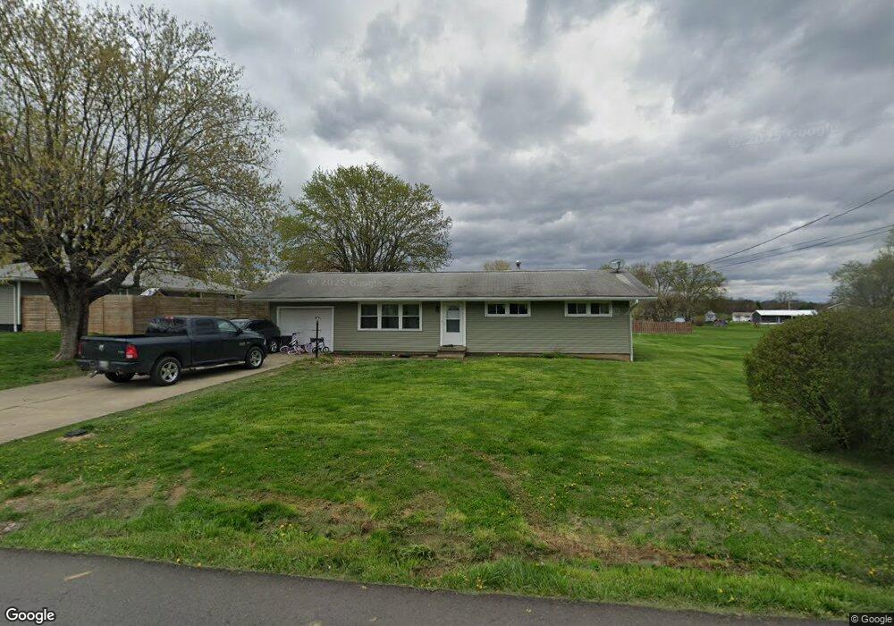
41 Sherwood Dr Zanesville, OH 43701
Estimated Value: $182,000 - $299,686
3
Beds
2
Baths
1,008
Sq Ft
$230/Sq Ft
Est. Value
About This Home
This home is located at 41 Sherwood Dr, Zanesville, OH 43701 and is currently estimated at $232,172, approximately $230 per square foot. 41 Sherwood Dr is a home located in Muskingum County with nearby schools including Maysville Elementary School, Maysville Middle School, and Maysville High School.
Ownership History
Date
Name
Owned For
Owner Type
Purchase Details
Closed on
Aug 21, 2014
Sold by
Rousculp Jeffrey A
Bought by
Morrison Ronald P and Morrison Peggy L
Current Estimated Value
Purchase Details
Closed on
Aug 9, 2003
Sold by
Rousculp Byron
Bought by
Hooper Charles M
Home Financials for this Owner
Home Financials are based on the most recent Mortgage that was taken out on this home.
Original Mortgage
$32,000
Interest Rate
5.5%
Mortgage Type
Purchase Money Mortgage
Purchase Details
Closed on
Aug 7, 2003
Sold by
Estate Of Betty J Hooper
Bought by
Hooper Charles M and Rousculp Dixie
Home Financials for this Owner
Home Financials are based on the most recent Mortgage that was taken out on this home.
Original Mortgage
$32,000
Interest Rate
5.5%
Mortgage Type
Purchase Money Mortgage
Purchase Details
Closed on
Feb 23, 1994
Bought by
Hooper Betty J
Create a Home Valuation Report for This Property
The Home Valuation Report is an in-depth analysis detailing your home's value as well as a comparison with similar homes in the area
Home Values in the Area
Average Home Value in this Area
Purchase History
| Date | Buyer | Sale Price | Title Company |
|---|---|---|---|
| Morrison Ronald P | $81,300 | None Available | |
| Hooper Charles M | $42,500 | -- | |
| Hooper Charles M | -- | -- | |
| Hooper Betty J | -- | -- |
Source: Public Records
Mortgage History
| Date | Status | Borrower | Loan Amount |
|---|---|---|---|
| Previous Owner | Hooper Charles M | $32,000 |
Source: Public Records
Tax History Compared to Growth
Tax History
| Year | Tax Paid | Tax Assessment Tax Assessment Total Assessment is a certain percentage of the fair market value that is determined by local assessors to be the total taxable value of land and additions on the property. | Land | Improvement |
|---|---|---|---|---|
| 2024 | $1,683 | $51,835 | $10,255 | $41,580 |
| 2023 | $2,158 | $35,000 | $7,945 | $27,055 |
| 2022 | $1,834 | $35,000 | $7,945 | $27,055 |
| 2021 | $1,816 | $35,000 | $7,945 | $27,055 |
| 2020 | $1,688 | $29,155 | $6,615 | $22,540 |
| 2019 | $1,571 | $29,155 | $6,615 | $22,540 |
| 2018 | $1,055 | $29,155 | $6,615 | $22,540 |
| 2017 | $1,076 | $25,410 | $6,615 | $18,795 |
| 2016 | $934 | $25,420 | $6,620 | $18,800 |
| 2015 | $1,054 | $25,420 | $6,620 | $18,800 |
| 2013 | $993 | $25,450 | $6,620 | $18,830 |
Source: Public Records
Map
Nearby Homes
- 1119 Ellen Dr
- 109 Sherwood Dr
- 108 Summit Dr
- 2876 Pinkerton Ln
- 1705 Bradford Ave
- 2945 Shaw Rd
- 108 N Montague Ave
- 3208 Lakewood Dr
- 3250 Maysville Pike Unit 33
- 3250 Maysville Pike Unit 32
- 3250 Maysville Pike Unit 13
- 3000 Moxadarla Dr Unit Lot 2
- 16 Beech Rock Dr
- 72 N Pembroke Ave
- 67 E King St
- 72 E Berkley St
- 97 E Main St
- 2860 Thompson Run Rd
- 105 Rains Cir
- 2810 Maysville Pike