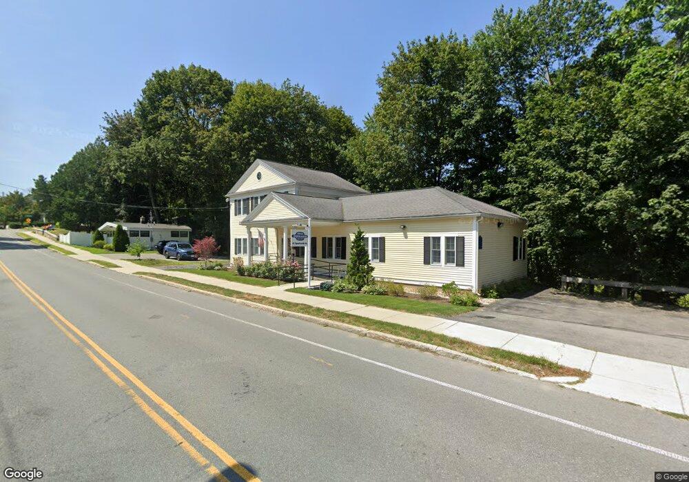
41 Sparhawk St Amesbury, MA 01913
Estimated Value: $456,342
--
Bed
2
Baths
2,304
Sq Ft
$198/Sq Ft
Est. Value
About This Home
This home is located at 41 Sparhawk St, Amesbury, MA 01913 and is currently estimated at $456,342, approximately $198 per square foot. 41 Sparhawk St is a home located in Essex County with nearby schools including Amesbury High School and Amesbury Seventh-Day Adventist School.
Ownership History
Date
Name
Owned For
Owner Type
Purchase Details
Closed on
Nov 5, 2020
Sold by
Amc Rt
Bought by
Magwhad Llc
Current Estimated Value
Home Financials for this Owner
Home Financials are based on the most recent Mortgage that was taken out on this home.
Original Mortgage
$167,500
Outstanding Balance
$148,645
Interest Rate
2.9%
Mortgage Type
Commercial
Estimated Equity
$307,697
Purchase Details
Closed on
Feb 4, 1992
Sold by
Karabetsos William and Karabetsos Dora
Bought by
Amc Rt
Create a Home Valuation Report for This Property
The Home Valuation Report is an in-depth analysis detailing your home's value as well as a comparison with similar homes in the area
Home Values in the Area
Average Home Value in this Area
Purchase History
| Date | Buyer | Sale Price | Title Company |
|---|---|---|---|
| Magwhad Llc | $325,000 | None Available | |
| Amc Rt | $95,000 | -- |
Source: Public Records
Mortgage History
| Date | Status | Borrower | Loan Amount |
|---|---|---|---|
| Open | Magwhad Llc | $167,500 | |
| Previous Owner | Amc Rt | $200,000 | |
| Previous Owner | Amc Rt | $400,000 | |
| Previous Owner | Amc Rt | $460,000 |
Source: Public Records
Tax History Compared to Growth
Tax History
| Year | Tax Paid | Tax Assessment Tax Assessment Total Assessment is a certain percentage of the fair market value that is determined by local assessors to be the total taxable value of land and additions on the property. | Land | Improvement |
|---|---|---|---|---|
| 2025 | $5,969 | $390,100 | $191,800 | $198,300 |
| 2024 | $5,932 | $379,300 | $181,000 | $198,300 |
| 2023 | $5,737 | $351,100 | $155,900 | $195,200 |
| 2022 | $6,156 | $348,000 | $155,900 | $192,100 |
| 2021 | $6,495 | $355,900 | $155,900 | $200,000 |
| 2020 | $6,114 | $355,900 | $155,900 | $200,000 |
| 2019 | $6,249 | $340,200 | $148,500 | $191,700 |
| 2018 | $6,202 | $326,600 | $134,900 | $191,700 |
| 2017 | $6,412 | $321,400 | $129,700 | $191,700 |
| 2016 | $6,301 | $310,700 | $124,100 | $186,600 |
| 2015 | $6,199 | $301,800 | $124,100 | $177,700 |
| 2014 | $6,329 | $301,800 | $124,100 | $177,700 |
Source: Public Records
Map
Nearby Homes
- 4 Larnard Ct
- 93 Friend St
- 49 W Greenwood St
- 4 Greenwood St
- 43 Aubin St Unit 43
- 31 Whitter Meadows Dr Unit 31
- 37 Millyard Unit 204
- 4 Winter St
- 13 High St Unit 2
- 48 Orchard St
- 97 Elm St
- 5 Moncrief St Unit 5
- 188 Lions Mouth Rd
- 118 Elm St
- 25 Cedar St Unit 4
- 25 Cedar St Unit 14
- 25 Cedar St Unit 7
- 3 Arlington St
- 102 Market St
- 101 Market St Unit B
- 43 Sparhawk St
- 43 Sparhawk St Unit 43
- 8 Whittier St
- 8 Whittier St Unit 8
- 42 Sparhawk St
- 15 Sparhawk St Unit 4
- 15 Sparhawk St Unit 1
- 44 Sparhawk St
- 34 Sparhawk St
- 34 Sparhawk St Unit 2
- 4 Whittier St
- 4 Whittier St
- 4 Whittier St Unit 4
- 3 Larnard Ct
- 2 Whittier St
- 2 Whittier St
- 12 Whittier St
- 32 Sparhawk St
- 5 Larnard Ct
- 47 Sparhawk St