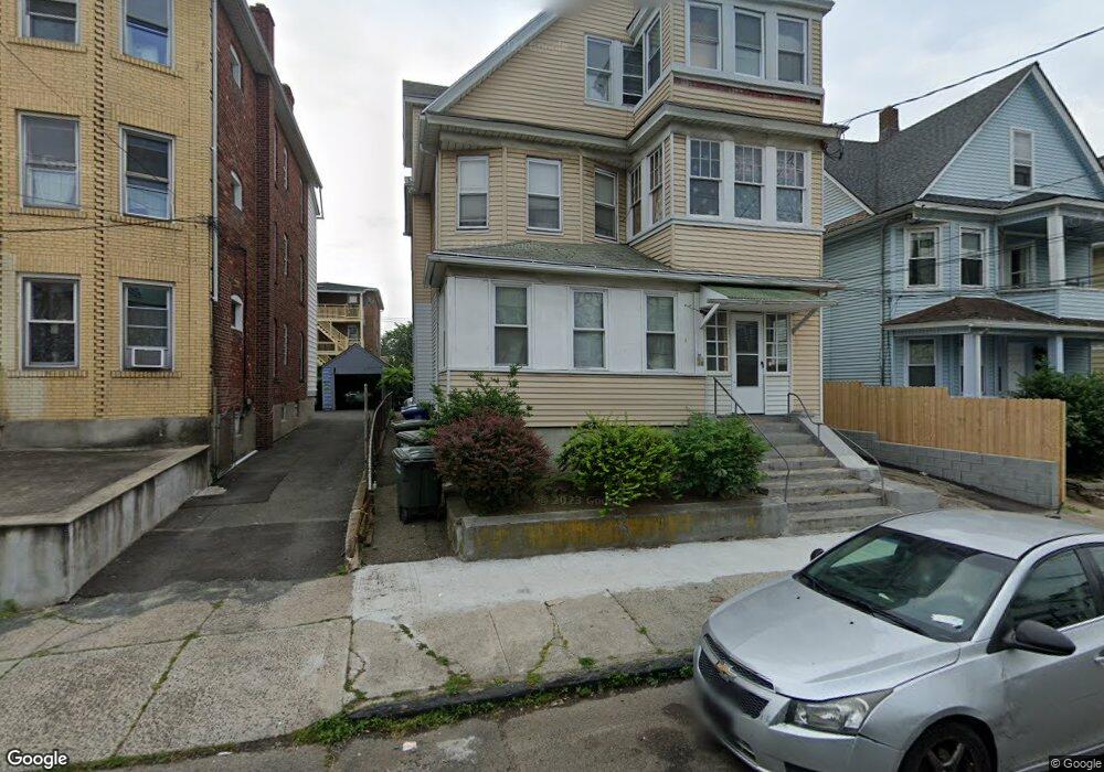
41 Taft Ave Bridgeport, CT 06606
Brooklawn-Saint Vincent NeighborhoodEstimated Value: $653,000 - $764,000
2
Beds
1
Bath
800
Sq Ft
$885/Sq Ft
Est. Value
About This Home
This home is located at 41 Taft Ave, Bridgeport, CT 06606 and is currently estimated at $708,000, approximately $885 per square foot. 41 Taft Ave is a home located in Fairfield County with nearby schools including Geraldine Johnson School, Central High School, and Catholic Academy of Bridgeport-St. Raphael Academy.
Ownership History
Date
Name
Owned For
Owner Type
Purchase Details
Closed on
Oct 31, 2011
Sold by
Jablecki Wieslaw
Bought by
Sound Course Props Llc
Current Estimated Value
Create a Home Valuation Report for This Property
The Home Valuation Report is an in-depth analysis detailing your home's value as well as a comparison with similar homes in the area
Home Values in the Area
Average Home Value in this Area
Purchase History
| Date | Buyer | Sale Price | Title Company |
|---|---|---|---|
| Sound Course Props Llc | $60,000 | -- | |
| Sound Course Props Llc | $60,000 | -- |
Source: Public Records
Mortgage History
| Date | Status | Borrower | Loan Amount |
|---|---|---|---|
| Open | Sound Course Props Llc | $1,345,700 | |
| Closed | Sound Course Props Llc | $1,345,700 |
Source: Public Records
Tax History Compared to Growth
Tax History
| Year | Tax Paid | Tax Assessment Tax Assessment Total Assessment is a certain percentage of the fair market value that is determined by local assessors to be the total taxable value of land and additions on the property. | Land | Improvement |
|---|---|---|---|---|
| 2025 | $9,288 | $213,760 | $70,900 | $142,860 |
| 2024 | $9,288 | $213,760 | $70,900 | $142,860 |
| 2023 | $9,288 | $213,760 | $70,900 | $142,860 |
| 2022 | $9,288 | $213,760 | $70,900 | $142,860 |
| 2021 | $9,288 | $213,760 | $70,900 | $142,860 |
| 2020 | $8,125 | $150,500 | $42,970 | $107,530 |
| 2019 | $8,125 | $150,500 | $42,970 | $107,530 |
| 2018 | $8,183 | $150,500 | $42,970 | $107,530 |
| 2017 | $8,183 | $150,500 | $42,970 | $107,530 |
| 2016 | $8,773 | $161,360 | $42,970 | $118,390 |
| 2015 | $8,563 | $202,920 | $45,500 | $157,420 |
| 2014 | $8,563 | $202,920 | $45,500 | $157,420 |
Source: Public Records
Map
Nearby Homes
- 31 Taft Ave
- 390 Charles St Unit 106
- 78 Fairmount Ave
- 724 Capitol Ave Unit 726
- 356 Taft Ave
- 90 Tom Thumb St
- 119 Madison Terrace
- 1275 Capitol Ave
- 2395 Main St Unit 2397
- 201 High Ridge Dr
- 191 Oak St
- 2345 Park Ave
- 100 Lorraine St
- 76 Porter St
- 318 Center St
- 125 Alexander Dr
- 2445 Park Ave Unit 23
- 150 Alexander Dr
- 508 Hawley Ave
- 241 Sampson St
- 51 Taft Ave Unit 53
- 57 Taft Ave
- 25 Taft Ave
- 40 Morgan Ave
- 50 Morgan Ave
- 32-36 Morgan Ave Unit 3
- 48 Taft Ave
- 46 Taft Ave Unit 48
- 22 Morgan Ave
- 56 Taft Ave Unit 58
- 32 Taft Ave
- 42 Morgan Ave
- 62 Morgan Ave
- 73 Taft Ave Unit 75
- 42 Taft Ave
- 46-48 Taft Ave Unit 1
- 46-48 Taft Ave
- 32-36 Taft Ave
- 32 Morgan Ave Unit 36
- 32 Morgan Ave Unit 3