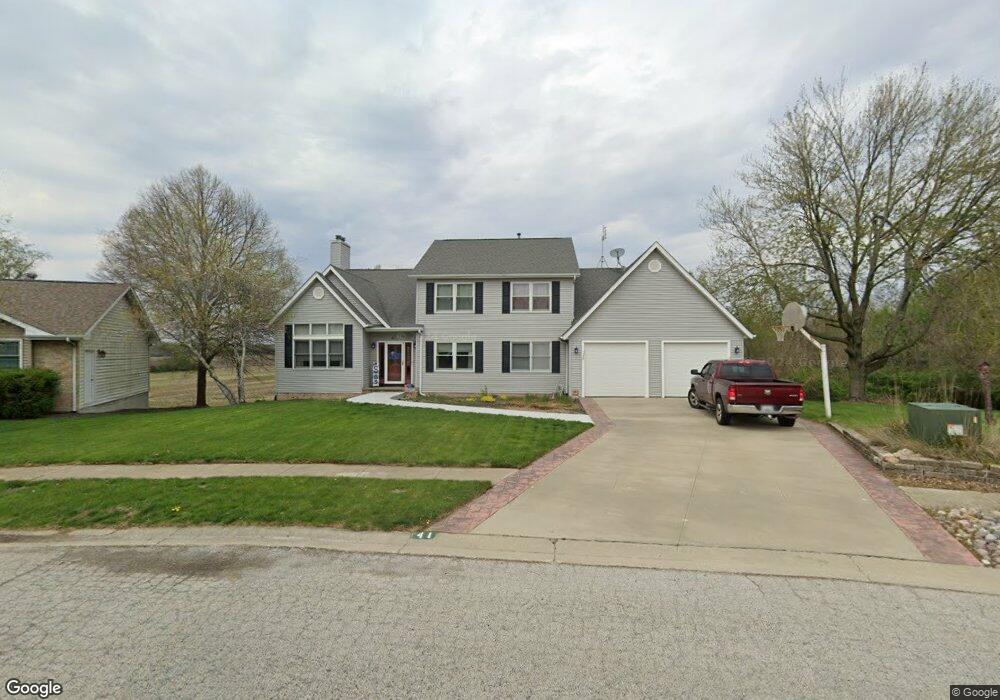
41 Taft Dr Unit 1 Rochester, IL 62563
Estimated Value: $375,000 - $448,000
4
Beds
4
Baths
4,060
Sq Ft
$104/Sq Ft
Est. Value
About This Home
This home is located at 41 Taft Dr Unit 1, Rochester, IL 62563 and is currently estimated at $421,684, approximately $103 per square foot. 41 Taft Dr Unit 1 is a home located in Sangamon County with nearby schools including Rochester Elementary Ec-1 School, Rochester Elementary School, and Rochester Intermediate School.
Ownership History
Date
Name
Owned For
Owner Type
Purchase Details
Closed on
Aug 1, 2023
Sold by
Jeffrey S Hill Living Trust
Bought by
Hasara Ron and Hasara Leeanne
Current Estimated Value
Home Financials for this Owner
Home Financials are based on the most recent Mortgage that was taken out on this home.
Original Mortgage
$296,250
Outstanding Balance
$289,722
Interest Rate
6.99%
Mortgage Type
New Conventional
Estimated Equity
$131,962
Purchase Details
Closed on
Aug 18, 2017
Sold by
Jeffrey Hill
Bought by
Jeffrey S Hill Living Trust
Purchase Details
Closed on
Nov 8, 2002
Purchase Details
Closed on
May 11, 1994
Create a Home Valuation Report for This Property
The Home Valuation Report is an in-depth analysis detailing your home's value as well as a comparison with similar homes in the area
Home Values in the Area
Average Home Value in this Area
Purchase History
| Date | Buyer | Sale Price | Title Company |
|---|---|---|---|
| Hasara Ron | $395,000 | Chicago Title | |
| Jeffrey S Hill Living Trust | -- | -- | |
| -- | $253,500 | -- | |
| -- | $193,000 | -- |
Source: Public Records
Mortgage History
| Date | Status | Borrower | Loan Amount |
|---|---|---|---|
| Open | Hasara Ron | $296,250 |
Source: Public Records
Tax History Compared to Growth
Tax History
| Year | Tax Paid | Tax Assessment Tax Assessment Total Assessment is a certain percentage of the fair market value that is determined by local assessors to be the total taxable value of land and additions on the property. | Land | Improvement |
|---|---|---|---|---|
| 2024 | $8,784 | $129,980 | $14,571 | $115,409 |
| 2023 | $8,609 | $123,461 | $13,840 | $109,621 |
| 2022 | $8,280 | $116,903 | $13,105 | $103,798 |
| 2021 | $7,945 | $112,234 | $12,582 | $99,652 |
| 2020 | $7,797 | $110,794 | $12,421 | $98,373 |
| 2019 | $7,657 | $111,519 | $12,502 | $99,017 |
| 2018 | $7,589 | $109,730 | $12,301 | $97,429 |
| 2017 | $7,470 | $108,569 | $12,171 | $96,398 |
| 2016 | $7,233 | $105,019 | $11,773 | $93,246 |
| 2015 | $6,765 | $98,191 | $11,996 | $86,195 |
| 2014 | $6,716 | $97,470 | $11,908 | $85,562 |
| 2013 | $6,615 | $96,352 | $11,771 | $84,581 |
Source: Public Records
Map
Nearby Homes
- 112 Deer Creek Rd Unit 1
- 1204 W Main St
- 427 Spring Ridge
- 217 E Main St Unit 1
- 525 E Mill St Unit 1
- 3440 Woodhaven Dr Unit 1
- 5 Swannanoa Unit 1
- 27 Mishawaka Dr Unit 1
- 3149 Beaver Creek Ln
- 3810 Bristlecone Dr Unit 2
- 46 Woodland Trail
- 3491 Woodhaven Dr
- 3120 Red Bud Ln
- 66 White Birch Rd
- 3504 Hoylake Dr
- 2265 Jostes Rd
- 329-331 Harbor Point Place
- 312 Harbor Point Place
- 314 Harbor Point Place
- 9 Acadia Ct Unit 1
- 39 Taft Dr Unit 1
- 43 Taft Dr Unit 1
- 37 Taft Dr Unit 1
- 45 Taft Dr Unit 1
- 35 Taft Dr Unit 1
- 49 Taft Dr Unit 1
- 30 Taft Dr Unit 1
- 46 Taft Dr Unit 1
- 51 Taft Dr Unit 1
- 33 Taft Dr Unit 1
- 48 Taft Dr Unit 1
- 31 Taft Dr Unit 1
- 28 Taft Dr Unit 1
- 53 Taft Dr Unit 1
- 50 Taft Dr Unit 1
- 29 Taft Dr Unit 1
- 26 Taft Dr Unit 1
- 55 Taft Dr Unit 1
- 52 Taft Dr Unit 1
- 27 Taft Dr Unit 1