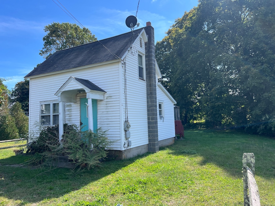
41 Trolley Rd Westbrook, CT 06498
Estimated payment $1,908/month
Highlights
- Cape Cod Architecture
- Property is near public transit, shops, and bus stop
- Public Transportation
- Westbrook Middle School Rated A-
- Walking Distance to Water
- 5-minute walk to Ted Lane Field
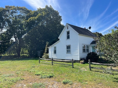
About This Home
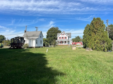
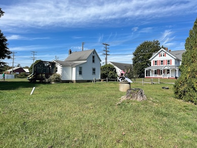
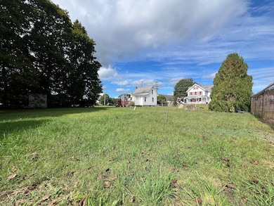
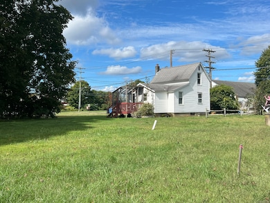
Tucked along Trolley Road in Westbrook, this year-round cottage offers a rare opportunity in one of the shoreline's most sought-after locations. The home itself is ready for a new owner's vision and care, but it's the walk-to-town lifestyle that makes this property truly special. Just steps from Christie's, Julie's Cup of Joe, The Turtle Cafe, and the Westbrook train station, you'll enjoy the ease of downtown living while still being south of Route 1 and within walking distance to Westbrook's sandy beaches. Set on a generous, level lot, with test holes already completed, the property offers incredible potential well beyond its current footprint. A small section of wetlands rests quietly at the very back, creating natural privacy while preserving the majority of the land as open and usable. Whether you envision refreshing the existing single-family home or building new construction, this property provides a prime canvas for your ideas. An ideal choice for buyers seeking both lifestyle and location, this home can also be purchased together with MLS #24124260, offering an even larger opportunity in the heart of Westbrook's shoreline community.
Listing Agent
William Raveis Real Estate Brokerage Phone: (860) 227-1212 License #RES.0002284 Listed on: 09/26/2025

Home Details
Home Type
- Single Family
Est. Annual Taxes
- $5,084
Year Built
- Built in 1900
Lot Details
- 12,632 Sq Ft Lot
- Property is zoned HDR
Home Design
- Cape Cod Architecture
- Gable Roof Shape
- Wood Foundation
- Concrete Siding
- Block Exterior
- Vinyl Siding
Interior Spaces
- 573 Sq Ft Home
- Crawl Space
Bedrooms and Bathrooms
- 2 Bedrooms
- 1 Full Bathroom
Schools
- Daisy Ingraham Elementary School
- Westbrook High School
Utilities
- Baseboard Heating
- Heating System Uses Oil
- Heating System Uses Propane
- Private Company Owned Well
- Electric Water Heater
Additional Features
- Walking Distance to Water
- Property is near public transit, shops, and bus stop
Community Details
- Public Transportation
Listing and Financial Details
- Assessor Parcel Number 1040416
Map
Home Values in the Area
Average Home Value in this Area
Tax History
We collect this data history from publicly available records. To have your information removed, we recommend requesting removal directly through your county’s website.
| Year | Tax Paid | Tax Assessment Tax Assessment Total Assessment is a certain percentage of the fair market value that is determined by local assessors to be the total taxable value of land and additions on the property. | Land | Improvement |
|---|---|---|---|---|
| 2025 | $5,084 | $225,940 | $188,500 | $37,440 |
| 2024 | $4,903 | $225,940 | $188,500 | $37,440 |
| 2023 | $4,817 | $225,940 | $188,500 | $37,440 |
| 2022 | $4,691 | $225,940 | $188,500 | $37,440 |
| 2021 | $3,741 | $149,640 | $114,240 | $35,400 |
| 2020 | $3,741 | $149,640 | $114,240 | $35,400 |
| 2019 | $3,692 | $149,640 | $114,240 | $35,400 |
| 2018 | $3,647 | $149,640 | $114,240 | $35,400 |
| 2017 | $3,647 | $149,640 | $114,240 | $35,400 |
| 2016 | $2,703 | $116,810 | $77,110 | $39,700 |
Property History
We collect this data history from publicly available records. To have your information removed, we recommend requesting removal directly through your county’s website.
| Date | Event | Price | List to Sale | Price per Sq Ft |
|---|---|---|---|---|
| 05/29/2026 05/29/26 | Price Changed | $275,000 | -21.4% | $480 / Sq Ft |
| 01/02/2026 01/02/26 | Price Changed | $350,000 | -6.7% | $611 / Sq Ft |
| 09/26/2025 09/26/25 | For Sale | $375,000 | -- | $654 / Sq Ft |
Purchase History
We collect this data history from publicly available records. To have your information removed, we recommend requesting removal directly through your county’s website.
| Date | Type | Sale Price | Title Company |
|---|---|---|---|
| Quit Claim Deed | -- | -- | |
| Quit Claim Deed | -- | -- | |
| Executors Deed | $65,000 | -- |
Mortgage History
We collect this data history from publicly available records. To have your information removed, we recommend requesting removal directly through your county’s website.
| Date | Status | Loan Amount | Loan Type |
|---|---|---|---|
| Open | $150,000 | Stand Alone Refi Refinance Of Original Loan |
Source: SmartMLS
MLS Number: 24129413
APN: WBRO-000177-000000-000146
Disclaimer: Certain information contained herein is derived from information provided by parties other than Homes.com. All information provided is deemed reliable, but is not guaranteed to be accurate and should be independently verified.
![]() IDX information is provided exclusively for personal, non-commercial use, and may not be used for any purpose other than to identify prospective properties consumers may be interested in purchasing. Information is deemed reliable but not guaranteed.
IDX information is provided exclusively for personal, non-commercial use, and may not be used for any purpose other than to identify prospective properties consumers may be interested in purchasing. Information is deemed reliable but not guaranteed.
- 29 Salt Island Rd
- 126 Magna Ln
- 7 Parker Ln
- 1340 Old Clinton Rd Unit 12
- 224 Salt Island Rd
- 79 Wesley Ave
- 100 2nd Ave
- 19 Old Forge Rd
- 273 Seaside Ave
- 11a/11b Pond Circle Rd
- 39 Churchill Ln
- 520 Marina Way Landing Unit 520
- 452 Essex Rd
- 29 Meeting House Ln
- 46 School Hill Ln
- 5 Cook Terrace
- 523 Essex Rd
- 85 McVeagh Rd
- 405 Pond Meadow Rd
- 449 Seaside Ave
- 34 Worthington Dr
- 505 Seaside Ave
- 19 Underway Dr
- 14 Leeway Dr
- 58 Chapman Ave
- 28 Beach Rd W
- 33 Beach Rd W
- 1500 Boston Post Rd Unit 8
- 8 Lewis Ave
- 8 Belaire Manor
- 89 Grove Beach Rd S
- 12 Allendale Rd
- 45 Broadway S
- 54 Hartford Ave
- 10 Groveway
- 21 Groveway Unit 21
- 170 Shore Rd
- 18 Cedarwood Ln
- 38 Seabreeze Rd
- 10 London Ct
Ask me questions while you tour the home.