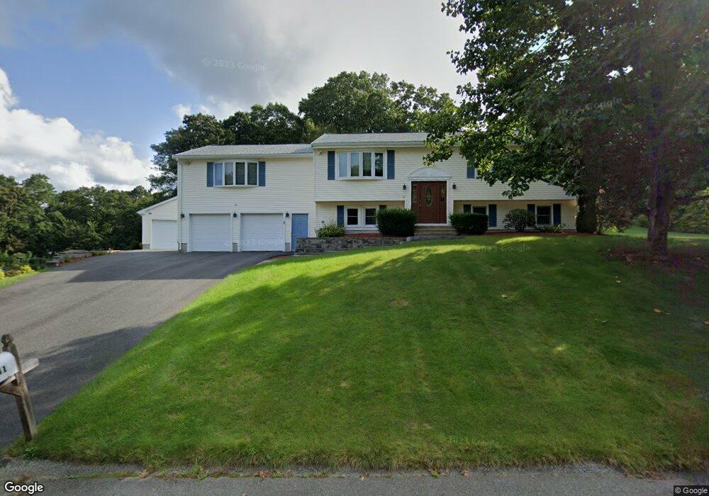
41 Upland St Holbrook, MA 02343
Estimated Value: $654,000 - $749,686
4
Beds
2
Baths
2,444
Sq Ft
$288/Sq Ft
Est. Value
About This Home
This home is located at 41 Upland St, Holbrook, MA 02343 and is currently estimated at $703,172, approximately $287 per square foot. 41 Upland St is a home located in Norfolk County with nearby schools including John F. Kennedy Elementary School, Holbrook Middle High School, and Boston Higashi School.
Create a Home Valuation Report for This Property
The Home Valuation Report is an in-depth analysis detailing your home's value as well as a comparison with similar homes in the area
Home Values in the Area
Average Home Value in this Area
Tax History
| Year | Tax Paid | Tax Assessment Tax Assessment Total Assessment is a certain percentage of the fair market value that is determined by local assessors to be the total taxable value of land and additions on the property. | Land | Improvement |
|---|---|---|---|---|
| 2025 | $88 | $669,100 | $263,300 | $405,800 |
| 2024 | $8,349 | $621,200 | $239,300 | $381,900 |
| 2023 | $8,930 | $580,600 | $217,800 | $362,800 |
| 2022 | $8,481 | $514,300 | $189,600 | $324,700 |
| 2021 | $8,054 | $467,700 | $177,400 | $290,300 |
| 2020 | $8,307 | $452,200 | $169,000 | $283,200 |
| 2019 | $8,117 | $417,100 | $150,900 | $266,200 |
| 2018 | $7,206 | $348,600 | $128,200 | $220,400 |
| 2017 | $7,070 | $338,300 | $128,200 | $210,100 |
| 2016 | $6,847 | $348,600 | $142,600 | $206,000 |
| 2015 | $6,333 | $331,900 | $134,200 | $197,700 |
| 2014 | $5,849 | $311,600 | $122,200 | $189,400 |
Source: Public Records
Map
Nearby Homes
- 12 Hamilton Way
- 14 Leonard Ln
- 16 Howard Ave
- 719 S Franklin St Unit C Block 1
- 660 S Franklin St
- 36 Kalmia Rd
- 52 Quincy St
- 610 S Franklin St Unit F102
- 275 Jon Dr
- 37 Reeds Ln
- 244 Hovendon Ave
- 170 Elsie Rd
- 193 E Spring St
- 191 E Spring St
- 19 Rodwell St
- 192 E Spring St
- 27 Valley Rd
- 109 Lester Rd
- 95 Rindone St
- 2 Glendower St
Your Personal Tour Guide
Ask me questions while you tour the home.