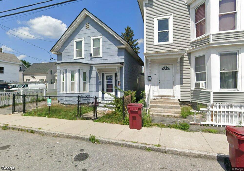
41 W 4th St Lowell, MA 01850
Centralville NeighborhoodEstimated Value: $438,000 - $610,000
Studio
1
Bath
--
Sq Ft
4,356
Sq Ft Lot
About This Home
This home is located at 41 W 4th St, Lowell, MA 01850 and is currently estimated at $531,165. 41 W 4th St is a home located in Middlesex County with nearby schools including Greenhalge Elementary School, S. Christa McAuliffe Elementary School, and Moody Elementary School.
Ownership History
Date
Name
Owned For
Owner Type
Purchase Details
Closed on
Aug 3, 2015
Sold by
Griffiths Brenda H
Bought by
Griffiths Brenda H and Asegan Paula
Current Estimated Value
Purchase Details
Closed on
May 1, 1991
Sold by
Hayes John G
Bought by
Asegan Brenda A
Home Financials for this Owner
Home Financials are based on the most recent Mortgage that was taken out on this home.
Original Mortgage
$48,000
Interest Rate
9.55%
Mortgage Type
Purchase Money Mortgage
Create a Home Valuation Report for This Property
The Home Valuation Report is an in-depth analysis detailing your home's value as well as a comparison with similar homes in the area
Home Values in the Area
Average Home Value in this Area
Purchase History
| Date | Buyer | Sale Price | Title Company |
|---|---|---|---|
| Griffiths Brenda H | -- | -- | |
| Griffiths Brenda H | -- | -- | |
| Asegan Brenda A | $35,000 | -- | |
| Asegan Brenda A | $35,000 | -- |
Source: Public Records
Mortgage History
| Date | Status | Borrower | Loan Amount |
|---|---|---|---|
| Previous Owner | Asegan Brenda A | $48,000 |
Source: Public Records
Tax History
| Year | Tax Paid | Tax Assessment Tax Assessment Total Assessment is a certain percentage of the fair market value that is determined by local assessors to be the total taxable value of land and additions on the property. | Land | Improvement |
|---|---|---|---|---|
| 2025 | $5,500 | $479,100 | $115,900 | $363,200 |
| 2024 | $5,290 | $444,200 | $101,900 | $342,300 |
| 2023 | $5,010 | $403,400 | $88,600 | $314,800 |
| 2022 | $4,645 | $366,000 | $75,400 | $290,600 |
| 2021 | $4,338 | $322,300 | $65,600 | $256,700 |
| 2020 | $4,275 | $320,000 | $76,200 | $243,800 |
| 2019 | $3,916 | $278,900 | $67,300 | $211,600 |
| 2018 | $3,826 | $265,900 | $64,100 | $201,800 |
| 2017 | $3,688 | $247,200 | $58,300 | $188,900 |
| 2016 | $3,895 | $256,900 | $47,400 | $209,500 |
| 2015 | $3,701 | $239,100 | $45,300 | $193,800 |
| 2013 | $3,367 | $224,300 | $55,400 | $168,900 |
Source: Public Records
Map
Nearby Homes
- 45 W 4th St
- 120 Lakeview Ave
- 27-29 Fifth St
- 99 W 6th St
- 25 Read St
- 94 1st St Unit 10
- 130 John St Unit 350
- 130 John St Unit G01
- 130 John St Unit 242
- 130 John St Unit 250
- 105 3rd St
- 27 Bunker Hill Ave
- 106 Methuen St Unit B
- 202 Coburn St
- 174 River Rd
- 18 May St
- 192 1st St
- 10 Kearney Square Unit 407
- 9 Central St Unit 601
- 9 Central St Unit 602
Your Personal Tour Guide
Ask me questions while you tour the home.