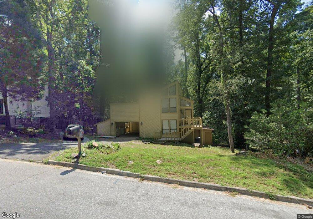
410 Bristol Rd Augusta, GA 30907
Estimated Value: $265,000 - $272,269
3
Beds
2
Baths
1,845
Sq Ft
$145/Sq Ft
Est. Value
About This Home
This home is located at 410 Bristol Rd, Augusta, GA 30907 and is currently estimated at $267,567, approximately $145 per square foot. 410 Bristol Rd is a home located in Columbia County with nearby schools including Northmore Elementary School, Lincoln Elementary School, and Blue Ridge Elementary School.
Ownership History
Date
Name
Owned For
Owner Type
Purchase Details
Closed on
Sep 13, 2010
Sold by
Gmac Mtg Llc
Bought by
Davis Paul
Current Estimated Value
Purchase Details
Closed on
Jun 2, 2004
Sold by
Cox Steven Eugene and Cox Catherine T
Bought by
Williams Chad and Williams Patti J
Home Financials for this Owner
Home Financials are based on the most recent Mortgage that was taken out on this home.
Original Mortgage
$121,410
Interest Rate
5.98%
Mortgage Type
Unknown
Create a Home Valuation Report for This Property
The Home Valuation Report is an in-depth analysis detailing your home's value as well as a comparison with similar homes in the area
Home Values in the Area
Average Home Value in this Area
Purchase History
| Date | Buyer | Sale Price | Title Company |
|---|---|---|---|
| Davis Paul | $69,000 | -- | |
| Williams Chad | $134,900 | -- |
Source: Public Records
Mortgage History
| Date | Status | Borrower | Loan Amount |
|---|---|---|---|
| Previous Owner | Williams Chad | $121,410 |
Source: Public Records
Tax History Compared to Growth
Tax History
| Year | Tax Paid | Tax Assessment Tax Assessment Total Assessment is a certain percentage of the fair market value that is determined by local assessors to be the total taxable value of land and additions on the property. | Land | Improvement |
|---|---|---|---|---|
| 2025 | $2,550 | $104,455 | $15,204 | $89,251 |
| 2024 | $2,622 | $102,592 | $18,004 | $84,588 |
| 2023 | $2,622 | $92,197 | $16,804 | $75,393 |
| 2022 | $2,406 | $90,332 | $14,004 | $76,328 |
| 2021 | $2,069 | $73,937 | $12,704 | $61,233 |
| 2020 | $1,928 | $67,327 | $11,904 | $55,423 |
| 2019 | $1,722 | $59,908 | $9,904 | $50,004 |
| 2018 | $1,740 | $60,330 | $11,004 | $49,326 |
| 2017 | $1,650 | $56,913 | $10,104 | $46,809 |
| 2016 | $1,702 | $60,943 | $9,880 | $51,063 |
| 2015 | $1,708 | $61,078 | $9,880 | $51,198 |
| 2014 | $1,725 | $60,916 | $9,680 | $51,236 |
Source: Public Records
Map
Nearby Homes
- 368 Sumac Trail
- 4157 Arlington Rd
- 358 Sumac Trail
- 155 Canton Park Ave
- 333 Sumac Trail
- 4069 Riverwatch Pkwy
- 4063 Danielle Dr
- 4070 Riverwatch Pkwy
- 4209 Fairfield Cir
- 317 Connor Cir
- 323 Connor Cir
- 310 Connor Cir
- 386 Connor Cir
- 0 Mc Cormick Rd
- 367 Connor Cir
- 0 Commons Dr
- 0 Mccormick Rd Unit 547611
- 3779 Winchester Trail
- 5553 Connor Dr
- 352 Mears St
- 412 Bristol Rd
- 408 Bristol Rd
- 441 Halifax Dr
- 406 Bristol Rd
- 414 Bristol Rd
- 409 Bristol Rd
- 411 Bristol Rd
- 439 Halifax Dr
- 413 Bristol Rd
- 416 Bristol Rd
- 407 Bristol Rd
- 404 Bristol Rd
- 415 Bristol Rd
- 4095 Amherst Ct
- 437 Halifax Dr
- 402 Bristol Rd
- 418 Bristol Rd
- 4097 Amherst Way
- 4098 Amherst Way
- 4093 Amherst Ct