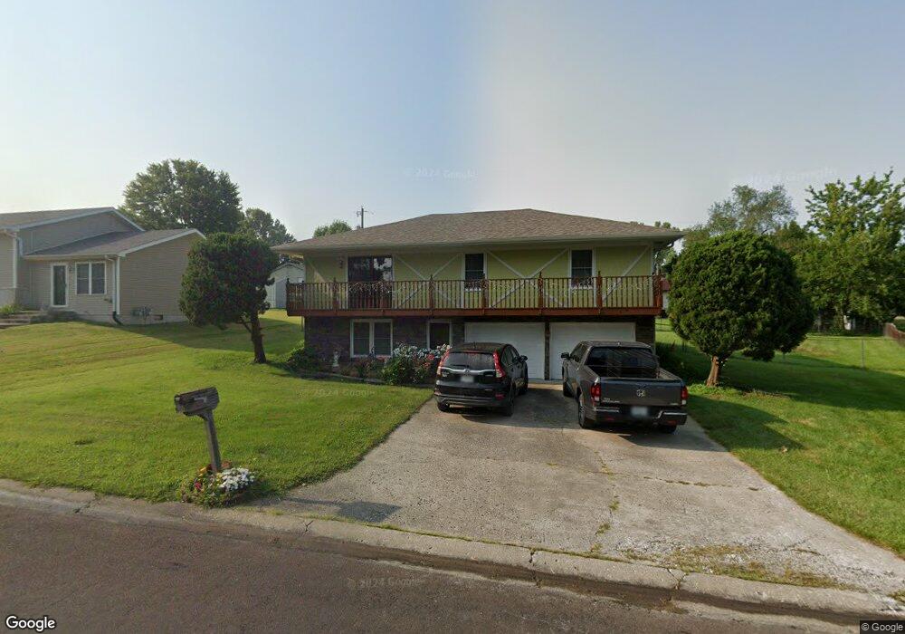
410 Chestnut Dr Marshall, MO 65340
Estimated Value: $142,815 - $259,000
3
Beds
3
Baths
1,529
Sq Ft
$121/Sq Ft
Est. Value
About This Home
This home is located at 410 Chestnut Dr, Marshall, MO 65340 and is currently estimated at $185,454, approximately $121 per square foot. 410 Chestnut Dr is a home located in Saline County with nearby schools including Marshall Senior High School and St. Peter Catholic School.
Ownership History
Date
Name
Owned For
Owner Type
Purchase Details
Closed on
Dec 15, 2023
Sold by
Almazan Pedro and Almazan Norma
Bought by
Almazan Pedro D and Almazan Norma
Current Estimated Value
Home Financials for this Owner
Home Financials are based on the most recent Mortgage that was taken out on this home.
Original Mortgage
$95,959
Outstanding Balance
$90,639
Interest Rate
0.68%
Mortgage Type
Construction
Estimated Equity
$94,815
Create a Home Valuation Report for This Property
The Home Valuation Report is an in-depth analysis detailing your home's value as well as a comparison with similar homes in the area
Home Values in the Area
Average Home Value in this Area
Purchase History
| Date | Buyer | Sale Price | Title Company |
|---|---|---|---|
| Almazan Pedro D | $119,949 | Truman Title Inc |
Source: Public Records
Mortgage History
| Date | Status | Borrower | Loan Amount |
|---|---|---|---|
| Open | Almazan Pedro D | $95,959 |
Source: Public Records
Tax History
| Year | Tax Paid | Tax Assessment Tax Assessment Total Assessment is a certain percentage of the fair market value that is determined by local assessors to be the total taxable value of land and additions on the property. | Land | Improvement |
|---|---|---|---|---|
| 2025 | $1,271 | $23,420 | $1,690 | $21,730 |
| 2024 | $1,251 | $20,370 | $1,470 | $18,900 |
| 2023 | $1,251 | $20,370 | $1,470 | $18,900 |
| 2022 | $991 | $20,370 | $1,470 | $18,900 |
| 2021 | $990 | $20,370 | $1,470 | $18,900 |
| 2020 | $726 | $13,270 | $1,470 | $11,800 |
| 2019 | $715 | $13,270 | $13,270 | $0 |
| 2018 | $711 | $13,270 | $13,270 | $0 |
| 2017 | $715 | $13,270 | $0 | $0 |
| 2016 | $710 | $13,270 | $0 | $0 |
| 2015 | -- | $13,270 | $0 | $0 |
| 2014 | -- | $13,270 | $0 | $0 |
Source: Public Records
Map
Nearby Homes
- 430 Chestnut Dr
- 630 N Lyon Ave
- 621 N Ellsworth Ave
- 126 W Slater St
- 682 N Benton Ave
- 602 N Franklin Ave
- 600 N Franklin Ave
- 618 N Franklin Ave
- 601 N Hamner Ave
- 717 N Jefferson Ave
- 502 N Ellsworth Ave
- 825 N Odell Ave
- 624 N Bond Ave
- 617 N Odell Ave
- 437 N Odell Ave
- 534 Seargent Ave
- 427 N Bond Ave
- 425 N Bond Ave
- 224 E Porter St
- 406 N Odell Ave
- 340 Chestnut Dr
- 400 Chestnut Dr
- 411 Chestnut Dr
- 411 W High St
- 337 Chestnut Dr
- 343 W High St
- 405 W High St
- 415 W High St
- 330 Chestnut Dr
- 339 W High St
- 410 W Slater St
- 333 Chestnut Dr
- 331 W High St
- 340 W Slater St
- 647 N Ellsworth Ave
- 323 W High St
- 644 N Ellsworth Ave
- 310 Chestnut Dr
- 330 W Slater St
- 340 W High St
Your Personal Tour Guide
Ask me questions while you tour the home.