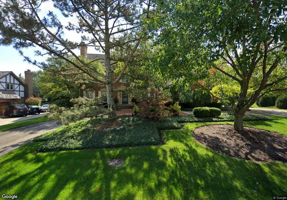
410 Devon Dr Burr Ridge, IL 60527
Burr Ridge West NeighborhoodEstimated Value: $865,651 - $1,044,000
Studio
1
Bath
3,659
Sq Ft
$260/Sq Ft
Est. Value
About This Home
This home is located at 410 Devon Dr, Burr Ridge, IL 60527 and is currently estimated at $950,163, approximately $259 per square foot. 410 Devon Dr is a home located in DuPage County with nearby schools including Anne M. Jeans Elementary School, Burr Ridge Middle School, and Hinsdale South High School.
Ownership History
Date
Name
Owned For
Owner Type
Purchase Details
Closed on
Feb 24, 2001
Sold by
Grannon Craig C and Grannon Linda D
Bought by
Grannon Craig C and Grannon Linda D
Current Estimated Value
Create a Home Valuation Report for This Property
The Home Valuation Report is an in-depth analysis detailing your home's value as well as a comparison with similar homes in the area
Home Values in the Area
Average Home Value in this Area
Purchase History
We collect this data history from publicly available records. To have your information removed, we recommend requesting removal directly through your county’s website.
| Date | Buyer | Sale Price | Title Company |
|---|---|---|---|
| Grannon Craig C | -- | -- |
Source: Public Records
Tax History
| Year | Tax Paid | Tax Assessment Tax Assessment Total Assessment is a certain percentage of the fair market value that is determined by local assessors to be the total taxable value of land and additions on the property. | Land | Improvement |
|---|---|---|---|---|
| 2024 | $14,166 | $259,353 | $95,596 | $163,757 |
| 2023 | $13,595 | $238,420 | $87,880 | $150,540 |
| 2022 | $14,005 | $245,530 | $90,500 | $155,030 |
| 2021 | $13,437 | $242,740 | $89,470 | $153,270 |
| 2020 | $13,218 | $237,930 | $87,700 | $150,230 |
| 2019 | $12,690 | $228,300 | $84,150 | $144,150 |
| 2018 | $12,820 | $239,430 | $83,690 | $155,740 |
| 2017 | $12,719 | $230,390 | $80,530 | $149,860 |
| 2016 | $12,407 | $219,880 | $76,860 | $143,020 |
| 2015 | $12,378 | $206,870 | $72,310 | $134,560 |
| 2014 | $11,735 | $193,730 | $70,310 | $123,420 |
| 2013 | $11,360 | $192,820 | $69,980 | $122,840 |
Source: Public Records
Map
Nearby Homes
- 15W601 S Grant St
- 15W601 89th Place
- 9045 Turnberry Dr
- 22 Rodeo Dr
- 8886 Johnston Rd
- 125 Circle Ridge Dr
- 10S370 Madison St
- 10S641 S Garfield Ave
- 766 Camelot Dr
- 11901 Heritage Dr
- 16W185 89th St
- 8673 Timber Ridge Dr
- 16W122 91st St
- 10S607 Glenn Dr
- 8611 Crest Ct
- 15W670 83rd St
- 106 Oak Ridge Dr W
- 8827 Palisades Rd
- 8511 Johnston Rd
- 9233 Falling Waters Dr W
Your Personal Tour Guide
Ask me questions while you tour the home.