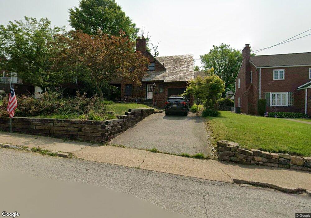
410 Freeport Rd New Kensington, PA 15068
Estimated Value: $68,489 - $160,000
3
Beds
2
Baths
--
Sq Ft
5,663
Sq Ft Lot
About This Home
This home is located at 410 Freeport Rd, New Kensington, PA 15068 and is currently estimated at $113,622. 410 Freeport Rd is a home located in Westmoreland County with nearby schools including Mary Queen of Apostles School.
Ownership History
Date
Name
Owned For
Owner Type
Purchase Details
Closed on
Nov 17, 2015
Sold by
Wells Fargo Bank Na
Bought by
Follett Mary Beth
Current Estimated Value
Purchase Details
Closed on
Oct 27, 2010
Sold by
Swartz Shawn A and Swartz Carrie A
Bought by
Simpson Jason M and Simpson Leah R
Home Financials for this Owner
Home Financials are based on the most recent Mortgage that was taken out on this home.
Original Mortgage
$78,837
Interest Rate
4.39%
Mortgage Type
FHA
Purchase Details
Closed on
Jul 12, 2002
Sold by
Uhler John D and Uhler Sheila M
Bought by
Beneficial Consumer Discount Company and Beneficial Mtg Co Of Pennsylvania
Create a Home Valuation Report for This Property
The Home Valuation Report is an in-depth analysis detailing your home's value as well as a comparison with similar homes in the area
Home Values in the Area
Average Home Value in this Area
Purchase History
| Date | Buyer | Sale Price | Title Company |
|---|---|---|---|
| Follett Mary Beth | $57,500 | None Available | |
| Simpson Jason M | $79,900 | None Available | |
| Beneficial Consumer Discount Company | $9,007 | -- |
Source: Public Records
Mortgage History
| Date | Status | Borrower | Loan Amount |
|---|---|---|---|
| Previous Owner | Simpson Jason M | $78,837 |
Source: Public Records
Tax History Compared to Growth
Tax History
| Year | Tax Paid | Tax Assessment Tax Assessment Total Assessment is a certain percentage of the fair market value that is determined by local assessors to be the total taxable value of land and additions on the property. | Land | Improvement |
|---|---|---|---|---|
| 2025 | $3,033 | $19,000 | $3,540 | $15,460 |
| 2024 | $3,005 | $19,000 | $3,540 | $15,460 |
| 2023 | $2,844 | $19,000 | $3,540 | $15,460 |
| 2022 | $2,757 | $19,000 | $3,540 | $15,460 |
| 2021 | $2,694 | $19,000 | $3,540 | $15,460 |
| 2020 | $2,637 | $19,000 | $3,540 | $15,460 |
| 2019 | $2,571 | $19,000 | $3,540 | $15,460 |
| 2018 | $2,533 | $19,000 | $3,540 | $15,460 |
| 2017 | $2,495 | $19,000 | $3,540 | $15,460 |
| 2016 | $2,495 | $19,000 | $3,540 | $15,460 |
| 2015 | $2,495 | $19,000 | $3,540 | $15,460 |
| 2014 | $2,397 | $19,000 | $3,540 | $15,460 |
Source: Public Records
Map
Nearby Homes
- 327 Charles Ave
- 533 Freeport Rd
- 1218 Woodmont Ave
- 318 Ridge Ave
- 486 McCargo St
- 620 Ridge Ave
- 1134 Leishman Ave
- 1308 Taylor Ave
- 1312 Woodmont Ave
- 254 Ridge Ave
- 1024 Knollwood Rd
- 201 Locust St
- 1216 Kenneth Ave
- 1025 Kenneth Ave
- 105 Locust St
- 1400 Orchard Ave
- 1233 Kenneth Ave
- 1506 Victoria Ave
- 168 Short St
- 1515 Woodmont Ave
- 408 Freeport Rd
- 412 Freeport Rd
- 417 Charles Ave
- 413 Charles Ave
- 414 Freeport Rd
- 406 Freeport Rd
- 431 Charles Ave
- 411 Freeport Rd
- 409 Freeport Rd
- 411 Charles Ave
- 432 Freeport Rd
- 415 Freeport Rd
- 419 Freeport Rd
- 433 Charles Ave
- 404 Freeport Rd
- 423 Freeport Rd
- 425 Freeport Rd
- 409 Charles Ave
- 427 Freeport Rd
- 427 Freeport Rd Unit 1/2