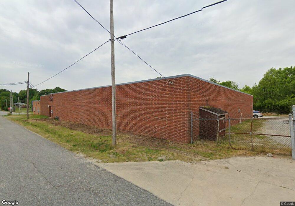
410 Grayson St High Point, NC 27260
Greater High Point NeighborhoodEstimated Value: $439,240
--
Bed
--
Bath
11,650
Sq Ft
$38/Sq Ft
Est. Value
About This Home
This home is located at 410 Grayson St, High Point, NC 27260 and is currently estimated at $439,240, approximately $37 per square foot. 410 Grayson St is a home located in Guilford County with nearby schools including Fairview Elementary School, Ferndale Middle School, and High Point Central High School.
Ownership History
Date
Name
Owned For
Owner Type
Purchase Details
Closed on
Jan 27, 2020
Sold by
Burrow Gary Ray and Burrow Rhonda K
Bought by
Grayson Llc
Current Estimated Value
Purchase Details
Closed on
Aug 24, 2018
Sold by
Jackson Stephanie Oxford and Jackson Wiley F
Bought by
Nunez Sergio D
Purchase Details
Closed on
Aug 14, 2018
Sold by
Burrow Gary Ray and Burrow Rhonda K
Bought by
Oxford Jackson Stephanie
Purchase Details
Closed on
Aug 16, 2017
Sold by
Burrow Jennifer N
Bought by
Burrow Robin Douglas
Create a Home Valuation Report for This Property
The Home Valuation Report is an in-depth analysis detailing your home's value as well as a comparison with similar homes in the area
Home Values in the Area
Average Home Value in this Area
Purchase History
| Date | Buyer | Sale Price | Title Company |
|---|---|---|---|
| Grayson Llc | $192,500 | None Available | |
| Nunez Sergio D | $129,000 | None Available | |
| Oxford Jackson Stephanie | -- | None Available | |
| Burrow Robin Douglas | -- | None Available |
Source: Public Records
Tax History Compared to Growth
Tax History
| Year | Tax Paid | Tax Assessment Tax Assessment Total Assessment is a certain percentage of the fair market value that is determined by local assessors to be the total taxable value of land and additions on the property. | Land | Improvement |
|---|---|---|---|---|
| 2025 | $3,172 | $230,200 | $47,700 | $182,500 |
| 2024 | $3,172 | $230,200 | $47,700 | $182,500 |
| 2023 | $3,172 | $230,200 | $47,700 | $182,500 |
| 2022 | $3,103 | $230,200 | $47,700 | $182,500 |
| 2021 | $2,979 | $216,200 | $47,700 | $168,500 |
| 2020 | $2,979 | $216,200 | $47,700 | $168,500 |
| 2019 | $2,979 | $195,800 | $0 | $0 |
| 2018 | $2,685 | $195,800 | $0 | $0 |
| 2017 | $2,685 | $195,800 | $0 | $0 |
| 2016 | $2,703 | $192,700 | $0 | $0 |
| 2015 | $2,717 | $192,700 | $0 | $0 |
| 2014 | $2,763 | $192,700 | $0 | $0 |
Source: Public Records
Map
Nearby Homes
- 523 Cross St
- 703 Langford Ave
- 608 Vail Ave
- 800 George Place
- 801 Amos St
- 616 S Elm St
- 808 Amos St
- 317 W High Ave Unit 15A
- 712 Cliffside Ave
- 800 Cliffside Ave
- 806 W Willis Ave
- 3637 Hobart Place
- 1110 Adams St
- 1307 Tipton St
- 604 W Ward Ave
- 207 N Rotary Dr Unit A
- 509 Chestnut Dr
- 702 Park St
- 707 Kennedy Ave
- 707 Park St