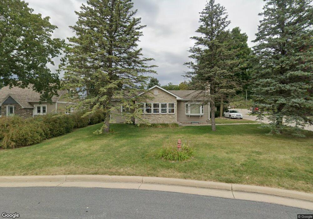
410 Grove St Sullivan, WI 53178
Estimated Value: $260,558 - $315,000
Studio
--
Bath
--
Sq Ft
7,492
Sq Ft Lot
About This Home
This home is located at 410 Grove St, Sullivan, WI 53178 and is currently estimated at $291,640. 410 Grove St is a home located in Jefferson County with nearby schools including Sullivan Elementary School, Jefferson Middle School, and Jefferson High School.
Ownership History
Date
Name
Owned For
Owner Type
Purchase Details
Closed on
Sep 24, 2012
Sold by
Crosby Michael H and Crosby Karen L
Bought by
Crosby Michael H
Current Estimated Value
Home Financials for this Owner
Home Financials are based on the most recent Mortgage that was taken out on this home.
Original Mortgage
$60,000
Interest Rate
3.57%
Mortgage Type
New Conventional
Create a Home Valuation Report for This Property
The Home Valuation Report is an in-depth analysis detailing your home's value as well as a comparison with similar homes in the area
Home Values in the Area
Average Home Value in this Area
Purchase History
| Date | Buyer | Sale Price | Title Company |
|---|---|---|---|
| Crosby Michael H | -- | Cunnie Lance Summit Lds Titl |
Source: Public Records
Mortgage History
| Date | Status | Borrower | Loan Amount |
|---|---|---|---|
| Closed | Crosby Michael H | $60,000 |
Source: Public Records
Tax History Compared to Growth
Tax History
| Year | Tax Paid | Tax Assessment Tax Assessment Total Assessment is a certain percentage of the fair market value that is determined by local assessors to be the total taxable value of land and additions on the property. | Land | Improvement |
|---|---|---|---|---|
| 2024 | $4,925 | $211,300 | $29,200 | $182,100 |
| 2023 | $5,215 | $157,600 | $22,500 | $135,100 |
| 2022 | $4,832 | $157,600 | $22,500 | $135,100 |
| 2021 | $4,395 | $157,600 | $22,500 | $135,100 |
| 2020 | $4,058 | $136,200 | $22,500 | $113,700 |
| 2019 | $3,672 | $136,200 | $22,500 | $113,700 |
| 2018 | $3,664 | $136,200 | $22,500 | $113,700 |
| 2017 | $3,595 | $136,200 | $22,500 | $113,700 |
| 2016 | $3,578 | $136,200 | $22,500 | $113,700 |
| 2015 | $3,673 | $136,200 | $22,500 | $113,700 |
| 2014 | $3,739 | $150,000 | $22,500 | $127,500 |
| 2013 | $3,568 | $150,000 | $22,500 | $127,500 |
Source: Public Records
Map
Nearby Homes
- 631 Bakertown Dr
- W1211 Hillview Dr Unit 128
- N6021 Grey Fox Trail
- W2344 Rome Rd
- W1048 Concord Center Dr
- W2723 U S 18
- N3075 Hardscrabble Rd
- Lt2 County Road z
- Lt1 County Road z
- Lt129 Twin Creeks Dr
- N6291 Sunset Rd
- 584 Twin Creeks Dr
- 596 Twin Creeks Dr
- 599 Twin Creeks Dr
- 590 Twin Creeks Dr
- 143 Twin Creeks Court Dr
- 137 Twin Creeks Ct Dr
- 149 Twin Creeks Ct
- 148 Twin Creeks Ct
- W377S3554 Lake Dr
- 412 Grove St
- 148 Main St
- 401 Grove St Unit 148
- 401 Grove St
- 411 Grove St
- 146 Main St
- 146 Main St Unit 1-6
- 418 Grove St
- 142 Main St Unit 144
- 142 Main St Unit Number A
- 142 Main St Unit 142 main street unit
- 142 Main St Unit 142 main street
- 142 Main St
- 142 Main St Unit 146 main street
- 502 Madison Ave
- 142-144 Main St
- 144 Main St
- 4 lots Vista Del Parco Rd
- 120 Vista Del
- 420 Grove St