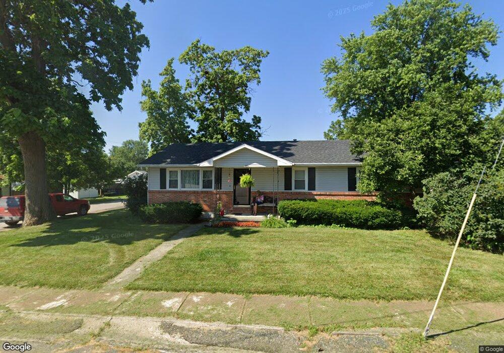
410 Harris St Pilot Grove, MO 65276
Estimated Value: $144,087 - $385,000
3
Beds
--
Bath
1,964
Sq Ft
$109/Sq Ft
Est. Value
About This Home
This home is located at 410 Harris St, Pilot Grove, MO 65276 and is currently estimated at $214,772, approximately $109 per square foot. 410 Harris St is a home with nearby schools including Pilot Grove Elementary School and Pilot Grove High School.
Create a Home Valuation Report for This Property
The Home Valuation Report is an in-depth analysis detailing your home's value as well as a comparison with similar homes in the area
Home Values in the Area
Average Home Value in this Area
Tax History Compared to Growth
Tax History
| Year | Tax Paid | Tax Assessment Tax Assessment Total Assessment is a certain percentage of the fair market value that is determined by local assessors to be the total taxable value of land and additions on the property. | Land | Improvement |
|---|---|---|---|---|
| 2024 | $931 | $12,920 | $0 | $0 |
| 2023 | $931 | $12,920 | $0 | $0 |
| 2022 | $802 | $11,880 | $0 | $0 |
| 2021 | $800 | $11,860 | $0 | $0 |
| 2020 | $810 | $11,230 | $0 | $0 |
| 2019 | $802 | $11,230 | $0 | $11,230 |
| 2018 | $761 | $11,230 | $0 | $11,230 |
| 2017 | $784 | $10,640 | $0 | $10,640 |
| 2016 | -- | $10,640 | $0 | $0 |
| 2015 | -- | $10,640 | $0 | $0 |
| 2011 | -- | $10,640 | $0 | $0 |
Source: Public Records
Map
Nearby Homes
- 403 Teller St
- 208 College St
- 13985 N Hwy
- 10251 Oakland Ln
- TBD Hwy Nn
- 0 M Hwy
- 17346 Olivia Ct
- 17382 Emily Ct
- 13787 Pecan Ct
- 0 Ferry Rd
- 1974 Franklin Dr
- LOT 205 Mid-America Industrial Ct
- LOT 202 Mid-America Industrial Ct
- LOT 17A Mid-America Industrial Ct
- LOT 16 Mid-America Industrial Ct
- 304 Herndon St
- 408 Vassar St
- Tract 3 K Hwy
- Tract 1 K Hwy
- LOT 207 Fuqua Dr