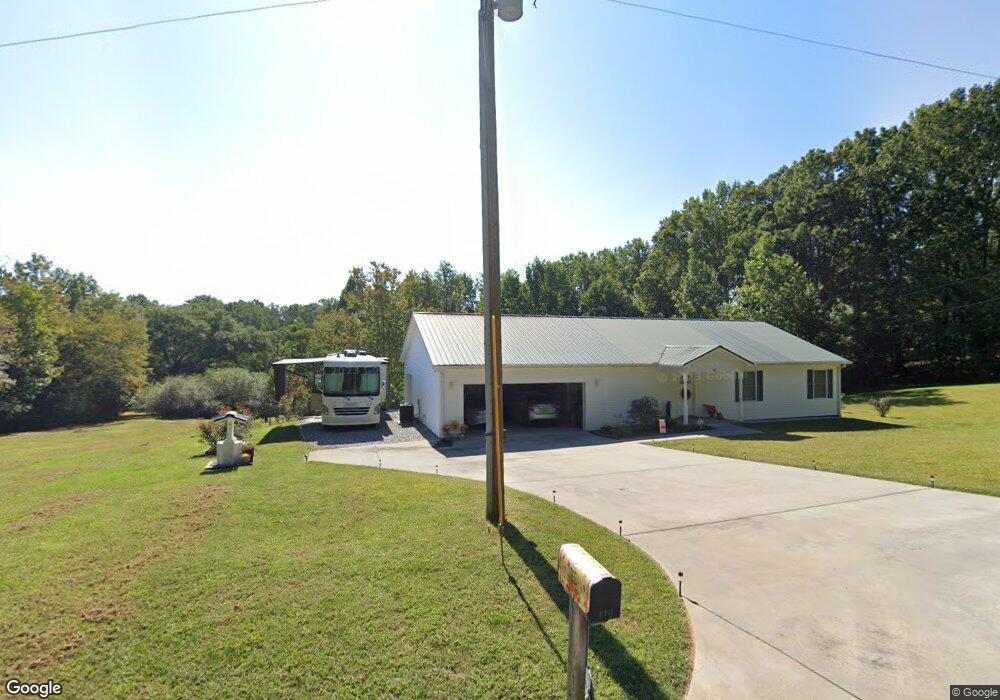
410 Lewis Brown Rd Dahlonega, GA 30533
Estimated Value: $324,000 - $436,000
--
Bed
--
Bath
1,800
Sq Ft
$208/Sq Ft
Est. Value
About This Home
This home is located at 410 Lewis Brown Rd, Dahlonega, GA 30533 and is currently estimated at $375,274, approximately $208 per square foot. 410 Lewis Brown Rd is a home with nearby schools including Clay County Middle School and Lumpkin County High School.
Ownership History
Date
Name
Owned For
Owner Type
Purchase Details
Closed on
Sep 13, 2012
Sold by
Scbt
Bought by
Scoggin Steven C and Scoggin Martha F
Current Estimated Value
Purchase Details
Closed on
Aug 3, 2012
Sold by
Tronsgard Barbara Ann Trustee
Bought by
Scbt Na D/B/A Cbt Division Of Scbt Na
Purchase Details
Closed on
Sep 13, 2011
Sold by
Tronsgard Barbara Ann
Bought by
Scbt
Purchase Details
Closed on
Sep 2, 2011
Sold by
Tronsgard Barbara Ann
Bought by
Scbt
Purchase Details
Closed on
Jun 15, 1994
Sold by
Tronsgard Barbara An
Bought by
Tronsgard Barbara An
Purchase Details
Closed on
Aug 26, 1991
Sold by
Tronsgard Barbara An
Bought by
Tronsgard Barbara An
Purchase Details
Closed on
Jun 1, 1984
Bought by
Hinton William B
Create a Home Valuation Report for This Property
The Home Valuation Report is an in-depth analysis detailing your home's value as well as a comparison with similar homes in the area
Home Values in the Area
Average Home Value in this Area
Purchase History
| Date | Buyer | Sale Price | Title Company |
|---|---|---|---|
| Scoggin Steven C | $10,000 | -- | |
| Scbt Na D/B/A Cbt Division Of Scbt Na | -- | -- | |
| Scbt | -- | -- | |
| Scbt | -- | -- | |
| Tronsgard Barbara An | $2,000 | -- | |
| Tronsgard Barbara An | $19,600 | -- | |
| Hinton Barbara | -- | -- | |
| Tronsgard Barbara An | $80,000 | -- | |
| Hinton William B | -- | -- |
Source: Public Records
Tax History Compared to Growth
Tax History
| Year | Tax Paid | Tax Assessment Tax Assessment Total Assessment is a certain percentage of the fair market value that is determined by local assessors to be the total taxable value of land and additions on the property. | Land | Improvement |
|---|---|---|---|---|
| 2024 | $265 | $124,057 | $10,065 | $113,992 |
| 2023 | $271 | $115,608 | $9,406 | $106,202 |
| 2022 | $360 | $99,321 | $7,839 | $91,482 |
| 2021 | $194 | $87,359 | $7,839 | $79,520 |
| 2020 | $171 | $84,759 | $7,511 | $77,248 |
| 2019 | $176 | $84,759 | $7,511 | $77,248 |
| 2018 | $86 | $75,434 | $7,511 | $67,923 |
| 2017 | $217 | $7,511 | $7,511 | $0 |
| 2016 | $225 | $7,511 | $7,511 | $0 |
| 2015 | $198 | $7,511 | $7,511 | $0 |
| 2014 | $198 | $7,511 | $7,511 | $0 |
| 2013 | -- | $7,511 | $7,511 | $0 |
Source: Public Records
Map
Nearby Homes
- 87 Tolleffs Trail
- 128 Young Deer Dr
- 202 Indian Trail
- 380 Copper Mill Rd
- 6480 Highway 52 W
- 0 Arborwood Dr Unit 10645890
- 83 Austin Ct
- 0 Bearden Rd Unit 10598024
- 0 Bearden Rd Unit 7642996
- 94 King Arthur Ct
- 1228 Winters Mountain Rd
- 300 Mountain Ridge Dr
- 0 Winters Mountain Rd Unit 7681054
- 0 Winters Mountain Rd Unit 10643431
- 962 Winters Mountain Rd
- 100 Rocky Branch Dr
- 600 Chapman Ridge Ln
- 500 Chapman Ridge Ln
- 27.68 Chapman Ridge Ln
- 0 Cool Spring Ln
- 0 Tolleffs Trail Unit 3171219
- 0 Tolleffs Trail Unit 3170892
- 0 Tolleffs Trail Unit 7054126
- 0 Tolleffs Trail Unit 7053852
- 0 Tolleffs Trail Unit 7111948
- 0 Tolleffs Trail Unit 5.6AC 7401251
- 0 Tolleffs Trail Unit 4311525
- 0 Tolleffs Trail Unit 4311262
- 0 Tolleffs Trail Unit 5112131
- 0 Tolleffs Trail Unit 5111939
- 0 Tolleffs Trail Unit 8668240
- 490 Lewis Brown Dr
- 58 Tolleffs Trail
- 43 Cool Springs Ln
- 0 Tollefs Ln
- 0 Cool Springs Ln Unit 3170434
- 0 Cool Springs Ln Unit 10038800
- 0 Cool Springs Ln
- 43 Cool Spring Ln