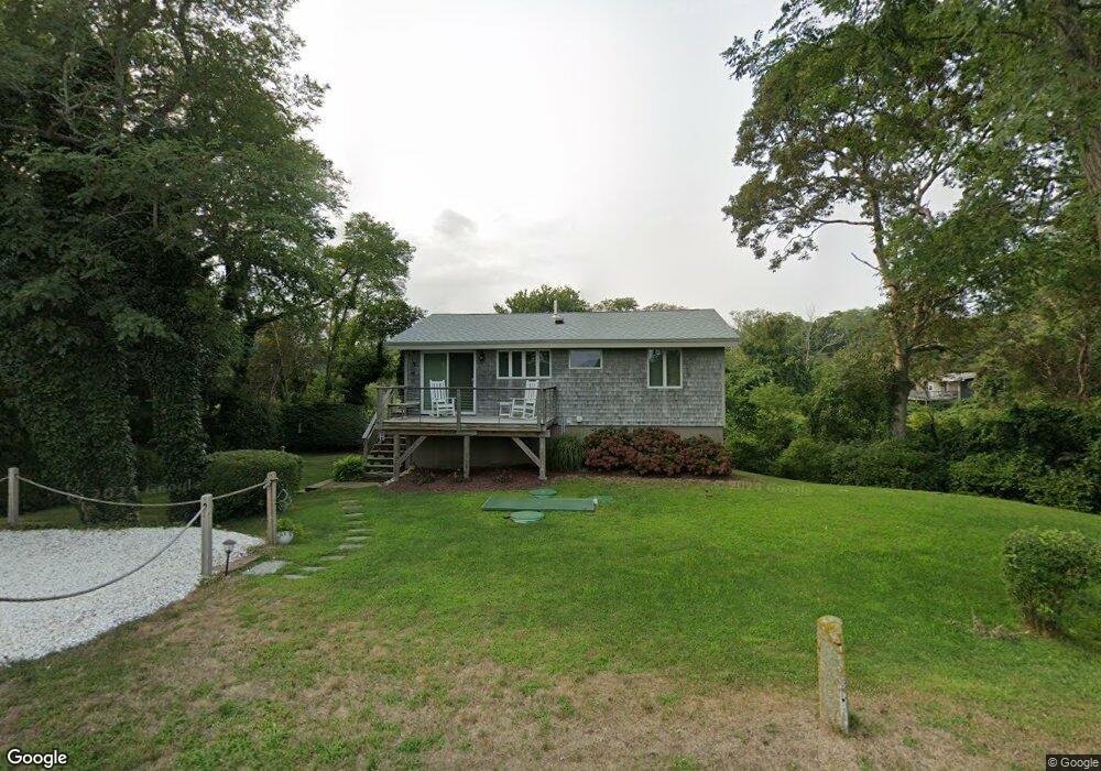
410 Lieutenant Island Rd Wellfleet, MA 02667
Estimated Value: $721,000 - $817,376
3
Beds
2
Baths
1,536
Sq Ft
$497/Sq Ft
Est. Value
About This Home
This home is located at 410 Lieutenant Island Rd, Wellfleet, MA 02667 and is currently estimated at $763,344, approximately $496 per square foot. 410 Lieutenant Island Rd is a home located in Barnstable County with nearby schools including Wellfleet Elementary School, Nauset Regional Middle School, and Nauset Regional High School.
Ownership History
Date
Name
Owned For
Owner Type
Purchase Details
Closed on
Feb 28, 2018
Sold by
Soares James and Soares Kathleen H
Bought by
Kathleen H Soares Lt
Current Estimated Value
Purchase Details
Closed on
Jul 17, 2014
Sold by
1993 Childrens T and Haelsen
Bought by
Soares James and Soares Kathleen
Purchase Details
Closed on
Sep 2, 2008
Sold by
Denessen Marlene C
Bought by
Haelsen Childrens T and Haelsen
Create a Home Valuation Report for This Property
The Home Valuation Report is an in-depth analysis detailing your home's value as well as a comparison with similar homes in the area
Home Values in the Area
Average Home Value in this Area
Purchase History
| Date | Buyer | Sale Price | Title Company |
|---|---|---|---|
| Kathleen H Soares Lt | -- | -- | |
| Kathleen H Soares Lt | -- | -- | |
| Soares James | $290,000 | -- | |
| Soares James | $290,000 | -- | |
| Haelsen Childrens T | -- | -- | |
| Haelsen Childrens T | -- | -- |
Source: Public Records
Tax History Compared to Growth
Tax History
| Year | Tax Paid | Tax Assessment Tax Assessment Total Assessment is a certain percentage of the fair market value that is determined by local assessors to be the total taxable value of land and additions on the property. | Land | Improvement |
|---|---|---|---|---|
| 2025 | $4,941 | $694,900 | $371,500 | $323,400 |
| 2024 | $4,562 | $667,900 | $353,800 | $314,100 |
| 2023 | $4,047 | $581,500 | $299,900 | $281,600 |
| 2022 | $3,618 | $465,100 | $263,100 | $202,000 |
| 2021 | $0 | $408,500 | $234,900 | $173,600 |
| 2020 | $3,157 | $407,300 | $237,700 | $169,600 |
| 2019 | $3,096 | $400,500 | $237,700 | $162,800 |
| 2018 | $0 | $397,500 | $237,700 | $159,800 |
| 2017 | $2,687 | $396,300 | $237,700 | $158,600 |
| 2016 | $2,447 | $358,300 | $188,500 | $169,800 |
| 2015 | $2,479 | $365,700 | $186,600 | $179,100 |
Source: Public Records
Map
Nearby Homes
- 90 Ring Rd
- 90 Blue Heron Rd
- 40 Leilla Rich Dr
- 55 Harvard St
- 95 Barker St
- 25 1st Ave
- 190 Meadow Ave W
- 210 West Rd Unit B9
- 210 West Rd Unit M-16
- 41-43 9th St
- 245 Paine Hollow Rd
- 80 4th St
- 60 Long Ave Unit E
- 176 Village Ln
- 11 Whelpley Rd
- 90 Paine Hollow Rd
- 140 Harvest Rd
- 675 N Sunken Meadow Rd
- 1937 State Hwy Rte 6 Unit 8
- 65 Harmes Way
- 0 Lieutenant Island Rd
- 420 Lieutenant Island Rd
- 400 Lieutenant Island Rd
- 55 Old Salt Ln
- 425 Lieutenant Island Rd
- 395 Lieutenant Island Rd
- 35 Old Salt Ln
- 386 Lieutenant Island Rd
- 5 Catboat Rd
- 25 Old Salt Ln
- 65 Old Salt Ln
- 445 Lieutenant Island Rd
- 385 Lieutenant Island Rd
- 44 Old Salt Ln
- 60 Old Salt Ln
- 5 Compass Hill Rd
- 10 Catboat Rd
- 450 Lieutenant Island Rd
- 365 Lieutenant Island Rd
- 15 Old Salt Ln