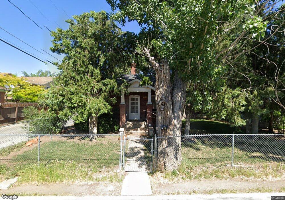
410 Locust St Reno, NV 89502
Wells Avenue District NeighborhoodEstimated Value: $361,532 - $417,000
2
Beds
1
Bath
675
Sq Ft
$566/Sq Ft
Est. Value
About This Home
This home is located at 410 Locust St, Reno, NV 89502 and is currently estimated at $382,383, approximately $566 per square foot. 410 Locust St is a home located in Washoe County with nearby schools including Libby C Booth Elementary School, Vaughn Middle School, and Earl Wooster High School.
Ownership History
Date
Name
Owned For
Owner Type
Purchase Details
Closed on
Jun 25, 2024
Sold by
Fiori Donald M
Bought by
Donald M Fiori Family Trust and Fiori
Current Estimated Value
Create a Home Valuation Report for This Property
The Home Valuation Report is an in-depth analysis detailing your home's value as well as a comparison with similar homes in the area
Home Values in the Area
Average Home Value in this Area
Purchase History
| Date | Buyer | Sale Price | Title Company |
|---|---|---|---|
| Donald M Fiori Family Trust | -- | None Listed On Document |
Source: Public Records
Tax History Compared to Growth
Tax History
| Year | Tax Paid | Tax Assessment Tax Assessment Total Assessment is a certain percentage of the fair market value that is determined by local assessors to be the total taxable value of land and additions on the property. | Land | Improvement |
|---|---|---|---|---|
| 2025 | $577 | $45,054 | $32,552 | $12,502 |
| 2024 | $577 | $43,679 | $31,388 | $12,291 |
| 2023 | $566 | $43,093 | $31,721 | $11,373 |
| 2022 | $542 | $35,587 | $26,434 | $9,153 |
| 2021 | $529 | $26,267 | $17,357 | $8,910 |
| 2020 | $513 | $26,832 | $18,088 | $8,744 |
| 2019 | $493 | $24,145 | $15,827 | $8,318 |
| 2018 | $466 | $19,383 | $11,405 | $7,978 |
| 2017 | $448 | $17,752 | $9,909 | $7,843 |
| 2016 | $447 | $16,568 | $8,811 | $7,757 |
| 2015 | $454 | $14,693 | $6,983 | $7,710 |
| 2014 | $441 | $12,310 | $4,988 | $7,322 |
| 2013 | -- | $10,985 | $3,824 | $7,161 |
Source: Public Records
Map
Nearby Homes
- 412 Locust St
- 725-745 Moran St
- 725 Moran St
- 0000 City St
- 400 Locust St
- 710 Stewart St
- 710 Stewart St Unit D
- 710 Stewart St Unit G
- 461 Locust St
- 720 Stewart St
- 742 Stewart St
- 411 Locust St
- 742 Stewart St
- 633 Moran St
- 740 Stewart St
- 740 Stewart St
- 0 Stewart St
- 0 Stewart St Unit 160007039
- 0 Stewart St Unit 210002207
- 670 Stewart St