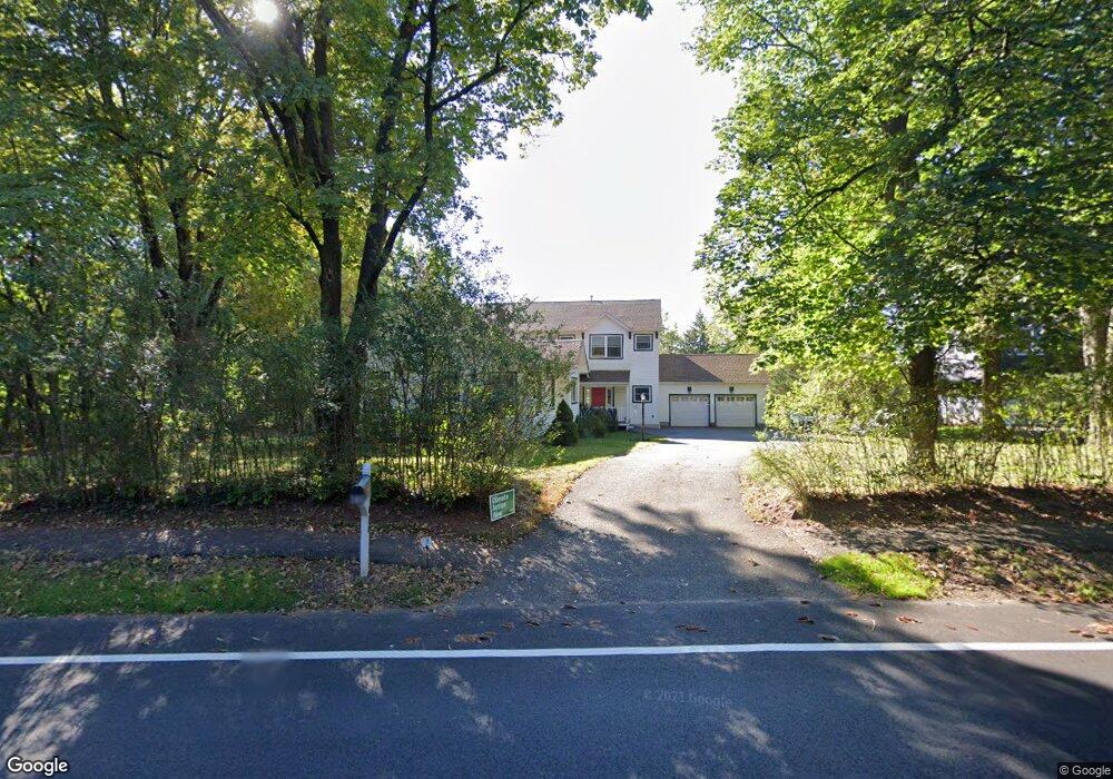
410 Lyons Rd Basking Ridge, NJ 07920
Bernards NeighborhoodEstimated Value: $1,165,000 - $1,374,000
Studio
--
Bath
3,755
Sq Ft
$329/Sq Ft
Est. Value
About This Home
This home is located at 410 Lyons Rd, Basking Ridge, NJ 07920 and is currently estimated at $1,236,619, approximately $329 per square foot. 410 Lyons Rd is a home located in Somerset County with nearby schools including Liberty Corner Elementary School, Cedar Hill Elementary School, and William Annin Middle School.
Ownership History
Date
Name
Owned For
Owner Type
Purchase Details
Closed on
Jun 3, 1999
Sold by
Vehnekamp Ernest
Bought by
Hannis William and Hilgendorff Heidi
Current Estimated Value
Home Financials for this Owner
Home Financials are based on the most recent Mortgage that was taken out on this home.
Original Mortgage
$228,600
Outstanding Balance
$59,545
Interest Rate
6.9%
Estimated Equity
$1,177,074
Purchase Details
Closed on
Apr 12, 1995
Sold by
Ukrainian Orthodox Church
Bought by
Vehnekamp Ernest and Vehnekamp Jina
Home Financials for this Owner
Home Financials are based on the most recent Mortgage that was taken out on this home.
Original Mortgage
$165,000
Interest Rate
8.55%
Create a Home Valuation Report for This Property
The Home Valuation Report is an in-depth analysis detailing your home's value as well as a comparison with similar homes in the area
Home Values in the Area
Average Home Value in this Area
Purchase History
| Date | Buyer | Sale Price | Title Company |
|---|---|---|---|
| Hannis William | $254,000 | -- | |
| Vehnekamp Ernest | $206,000 | -- |
Source: Public Records
Mortgage History
| Date | Status | Borrower | Loan Amount |
|---|---|---|---|
| Open | Hannis William | $228,600 | |
| Previous Owner | Vehnekamp Ernest | $165,000 |
Source: Public Records
Tax History
| Year | Tax Paid | Tax Assessment Tax Assessment Total Assessment is a certain percentage of the fair market value that is determined by local assessors to be the total taxable value of land and additions on the property. | Land | Improvement |
|---|---|---|---|---|
| 2025 | $16,561 | $1,011,900 | $340,400 | $671,500 |
| 2024 | $16,561 | $930,900 | $304,400 | $626,500 |
Source: Public Records
Map
Nearby Homes
- 24 Chelsea Ct
- 28 Lafayette Ln
- 436 Mount Airy Rd
- 247 Lyons Rd
- 12 Wayne Terrace
- 26 Woodward Ln
- 105 Annin Rd
- 279 English Place
- 7 Valley View Dr
- 275 Crabtree Ct
- 213 Liberty Corner Rd
- 227 Arrowood Way
- 254 Penns Way
- 40 Chestnut Ct
- 85 Sycamore Ct Ondo
- 341 Penns Way Unit D2
- 12 Beacon Crest Dr
- 195 Alexandria Way
- 49 Alexandria Way Ondo
- 36 Debra Ln
Your Personal Tour Guide
Ask me questions while you tour the home.