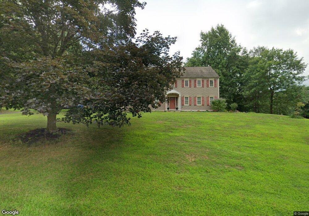
410 Mackenzie Dr West Chester, PA 19380
Estimated Value: $812,892 - $924,000
5
Beds
3
Baths
3,002
Sq Ft
$286/Sq Ft
Est. Value
About This Home
This home is located at 410 Mackenzie Dr, West Chester, PA 19380 and is currently estimated at $858,723, approximately $286 per square foot. 410 Mackenzie Dr is a home located in Chester County with nearby schools including East Bradford Elementary School, E.N. Peirce Middle School, and Henderson High School.
Ownership History
Date
Name
Owned For
Owner Type
Purchase Details
Closed on
May 29, 2003
Sold by
Peterson David L and Peterson Patricia H
Bought by
Mohl Stephen K and Mohl Jacqueline M
Current Estimated Value
Home Financials for this Owner
Home Financials are based on the most recent Mortgage that was taken out on this home.
Original Mortgage
$303,920
Outstanding Balance
$133,614
Interest Rate
5.83%
Mortgage Type
Purchase Money Mortgage
Estimated Equity
$725,109
Create a Home Valuation Report for This Property
The Home Valuation Report is an in-depth analysis detailing your home's value as well as a comparison with similar homes in the area
Home Values in the Area
Average Home Value in this Area
Purchase History
| Date | Buyer | Sale Price | Title Company |
|---|---|---|---|
| Mohl Stephen K | $379,900 | -- |
Source: Public Records
Mortgage History
| Date | Status | Borrower | Loan Amount |
|---|---|---|---|
| Open | Mohl Stephen K | $303,920 |
Source: Public Records
Tax History Compared to Growth
Tax History
| Year | Tax Paid | Tax Assessment Tax Assessment Total Assessment is a certain percentage of the fair market value that is determined by local assessors to be the total taxable value of land and additions on the property. | Land | Improvement |
|---|---|---|---|---|
| 2025 | $7,183 | $247,810 | $48,000 | $199,810 |
| 2024 | $7,183 | $247,810 | $48,000 | $199,810 |
| 2023 | $7,183 | $247,810 | $48,000 | $199,810 |
| 2022 | $7,090 | $247,810 | $48,000 | $199,810 |
| 2021 | $6,992 | $247,810 | $48,000 | $199,810 |
| 2020 | $6,946 | $247,810 | $48,000 | $199,810 |
| 2019 | $6,850 | $247,810 | $48,000 | $199,810 |
| 2018 | $6,704 | $247,810 | $48,000 | $199,810 |
| 2017 | $6,559 | $247,810 | $48,000 | $199,810 |
| 2016 | $4,936 | $247,810 | $48,000 | $199,810 |
| 2015 | $4,936 | $247,810 | $48,000 | $199,810 |
| 2014 | $4,936 | $247,810 | $48,000 | $199,810 |
Source: Public Records
Map
Nearby Homes
- 4 Amanda Ln
- 1252 Memory Ln
- 1280 Cardinal Ave
- 479 Douglas Dr
- Lot 1 Susan Dr
- 530 Legion Dr
- 48 Sheffield Ln
- 1430 Grove Ave
- 1432 Grove Ave
- 510 Pine Needle Dr
- 1500 Cardiff Terrace
- 1354 Old Pottstown Pike
- 306 Greenhill Rd
- 112 Crosspointe Dr
- 456 Cardigan Terrace Unit 456
- 1402 Redwood Ct Unit 57
- 415 Anglesey Terrace
- 1492 Conifer Dr
- 806 Downingtown Pike
- 214 Silverbell Ct
- 520 Mackenzie Dr
- 400 Mackenzie Dr
- 411 Mackenzie Dr
- 401 Mackenzie Dr
- 430 Mackenzie Dr
- 401 Sunset Hollow Rd
- 421 Mackenzie Dr
- 341 Mackenzie Dr
- 1163 Macpherson Dr
- 440 Mackenzie Dr
- 411 Sunset Hollow Rd
- 403 Sunset Hollow Rd
- 338 Mackenzie Dr
- 407 Sunset Hollow Rd
- 415 Sunset Hollow Rd
- 1167 Macpherson Dr
- 337 Mackenzie Dr
- 405 Sunset Hollow Rd
- 334 Mackenzie Dr
- 1166 Macpherson Dr