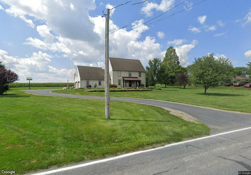
410 Mill Creek Rd Bird In Hand, PA 17505
Estimated Value: $347,000 - $749,000
4
Beds
3
Baths
2,492
Sq Ft
$217/Sq Ft
Est. Value
About This Home
This home is located at 410 Mill Creek Rd, Bird In Hand, PA 17505 and is currently estimated at $541,932, approximately $217 per square foot. 410 Mill Creek Rd is a home located in Lancaster County with nearby schools including Smoketown Elementary School, Gerald G. Huesken Middle School, and Conestoga Valley High School.
Ownership History
Date
Name
Owned For
Owner Type
Purchase Details
Closed on
Sep 21, 2005
Sold by
Bare Dean Edward and Bare Eileen Susan
Bought by
Bare Joshua David and Bare Danelle Sharpe
Current Estimated Value
Create a Home Valuation Report for This Property
The Home Valuation Report is an in-depth analysis detailing your home's value as well as a comparison with similar homes in the area
Home Values in the Area
Average Home Value in this Area
Purchase History
| Date | Buyer | Sale Price | Title Company |
|---|---|---|---|
| Bare Joshua David | -- | -- |
Source: Public Records
Tax History Compared to Growth
Tax History
| Year | Tax Paid | Tax Assessment Tax Assessment Total Assessment is a certain percentage of the fair market value that is determined by local assessors to be the total taxable value of land and additions on the property. | Land | Improvement |
|---|---|---|---|---|
| 2025 | $7,505 | $370,700 | $77,500 | $293,200 |
| 2024 | $7,505 | $370,700 | $77,500 | $293,200 |
| 2023 | $7,331 | $370,700 | $77,500 | $293,200 |
| 2022 | $7,149 | $370,700 | $77,500 | $293,200 |
| 2021 | $6,897 | $370,700 | $77,500 | $293,200 |
| 2020 | $6,897 | $370,700 | $77,500 | $293,200 |
| 2019 | $6,749 | $370,700 | $77,500 | $293,200 |
| 2018 | $9,930 | $370,700 | $77,500 | $293,200 |
| 2017 | $5,910 | $273,000 | $59,600 | $213,400 |
| 2016 | $5,839 | $273,000 | $59,600 | $213,400 |
| 2015 | $1,492 | $273,000 | $59,600 | $213,400 |
| 2014 | $4,049 | $273,000 | $59,600 | $213,400 |
Source: Public Records
Map
Nearby Homes
- 425 Mill Creek Rd
- 2498 Old Philadelphia Park
- 103 Fairhill Dr
- 2596 Old Philadelphia Pike
- 339 Enterprise Dr
- 323 Enterprise Dr
- 2453 Lincoln Hwy E
- 7 Pleasant Dr
- 70 Hellers Church Rd
- 71 Apricot Ave
- 68 Horseshoe Rd
- 33 Black Oak Dr
- 347 Greenland Dr
- 305 Greenland Dr Unit 385
- 37 Black Oak Dr
- 466 Eastwood Ln
- 439 Coreopsis Dr
- 259 Raspberry Rd
- 71 Black Oak Dr Unit 71
- 403 Eastwood Ln
- 416 Mill Creek Rd
- 419 Mill Creek Rd
- 422 Mill Creek Rd
- 433 Mill Creek Rd
- 384 Mill Creek Rd
- 382 Mill Creek Rd
- 453 Mill Creek Rd
- 378 Mill Creek Rd
- 374 Mill Creek Rd
- 370 Mill Creek Rd
- 458 Beechdale Rd
- 368 Mill Creek Rd
- 366 Mill Creek Rd
- 462 Mill Creek Rd
- 520 Beechdale Rd
- 362 Mill Creek Rd
- 2434 Stumptown Rd
- 358 Mill Creek Rd
- 514 Beechdale Rd
- 2402 Stumptown Rd