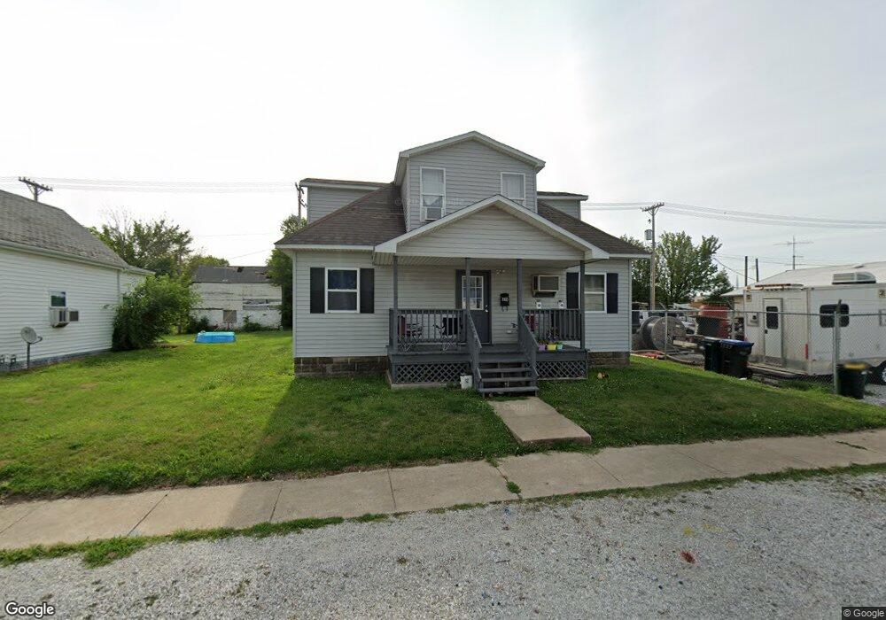
410 N Main St Kirksville, MO 63501
Estimated Value: $94,000 - $133,208
5
Beds
2
Baths
1,900
Sq Ft
$60/Sq Ft
Est. Value
About This Home
This home is located at 410 N Main St, Kirksville, MO 63501 and is currently estimated at $113,052, approximately $59 per square foot. 410 N Main St is a home located in Adair County with nearby schools including Kirksville Primary School, Ray Miller Elementary School, and William Matthew Middle School.
Ownership History
Date
Name
Owned For
Owner Type
Purchase Details
Closed on
May 7, 2013
Sold by
Green Walter E and Green Elizabeth
Bought by
Gregory Kevin D
Current Estimated Value
Home Financials for this Owner
Home Financials are based on the most recent Mortgage that was taken out on this home.
Original Mortgage
$40,000
Outstanding Balance
$28,306
Interest Rate
3.45%
Mortgage Type
Future Advance Clause Open End Mortgage
Estimated Equity
$84,746
Purchase Details
Closed on
Dec 4, 2012
Sold by
Snyder Sammyjoe B
Bought by
Wayman Frank D and Green Walter E
Create a Home Valuation Report for This Property
The Home Valuation Report is an in-depth analysis detailing your home's value as well as a comparison with similar homes in the area
Home Values in the Area
Average Home Value in this Area
Purchase History
| Date | Buyer | Sale Price | Title Company |
|---|---|---|---|
| Gregory Kevin D | -- | -- | |
| Wayman Frank D | -- | -- |
Source: Public Records
Mortgage History
| Date | Status | Borrower | Loan Amount |
|---|---|---|---|
| Open | Gregory Kevin D | $40,000 |
Source: Public Records
Tax History Compared to Growth
Tax History
| Year | Tax Paid | Tax Assessment Tax Assessment Total Assessment is a certain percentage of the fair market value that is determined by local assessors to be the total taxable value of land and additions on the property. | Land | Improvement |
|---|---|---|---|---|
| 2024 | $397 | $6,490 | $1,120 | $5,370 |
| 2023 | $396 | $8,110 | $1,120 | $6,990 |
| 2022 | $396 | $8,110 | $1,120 | $6,990 |
| 2021 | $391 | $8,110 | $1,120 | $6,990 |
| 2020 | $399 | $6,490 | $1,120 | $5,370 |
| 2019 | $384 | $6,490 | $1,120 | $5,370 |
| 2018 | $375 | $6,380 | $1,120 | $5,260 |
| 2017 | $192 | $3,280 | $1,120 | $2,160 |
| 2016 | $192 | $3,280 | $1,120 | $2,160 |
| 2015 | -- | $3,280 | $1,120 | $2,160 |
| 2011 | -- | $0 | $0 | $0 |
Source: Public Records
Map
Nearby Homes
- 616 N Elson St
- 602 N Franklin St
- 709 N Franklin St
- 414 N Florence St
- 1001 N Edgar St
- 404 S Franklin St
- 504 E Washington St
- 607 E Cottonwood St
- 611 E Cottonwood St
- 1220 N Franklin St
- 411 S High St
- 516 E Jefferson St
- 101 E Burton St
- 602 S Franklin St
- 606 S Franklin St
- 801 E Harrison St
- 1304 Green St
- 513 W Porter St
- 709 E Jefferson St
- 415 S Davis St