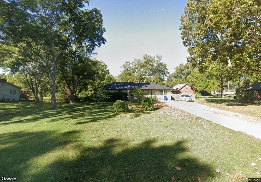
410 NW Watson Rd Lees Summit, MO 64063
Estimated Value: $272,000 - $333,000
3
Beds
2
Baths
1,442
Sq Ft
$209/Sq Ft
Est. Value
About This Home
This home is located at 410 NW Watson Rd, Lees Summit, MO 64063 and is currently estimated at $301,121, approximately $208 per square foot. 410 NW Watson Rd is a home located in Jackson County with nearby schools including Bernard C. Campbell Middle School, Westview Elementary School, and Lee's Summit North High School.
Ownership History
Date
Name
Owned For
Owner Type
Purchase Details
Closed on
Sep 23, 2011
Sold by
Doane Keith A and Doane Karen Sue
Bought by
Doane Keith A and Doane Karen Sue
Current Estimated Value
Home Financials for this Owner
Home Financials are based on the most recent Mortgage that was taken out on this home.
Original Mortgage
$108,023
Outstanding Balance
$9,145
Interest Rate
3.59%
Mortgage Type
New Conventional
Estimated Equity
$291,976
Purchase Details
Closed on
May 9, 2011
Sold by
Doane Nicole M and Kelly Nicole Marie
Bought by
Doane Keith A
Purchase Details
Closed on
Aug 12, 1998
Sold by
Bramblett Virgil O and Bramblett Brenda R
Bought by
Doane Keith A
Home Financials for this Owner
Home Financials are based on the most recent Mortgage that was taken out on this home.
Original Mortgage
$110,650
Interest Rate
6.95%
Mortgage Type
Purchase Money Mortgage
Create a Home Valuation Report for This Property
The Home Valuation Report is an in-depth analysis detailing your home's value as well as a comparison with similar homes in the area
Home Values in the Area
Average Home Value in this Area
Purchase History
| Date | Buyer | Sale Price | Title Company |
|---|---|---|---|
| Doane Keith A | -- | Stewart Title Company Midwes | |
| Doane Keith A | -- | Stewart Title Company Midwes | |
| Doane Keith A | -- | Stewart Title |
Source: Public Records
Mortgage History
| Date | Status | Borrower | Loan Amount |
|---|---|---|---|
| Open | Doane Keith A | $108,023 | |
| Closed | Doane Keith A | $110,650 |
Source: Public Records
Tax History
| Year | Tax Paid | Tax Assessment Tax Assessment Total Assessment is a certain percentage of the fair market value that is determined by local assessors to be the total taxable value of land and additions on the property. | Land | Improvement |
|---|---|---|---|---|
| 2025 | $2,513 | $37,691 | $14,940 | $22,751 |
| 2024 | $2,513 | $34,804 | $12,044 | $22,760 |
| 2023 | $2,495 | $34,804 | $4,210 | $30,594 |
| 2022 | $2,301 | $28,500 | $10,156 | $18,344 |
| 2021 | $2,348 | $28,500 | $10,156 | $18,344 |
| 2020 | $2,260 | $27,163 | $10,156 | $17,007 |
| 2019 | $2,198 | $27,163 | $10,156 | $17,007 |
| 2018 | $2,006 | $23,004 | $4,369 | $18,635 |
| 2016 | $1,833 | $20,805 | $5,339 | $15,466 |
Source: Public Records
Map
Nearby Homes
- 412 NW Donovan Rd
- 604 NW Carroll Dr
- 211-213 NW Orchard Ct
- 211 NW Orchard Ct
- 213 NW Orchard Ct
- 219 NW Orchard Ct
- 217 NW Orchard Ct
- 216 NW Orchard Ct
- 225 NW Orchard Ct
- 218 NW Orchard Ct
- 229 NW Orchard Ct
- 626 NW Village Dr
- 27010 NW Olive St
- 27003 NW Olive St
- 104 SW Alderson Place
- 1 NW Walnut St
- 158 SW Robin Rd
- 109 SW Walnut St
- 300 W 1st St
- 302 NE Green St
- 408 NW Watson Rd
- 412 NW Watson Rd
- 411 NW Watson Rd
- 409 NW Watson Rd
- 406 NW Watson Rd
- 409 NW Waston Rd
- 413 NW Watson Rd
- 400 NW Carroll Dr
- 501 NW Watson Rd
- 407 NW Watson Rd
- 409 NW Ward Rd
- 502 NW Watson Rd
- 407 NW Ward Rd
- 503 NW Watson Rd
- 501 NW Ward Rd
- 504 NW Watson Rd
- 503 NW Ward Rd
- 416 NW Ward Rd
- 502 NW Ward Ln
- 404 NW Obrien Rd
Your Personal Tour Guide
Ask me questions while you tour the home.