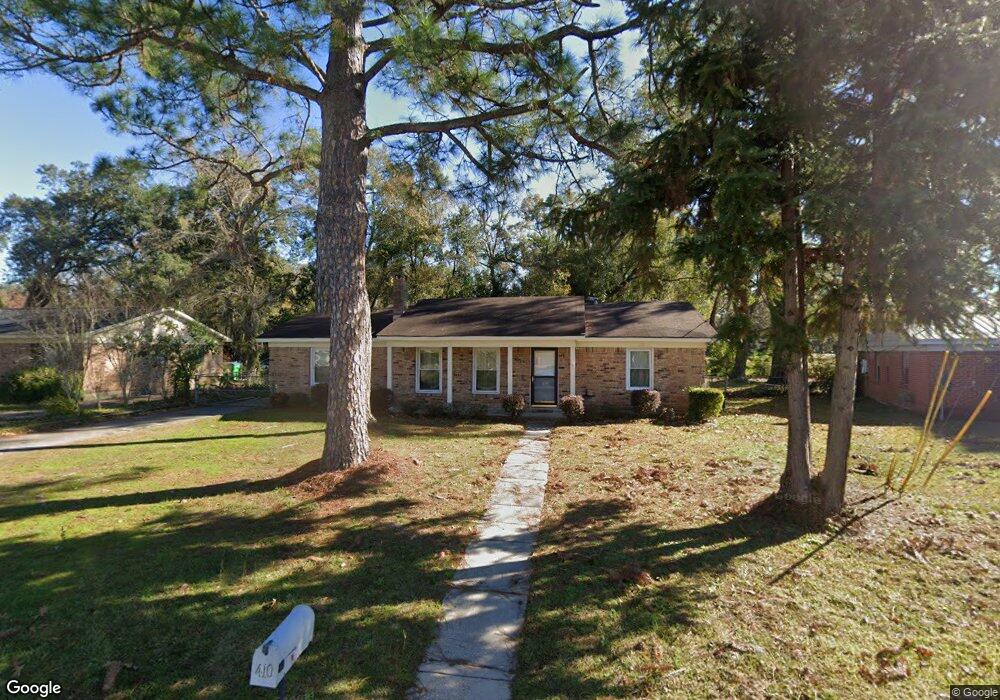
410 Scott Dr Saraland, AL 36571
Estimated Value: $154,000 - $187,000
3
Beds
2
Baths
1,232
Sq Ft
$137/Sq Ft
Est. Value
About This Home
This home is located at 410 Scott Dr, Saraland, AL 36571 and is currently estimated at $168,886, approximately $137 per square foot. 410 Scott Dr is a home located in Mobile County with nearby schools including Saraland Elementary School, Nelson Leon Adams Middle School/Saraland Middle School, and Saraland High School.
Ownership History
Date
Name
Owned For
Owner Type
Purchase Details
Closed on
Oct 22, 2021
Sold by
Stringfellow Bruce B and Stringfellow Tammy P
Bought by
Huff Matthew
Current Estimated Value
Purchase Details
Closed on
Mar 25, 1998
Sold by
Lanell Young Larry and Lanell Linda
Bought by
Stringfellow Bruce D and Stringfellow Tammy P
Home Financials for this Owner
Home Financials are based on the most recent Mortgage that was taken out on this home.
Original Mortgage
$60,800
Interest Rate
7.01%
Create a Home Valuation Report for This Property
The Home Valuation Report is an in-depth analysis detailing your home's value as well as a comparison with similar homes in the area
Home Values in the Area
Average Home Value in this Area
Purchase History
| Date | Buyer | Sale Price | Title Company |
|---|---|---|---|
| Huff Matthew | $110,000 | Fmt | |
| Stringfellow Bruce D | -- | Surety Land Title Inc |
Source: Public Records
Mortgage History
| Date | Status | Borrower | Loan Amount |
|---|---|---|---|
| Previous Owner | Stringfellow Bruce D | $60,800 |
Source: Public Records
Tax History Compared to Growth
Tax History
| Year | Tax Paid | Tax Assessment Tax Assessment Total Assessment is a certain percentage of the fair market value that is determined by local assessors to be the total taxable value of land and additions on the property. | Land | Improvement |
|---|---|---|---|---|
| 2024 | $1,660 | $27,900 | $6,000 | $21,900 |
| 2023 | $1,414 | $23,760 | $5,280 | $18,480 |
| 2022 | $636 | $11,810 | $2,420 | $9,390 |
| 2021 | $555 | $10,440 | $2,200 | $8,240 |
| 2020 | $555 | $10,440 | $2,200 | $8,240 |
| 2019 | $552 | $10,400 | $0 | $0 |
| 2018 | $552 | $10,400 | $0 | $0 |
| 2017 | $507 | $9,640 | $0 | $0 |
| 2016 | $499 | $9,520 | $0 | $0 |
| 2013 | $497 | $10,760 | $0 | $0 |
Source: Public Records
Map
Nearby Homes
- 205 Stauffer Ave
- 159 Courtaulds Ave
- 0 Shelton Beach Rd Unit 7618795
- 503 Shelton Beach Rd
- 129 Melinda Dr
- 832 Shelton Beach Rd
- 711 Ann St
- 30 Melinda Dr
- 253 Autumn Dr
- 234 Autumn Dr
- 20 Robbie Ln
- 0 Joaneen Dr Unit 7576451
- 804 Myron Ave
- 0 Lincoln St
- 505 Norton Ave
- 410 Allen Cir
- 325 Bryant Ct
- 1019 Joaneen Dr
- 820 James St
- 209 Kimberly Ct
- 412 Scott Dr
- 408 Scott Dr
- 414 Scott Dr
- 303 Ideal Dr
- 411 Scott Dr
- 408 International Blvd
- 416 Scott Dr
- 413 Scott Dr
- 410 International Blvd
- 229 Ideal Dr
- 415 Scott Dr
- 418 Scott Dr
- 412 International Blvd
- 402 International Blvd
- 407 International Blvd
- 405 International Blvd
- 409 International Blvd
- 403 International Blvd
- 417 Scott Dr
- 420 Scott Dr