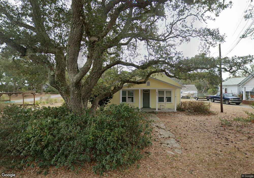
410 Shell Rd Atlantic, NC 28511
Estimated Value: $177,000 - $212,000
3
Beds
1
Bath
1,112
Sq Ft
$178/Sq Ft
Est. Value
About This Home
This home is located at 410 Shell Rd, Atlantic, NC 28511 and is currently estimated at $197,801, approximately $177 per square foot. 410 Shell Rd is a home located in Carteret County with nearby schools including Atlantic Elementary School and East Carteret High School.
Ownership History
Date
Name
Owned For
Owner Type
Purchase Details
Closed on
Nov 6, 2020
Sold by
Nash Anthony and Nash Tara A
Bought by
Carrol Jimmy Alan
Current Estimated Value
Purchase Details
Closed on
Jul 11, 2006
Sold by
Thomas Arthur Vance and Thomas Georgianna W
Bought by
Nash Anthony and Nash Tara A
Home Financials for this Owner
Home Financials are based on the most recent Mortgage that was taken out on this home.
Original Mortgage
$96,000
Interest Rate
6.55%
Mortgage Type
Purchase Money Mortgage
Purchase Details
Closed on
Apr 27, 2006
Sold by
Robertson David M
Bought by
Thomas Arthur Vance and Thomas Georgianna W
Create a Home Valuation Report for This Property
The Home Valuation Report is an in-depth analysis detailing your home's value as well as a comparison with similar homes in the area
Home Values in the Area
Average Home Value in this Area
Purchase History
| Date | Buyer | Sale Price | Title Company |
|---|---|---|---|
| Carrol Jimmy Alan | $129,000 | None Available | |
| Nash Anthony | $120,000 | None Available | |
| Thomas Arthur Vance | $105,000 | None Available |
Source: Public Records
Mortgage History
| Date | Status | Borrower | Loan Amount |
|---|---|---|---|
| Previous Owner | Nash Anthony | $96,000 |
Source: Public Records
Tax History
| Year | Tax Paid | Tax Assessment Tax Assessment Total Assessment is a certain percentage of the fair market value that is determined by local assessors to be the total taxable value of land and additions on the property. | Land | Improvement |
|---|---|---|---|---|
| 2025 | $765 | $182,752 | $42,375 | $140,377 |
| 2024 | $454 | $68,381 | $24,564 | $43,817 |
| 2023 | $528 | $68,381 | $24,564 | $43,817 |
| 2022 | $521 | $68,381 | $24,564 | $43,817 |
| 2020 | $529 | $68,381 | $24,564 | $43,817 |
| 2019 | $551 | $75,704 | $22,962 | $52,742 |
| 2017 | $551 | $75,704 | $22,962 | $52,742 |
| 2016 | $551 | $75,704 | $22,962 | $52,742 |
| 2015 | $543 | $75,704 | $22,962 | $52,742 |
| 2014 | $616 | $92,825 | $48,197 | $44,628 |
Source: Public Records
Map
Nearby Homes
- 200 Lee Daniels Rd
- 120 Clem Fulcher Ct
- 620 Seashore Dr
- 664 Seashore Dr
- 630 Seashore Dr
- 540 Seashore Dr
- 216 Styron Creek Rd
- 210 Styron Creek Rd
- 198 Styron Creek Rd
- 196 Styron Creek Rd
- 1268 Old Cedar Island Rd
- 730 Highway 70 Sea Level
- 139 Bayshore St
- 263 Nelson Neck Rd
- 220 Nelson Neck Rd
- 249 Nelson Neck Rd
- 579 Nelson Neck Rd
- 930 U S 70
- 801 Lola
- 429 Lola Rd
- 398 Shell Rd
- 219 Morris Dr
- 192 Morris Dr
- 413 Shell Rd
- 395 Shell Rd
- 388 Shell Rd
- 429 Shell Rd
- 383 Shell Rd
- 146 Lee Daniels Drive Extension
- 378 Shell Rd
- 116 Clayton Ln
- 376 Shell Rd
- 155 Lee Daniels Dr
- 155 Lee Daniels Dr
- 167 Morris Dr
- 112 Clayton Ln
- 174 Morris Dr
- 161 Lee Daniels Rd
- 161 Lee Daniels Dr
- 161 Lee Daniels Dr
Your Personal Tour Guide
Ask me questions while you tour the home.